username
X
password
register
for free!
help
ArticlesGuidesRoutes
 
Photosets
 
 Comments
triplogs   photosets   labels comments more
Indian Mesa Ruins - 13 members in 34 triplogs have rated this an average 3.5 ( 1 to 5 best )
1, 2  Next
34 triplogs
login for filter options
Oct 30 2022
avatar

 Guides 37
 Routes 556
 Photos 10,872
 Triplogs 1,052

43 male
 Joined Jan 21 2013
 AZ
Indian Mesa RuinsPhoenix, AZ
Phoenix, AZ
Hiking avatar Oct 30 2022
FOTGTriplogs 1,052
Hiking7.44 Miles 845 AEG
Hiking7.44 Miles   4 Hrs   48 Mns   1.91 mph
845 ft AEG      54 Mns Break
 no routes
1st trip
Linked   none no linked trail guides
Partners none no partners
We took the standard route to the ruins from the pay site parking area and got a generally early 6:30 a.m. start.

The stroll through the closed rec sites and launch area was a pleasant start to the hike. The dogs really enjoyed the large grassy areas surrounded by the forest of mesquite trees. The burrs were easy to navigate, as the road cuts a nice path through them. However, the dogs picked up a handful of them in their fur and paws each time through. We brought scissors in anticipation of this, so it was only a minor inconvenience for us. We were shocked to see an older style Subaru Forester high-sided with a blown out front left tire in the middle of the road on the approach. The fact that the car got that far down that road is simply astounding and I cannot fathom how anyone is every going to get that vehicle out of there. The volunteer at the pay station called it a google mapping fail and said the proper people were aware of it. I found the ruins intriguing and the setting pretty superb for the area. We took a nice break on the top and then headed back down. The exit off the mesa is a little tricky on the pups, use caution if you bring them. We hiked back to nice cloud cover and a cool breeze.
_____________________
  1 archive
Dec 01 2021
avatar

 Guides 117
 Routes 339
 Photos 11,415
 Triplogs 895

63 male
 Joined Dec 20 2010
 Sunnyslope, PHX
Indian Mesa RuinsPhoenix, AZ
Phoenix, AZ
Hiking avatar Dec 01 2021
kingsnakeTriplogs 895
Hiking8.78 Miles 847 AEG
Hiking8.78 Miles   3 Hrs   31 Mns   2.50 mph
847 ft AEG
 
1st trip
Linked   none no linked trail guides
Partners none no partners
I parked at the Upper Parking Lot, by the first heavy locked gate. The $7 parking fee is a tax I don't mind paying, as it goes to something I enjoy. There are signs that announce the Upper Parking Lot opens at 6:00 a.m., the road is closed, but somewhere further on the Bald Eagle Trailhead and Agua Fria Trailhead open at 5:00 a.m. Confusing!

Between the first and second locked gate is what appears to be a vehicle campground, with the host’s RV still onsite. There’s also a sign indicating trails to the left: Ignore it. Stay on Table Mesa Rd. Like I said, confusing.

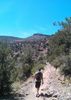
Just past the second gate, is the Agua Fria River. On the left is a California fan palm, but the jeep trail curves right. Unsure which way to go, and with yet more confusing signs, I went left, hiking down the dry river bed. 🤔

As I hiked down the Agua Fria River, I was looking for the road which I knew crossed over the saddle between Indian Mesa and Dutch Butte. I thought I found it on the dry river bank, but no. After a half mile, I exited the river bed to my right, picking up a jeep trail that curled east, ending up back at the California fan palm. Yes, that was the road I should have been on.

Long story short, at the fan palm, follow the road right, then stay between the poles across the Agua Fria River, to pick up the jeep trail on the other side. As long as you are hiking to Indian Mesa Ruins after mid-June and before mid-December, ignore any “area closed” signs: They are meant for vehicles.

The jeep trail is smooth, and still in shade at 9:15 a.m. Here and there, the jeep trail has iron tube fencing with no parking signs. On a road that does not allow vehicles. At 1¼ miles, the jeep trail expands into a large, grassy, lot that was apparently once a boat ramp. There are two picnic tables and a portapotty that did not stink. And, of course, more signs. 🚧

The grassy lot has two locked gates, left and right. Unsure which way to go, I went right. It should come as no surprise, the correct way is left. The jeep trail crosses dusty Boulder Creek. At the large tree on the far side, turn right to stay on the jeep trail for a pain-free path through the cockleburs. I, of course, went left, once again travelling the still dry bed of the Agua Fria River.

In the course of my wandering a group of older folks had passed me, so I followed them down the Agua Fria River, skirting the cockleburs. (The GPS route attached to this triplog shows the correct route to Indian Mesa, without any misdirection.) Eventually, we found our way back to the jeep trail, where it begins its ascent to the saddle between Indian Mesa and Dutch Butte.

What was once smooth, easy, jeep trail becomes extremely rugged Cow Creek Rd. Due to deep erosion — especially on the initial climb — even a heavy duty 4×4 would be unwise. But on foot, Cow Creek Rd. was no problem. What may have seemed a difficult climb from the trailhead, is no problem, only 300 ft. in ¾ of a mile. 👍

Just before reaching the high point of Cow Creek Rd., on the left is a cairn. Head up that trail, aiming for the saddle between Indian Mesa and the small hill to its right. Despite climbing 200 ft. in 250 yds., the foot trail is also no problem. At the saddle turn left, for a short traverse along the Indian Mesa cliff band. When you see a short wall, with arrow holes, climb 6 ft. up the crack towards the brown sign.

The Indian Mesa summit is very exposed: the only shade is scrunching into the corner of a ruined wall. The vegetation consists of the usual Sonoran Desert species: ocotillo, several varities of cholla, creosote, prickly pear, small palo verde, a few immature saguaro, strawberry hedgehog, and a noticeably large quantity of Arizona fishhook cactus. 🌵

I tend to regularly wander off trail beause I spend my time looking down, to avoid ankle breakers, but snakes too. Good thing, as I almost stepped on a tiny one, maybe 6" long. I thought at first he was harmless, but then I realized his pattern matched that of a tiger snake. His rattle was so small -- a ¼" at most -- that it was almost invisible, and definitely inaudible.

The older folks left awhile before me, but going downhill and not wandering caught me up to them near the grassy lot. So, we spent the last mile back to the trailhead chatting. Nice folks. 🙂

Hike Video: https://vimeo.com/653398093
 Fauna
 Fauna [ checklist ]
[ checklist ]  Wild Burro
_____________________
http://prestonm.com : Everyone's enjoyment of the outdoors is different and should be equally honored.
 
Nov 13 2021
avatar

 Guides 25
 Routes 377
 Photos 5,927
 Triplogs 347

40 male
 Joined Mar 01 2018
 Chandler, AZ
Indian Mesa RuinsPhoenix, AZ
Phoenix, AZ
Hiking avatar Nov 13 2021
John10sTriplogs 347
Hiking6.94 Miles 795 AEG
Hiking6.94 Miles   3 Hrs   36 Mns   2.39 mph
795 ft AEG      42 Mns Break
 
1st trip
Linked   none no linked trail guides
Partners partners
TboneKathy
Route Scout Route Recorded  on Route Scout | Pop | Map | Popup | MapDEX
We planned to visit Indian Mesa Ruins last year but didn't end up getting out there before the seasonal bald eagle closures started in December, so we wanted to make sure we made it this year. Rather than driving the rough 4x4 roads that would take us right to the base of the mesa with the ruins, we parked at the Lake Pleasant Table Mesa Road parking area and paid the $7 day use fee. It was surprising to see bear-proof trash bins at the parking lot--I wouldn't expect bears at this elevation.

The hike is very easy, following the road and the riverbed the majority of the way. We saw the first wild burro of the day near the boat launch at Boulder Creek, walking away from us across the dry river bed toward a larger group of burros clustered together in the cockleburs. There were six or seven standing side-by-side, all facing the same direction, and they started approaching us but then ran off as we passed. A lot of burros and cattle were grazing near White Bluffs, and it's a beautiful area with the stripes in the white rock.

We stayed in the riverbed to avoid the cockleburs and then cut over to Cow Creek Road just before we started to see water up ahead. The unofficial trail up to the east side of the mesa is well-worn and free of brush, and it's a steep but short and easy ascent. At the top, the Agua Fria River and Lake Pleasant come into view, and there were a few boats down on the water. We made our way up to the ruins, and it's an impressive site, with a large complex of white-walled rooms on the west side of the mesa.

There's a large post hole in the ground among the rooms, which was likely used to hold up a log for roof support. There was one larger room with taller, more intact walls that had a lot of pottery sherds scattered around. It's interesting, though, that there were almost no structures farther east on the mesa, just one more standalone room with low walls. There was plenty of space up there, but the dwellings were clustered together in one area. We found a few larger pieces of pottery away from the dwellings and also located the USGS benchmark on a rocky ridge in the middle of the mesa. It had "CNWD 23" stamped on it...not sure what that strands for.

As we made our way back down toward the riverbed, we could hear wild burros braying in the distance...certainly an upgrade from the sound of gunfire from the shooting ranges we'd passed on the way in that we could hear for most of the hike. We saw a few more wild burros near Boulder Creek, and it was a quick hike out on the road. We hadn't seen anyone during the hike, but there were two vehicles in the lot when we returned. Overall, an easy hike to an interesting historical site with some great scenery, and I was happy we made it out before the eagle closures next month. Since this was a short hike, we headed for Governors Peak in Hells Canyon Wilderness next to get another one in today.
 Flora
 Flora [ checklist ]
[ checklist ]  Common Cocklebur
 Fauna
 Fauna [ checklist ]
[ checklist ]  Cow  Wild Burro

dry Boulder Creek Dry Dry
  3 archives
Nov 21 2020
avatar

 Guides 1
 Routes 226
 Photos 1,675
 Triplogs 1,867

65 male
 Joined Oct 17 2008
 Phoenix, AZ
Indian Mesa RuinsPhoenix, AZ
Phoenix, AZ
Hiking avatar Nov 21 2020
rcorfmanTriplogs 1,867
Hiking9.15 Miles 1,073 AEG
Hiking9.15 Miles   3 Hrs   49 Mns   2.64 mph
1,073 ft AEG      21 Mns Break
 
1st trip
Linked   none no linked trail guides
Partners none no partners
I started my walk at the Lake Pleasant Table Mesa Road parking area. The walk starts out pretty easy, going down to the Agua Fria riverbed, where it crosses, then follows the the road to the Lake Pleasant boat launch. The lake level is down so there was no water to worry about and the road was very dusty. The bit before the launch is nice as it is through a mesquite grove and is shady and enjoyable.

After the boat launch I continued along the dried lakebed, road. It was very dusty. Along here, I saw two burros on the way out and four on the way back.

After a time, I cut across and onto Cow Creek road, which I followed past Indian Mesa and to Tule Creek where I stopped to find a geocache. There is a concrete platform where Tule Creek runs. I have no idea what its purpose was. It doesn't dam the creek. Strange. Tule Creek was dry.

After finding that cache, I turned back onto Cow Creek road to Indian Mesa. There is a steep road that goes partially up the mesa that I took. Then there's a path that connects to the main trail. Just before reaching the top of the mesa, there was another geocache that I stopped to find. After that, I climbed up onto the mesa and wandered around looking at most of the ruins. Most of the ruins are on the west side but there are some on the east too.
_____________________
Go find a LonelyCache
 
Nov 01 2020
avatar

 Guides 1
 Routes 2
 Photos 472
 Triplogs 38

female
 Joined Apr 27 2015
 cave creek, az
Indian Mesa RuinsPhoenix, AZ
Phoenix, AZ
Hiking avatar Nov 01 2020
thirstylizardTriplogs 38
Hiking7.00 Miles 800 AEG
Hiking7.00 Miles   4 Hrs      1.75 mph
800 ft AEG
 no routes
1st trip
Linked   none no linked trail guides
Partners none no partners
On the warm side for this hike and yet due to the Eagle closure, about a month remains prior to a six month closure to get this one in.

Saw three heron and one egret of the feather, and cattle, burros and Javelina of the hide.

The Javelina were amazingly agile trotting down the white bluff slope on the way to the mesa. I didn’t see them until they were almost down into the mesquite grove. A photo would be money, yet this remains a check made to “self” as my camera lagged behind the opportunity.

Views from the top are expansive—as ruins go, standard fair as mesa top dwellings are found.

Cattle present and with that, goes standard cowboy moves along the route in and out. Feral burros were at a minimum today. No water crossings as landscape remains very dry. The mesquite bosque road walk on the way in and out is pretty much the only shade on the route.

My statistics are approximate.
 Culture
 Culture [ checklist ]
[ checklist ]  PaleoRob Pose
_____________________
  2 archives
Mar 07 2020
avatar

 Guides 1
 Routes 136
 Photos 1,367
 Triplogs 364

47 male
 Joined Jun 10 2011
 Phoenix, AZ
Lake Pleasant Paddle & Indian Mesa, AZ 
Lake Pleasant Paddle & Indian Mesa, AZ
 
Kayak avatar Mar 07 2020
The_DudeTriplogs 364
Kayak12.00 Miles 600 AEG
Kayak12.00 Miles   5 Hrs   50 Mns   2.29 mph
600 ft AEG
 no routesno photosets
1st trip
Partners partners
Uberdroog
Great Saturday adventure with the Droog. We put in on the Agua Fria at the far north end of Lake Pleasant where Table Mesa road stops. We spent the first mile alternating paddling and boat dragging, we were about 2 inches shy of enough flow to keep floating the whole way. After the first mile, we came upon the north boat ramp, which I did not know existed. It is open only from 8-4 and can be reached by 4x4 (or well skilled high clearance 2wd), you have to drive across the Agua Fria to get to it. We paddled all the way out and up the bay into Tule creek, and circled the lake portion up here that is not closed for the bald eagle nesting areas. On the paddle back we pulled into a bay on the east side of Indian Mesa for the second portion of our trip. We followed an off trail wash up to the Cow Creek road/trail to make our way around the north end of Indian Mesa. We made the steep climb up the Mesa and explored around and took a nice break to enjoy the sights. We retraced our steps back down to the boats, paddled back to the north ramp, left the boats and hiked back to the truck. Then we made the short mile drive back to load up and head home. My phone gps/route scout were not cooperating well today so mileage is an approximation, I figured about 9 miles of paddle and 3 miles of hiking. We saw a ton of wildlife, storks, cormorants, and ducks galore on the water. When we pulled in to start our IM hike, we dispersed a mixed herd of burros and tagged cattle, I have never seen them so happily comingling. All in all a fantastic day in the wild, without the powerboat yahoo's of the lower end of the lake. Win!
wildflower observationwildflower observationwildflower observationwildflower observationwildflower observation
Wildflowers Observation Light
Brittlebush with some Lupine and paintbrush
_____________________
 
Dec 06 2019
avatar

 Guides 27
 Routes 518
 Photos 5,861
 Triplogs 883

72 female
 Joined Jan 21 2006
 Eagar AZ
Lake Pleasant 3-Day Kayak Camping, AZ 
Lake Pleasant 3-Day Kayak Camping, AZ
 
Kayak avatar Dec 06 2019
azbackpackrTriplogs 883
Kayak22.77 Miles 240 AEG
Kayak22.77 Miles2 Days   1 Hour   13 Mns   
240 ft AEG
 
1st trip
Linked   linked  
Partners none no partners
A three-day kayak trip with several people from the Southern Arizona Paddlers Club. The lake was 82% full, so not too bad. Starting at the north ramp of the lake, we paddled across the lake and up Humbug Bay, making camp the first night near the end of that bay. The weather was overcast and gloomy, and rain was in the forecast.

We had a nice fire, and I played my ukulele and sang CC Rider, Sloop John B, Route 66, and some other old songs. We talked about bicycle touring, kayak touring and river rafting. Earlier, while we were setting up our tents, a burro came near and planted his feet, threw back his head, and brayed at us over and over. "HEE HAW, HEE HAW, GO AWAY, YOU ARE ON MY PROPERTY!" he yelled. We just laughed at him.

The next morning the weather was really gloomy! Very dark clouds had moved in. Two guys elected to leave us and go home, and paddled away at the mouth of the Agua Fria canyon. One gal, who was the trip organizer, myself, and one man continued on. We went up the Agua Fria Canyon. Right away, we spotted an eagle flying and landing on its nest, way up on a cliff. After taking photos (glad I had the Nikon with a zoom) we paddled on. We took a left turn at Tule Creek. We found a good campsite at the end there, above any possible flash flooding from the impending storm. Before setting up camp we took a very nice three-mile hike to the top of Indian Mesa to see the large ruins. (Apparently there are also petroglyphs, but no one knew where they were.)

As we hiked back into camp it was starting to rain. We managed to get our tents up without getting them too wet.

The next morning, after raining all night, it let up a bit, long enough for us to get our tents down. Once in the boats it started up again. Paddling in the rain is never much of a problem, since you have a waterproof skirt on your cockpit, plus a splash jacket and rain hat, at the very least. We weren't wearing drysuits. Everyone on this trip used sea kayaks, which was required by the organizer.

I am really glad I joined this group for the trip. It was fun, and the folks were nice, and were experienced kayakers. It was my second multi-day trip with this club, the first being a Lake Powell trip over a year ago.
 Fauna
 Fauna [ checklist ]
[ checklist ]  Bald Eagle
 Named place
 Named place [ checklist ]
[ checklist ]  Agua Fria River  Indian Mesa
_____________________
There is a point of no return unremarked at the time in most lives. Graham Greene The Comedians
A clean house is a sign of a misspent life.
  1 archive
Oct 27 2019
avatar

 Routes 215
 Photos 1,337
 Triplogs 124

53 male
 Joined May 26 2017
 Phoenix, AZ
Indian Mesa RuinsPhoenix, AZ
Phoenix, AZ
Hiking avatar Oct 27 2019
Nate_FTriplogs 124
Hiking6.69 Miles 871 AEG
Hiking6.69 Miles   3 Hrs   46 Mns   1.88 mph
871 ft AEG      12 Mns Break
 
1st trip
Linked   none no linked trail guides
Partners partners
caragruey
Beautiful ruins in the New River/Lake Pleasant area! Took the long way to the ruins which involved hiking through a wash and on some dirt roads. Nice scenery that definitely does not look like Phoenix! Saw plenty of donkeys, cows, cowboys, and other wildlife. Very much had a ranch-like feel to it. The surrounding mountains were pretty and the ruins at the end were something special. Very satisfying hike!
_____________________
 
Dec 13 2018
avatar

 Routes 70
 Photos 3,081
 Triplogs 601

70 male
 Joined Feb 10 2019
 Cave Creek, AZ
Indian Mesa RuinsPhoenix, AZ
Phoenix, AZ
Hiking avatar Dec 13 2018
LosDosSloFolksTriplogs 601
Hiking7.98 Miles 870 AEG
Hiking7.98 Miles
870 ft AEG12 LBS Pack
 no routes
1st trip
Linked   none no linked trail guides
Partners none no partners
Since we were not members of HAZ at the time of this trek this triplog and maybe a few more will be post dated. I have been told by a long time member (I won't mention any names but it rhymes with tibber) that this would be OK to do so I'll proceed :scared: The actual date of this trek was 12/13/18.

On the drive to the trailhead I was pleasantly surprised at the excellent condition of the unpaved section of Table Mesa Road west of the freeway. I'm assuming some of the local businesses keep it up. Well done! It was smooth as glass.

One of the objectives on this trip was to see some of the wild burros known to live in the area. There are other places near Lake Pleasant that boast having them but we tend to stay away from those areas that are heavily trafficked by tourists. We hit the jackpot! We parked in the small public parking area near the river bottom (we were the only car there) and as soon as we opened our car doors to get out we were greeted with a cacophony of braying all around us. It appeared to me that some sort of territorial dispute was occurring between two or three Jack's. But then we saw a cute Jenny trying to look invisible and it became obvious they all were vying for her attention.

Back to the hike...we crossed the dry section of the Agua Fria river and saw another family unit of burros. Some standing, some laying down in the sand. Life looked good for them. After traversing the mesquite forest we
entered a fenced corral with a sign stating the area would close on the 15th (this was the 13th) due to the nesting bald eagles in the area. Phew! We just got in under the wire by dumb luck (my usual kind). The area opens up again to people on June 15th but this is not an area I would want to hike in the summer.

For those of you that have done this hike to the mesa you know what's coming next. Possibly the largest stand or infestation of cockle burr plants in North America. I'm unsure if these plants from hell are indigenous to the area or not but they have no redeeming qualities as far as I'm concerned. :M2C: Maybe they have a pretty bloom...if so, I'll apologize to them personally! They aren't painful, but they just stick to everything (except my hiking pants.) Anyway, after the burrs the climbing portion of the hike begins. Not a lot of AEG and it gets over with pretty quickly and you are on top of the mesa sooner than you think. Just the right amount of workout for a old geezer like me. I want to thank A.Romain, aka tibber, for the excellent YouTube video she posted earlier of this trip that made path finding a breeze for us.

The ruins on top of the mesa are interesting in the fact that the rocks are white limestone as opposed to the dark brown we are used to seeing the Hohokam use in central Az. It looks as if at least one of the rooms has been "helped" out with a little re-stacking. Still a lot of pottery shards laying around considering how many people must have been up here over the years. The best part of it all is the marvelous views from up top. They sure picked a great spot to live and it's definitely very defensible. I can't imagine the trips they must have made on possibly a daily basis just to get water and food. Then I think about the fact that they did it wearing yucca fiber sandals! Geez are we ever fortunate. :worthy:

On the return leg of the trip we got to see one of the bald eagles doing a low altitude glide over the river. I don't know if he/she was fishing or just having a good time but it was spectacular. Large and in charge! I have since learned from the Az. Game and Fish website that ravens stole the eagle eggs out of one of the nests. No young'uns until next year. What a shame. We altered our return route to shake things up (and avoid some burrs) by following the far side of the riverbed back part of the way. Near the end we encountered an adult burro with a juvenile. They looked really friendly but were very cautious of us. They will be in the photoset. Cuteness warning!

On a side note, the software company Bushnell uses for my GPS is FUBAR so I'm unable to post my route properly. I cut out a screenshot of it and will add it to the photoset.
 Fauna
 Fauna [ checklist ]
[ checklist ]  Wild Burro
_____________________
"If you wait, all that happens is you get older"
  1 archive
Sep 09 2017
avatar

 Routes 189
 Photos 7,244
 Triplogs 1,742

57 male
 Joined Apr 25 2011
 Goodyear, AZ
Indian Mesa RuinsPhoenix, AZ
Phoenix, AZ
Hiking avatar Sep 09 2017
NightstalkerTriplogs 1,742
Hiking7.01 Miles 1,130 AEG
Hiking7.01 Miles   3 Hrs   50 Mns   1.93 mph
1,130 ft AEG      12 Mns Break10 LBS Pack
 
Linked   none no linked trail guides
Partners none no partners
Was planning on hiking Weatherford trail in Flagstaff, but questionable weather north of valley diverted our trip to someplace closer. A return trip to Indian Mesa Ruins had been on my mind for some time, so that became our destination. A quick download of the track to Route Scout and we were ready! Table Mesa road in from I-17 was in very good shape. The trailhead has changed a bit from my last visit 3 1/2 years ago. 4 RV spots have been installed below the staging area and beyond the locked gate. We followed the road down to the Agua Fria river and found a wide stretch of water and mud and frogs! It took quite some time to navigate a route across, but we were successful in staying mostly dry and mud free. Once across the river and back on the road we made good time. The road has a lot of welded steel fencing lining both sides until reaching a large open area containing an abundant supply of cow pies. The source of the cow pies was evident all along the route. Continuing on, we tried to follow the GPS track, which was also the way I followed last time I visited the ruins. This route had us bushwacking through shoulder height reeds. We could hear bands of burros stomping and rustling through the tall reeds with only the ears of the largest poking above the dense foliage. The noise all around us was a bit unnerving in the overcast dim hours of the early morning. Eventually we cleared the thick reed section and started climbing out of the river bed. Fish bones lined the beginning of the road up. The old road is now washed out with deep channels, but easy enough to hike up. There's a large cairn on the left side of the road that marks the trail up to Indian Mesa. Great 360 degree views of the surrounding area and rubble outlines of large rooms across the top of the mesa. On the way back we took a different route that bypassed bushwacking through the weeds, but deep silt slowed us down a bit. Also found a better way across the river by staying just south of the road coming down from the trailhead. Great burgers and beers at the Wild Horse Saloon afterwards.
 Flora
 Flora [ checklist ]
[ checklist ]  Velvetleaf
_____________________
 
Oct 09 2016
avatar

 Routes 28
 Photos 1,661
 Triplogs 20

52 male
 Joined Apr 05 2013
 Peoria, AZ
Indian Mesa RuinsPhoenix, AZ
Phoenix, AZ
Hiking avatar Oct 09 2016
MudholeTriplogs 20
Hiking1.12 Miles 406 AEG
Hiking1.12 Miles   1 Hour   18 Mns   0.91 mph
406 ft AEG      4 Mns Break7 LBS Pack
 
1st trip
Linked   none no linked trail guides
Partners none no partners
Finally decided to knock this one off of the bucket list, and also get my first GPS route, triplog, and photoset uploaded to HAZ! I'm always exploring the north side of Lake Pleasant in my truck, and I had been back in this area 4-wheeling on Cow Creek road but didn't realize that the ruins were right above me to the south of the trail.

I started later in the day on Sunday than I had planned, but laziness had gotten the best of me in the morning so I didn't leave the house until 1:30pm. I live within 30 minutes of Lake Pleasant, so I knew I had time to get out to the ruins and check it out while there was still daylight. Off I went with a light pack of a few liters of water (wasn't sure how close I could actually drive to the ruins) and some snacks and my trusty multitool with pliers that I always bring as my cactus thorn extractor. I decided to approach the trailhead from the west on Cow Creek road, not trusting that the eastern access from the I-17 wouldn't be gated. Even if the path was open and the riverbed was clear, I know of a few steep obstacles on that side which would be difficult for even the most well-equipped 4x4 rigs. Off to Castle Hot Springs road I go...

The lake levels were low, so I was a go for crossing the lakebed on the drive in at Humbug Creek. The gate there is still closed, but the drive-around is still well intact. Sand and fine silt were to a minimum in the creek, so there were no issues getting across. Once through what I call "Pinstripe Alley" - a tunnel of mesquite trees overgrowing the trail - there was only 1 other set of tire tracks for the next mile. Then, all signs of other vehicles completely disappeared. This eastbound stretch of Cow Creek road has seen little use in the past couple of years, and it was the most barren I've seen it for quite some time. Nice and peaceful, so I took it slow and enjoyed the scenery on this clear day.

The last mile to the trailhead of the ruins was very washed out, and 4x4 plus some high clearance is highly recommended. Mixtures of rock obstacles, river rock boulders in sand, and off-camber washouts are all througout this stretch. Take it slow, find your line, and you'll be fine.

I arrived to an open gate (no gate at all, actually) about 1/4 mile short of the cairned trailhead to the mesa. I parked at the fence since this is posted as a restoration area and I didn't want to add my tracks to the erosion of the area. It's nice that the trail is wearing down more each year, hopefully to a point where this is a hike-in area only.

The trailhead is marked very well with a few large cairns, and a visible trail. Up you go for a very short distance to the saddle between the mesa with the ruins, and the small mountain to the west. The trail is steep in some sections, and the ground is covered in crumbling gravel which can get slick once in a while. I'm fine going uphill on slick gravel like this, but I'm horrible at going downhill on it so I was already dreading the return trip in some sections. It's easy to lose your way in a couple spots on this trail, so if it looks like it disappears, just stand there and scan up the hill and you'll see the natural path.

The last little jaunt up to what I call the "front door" of the ruins (southwest face of the mesa) is a fun little scramble up about 6' of rock with 3 great footholds to push you up. It's a sit-downer coming back down but stable with hand-holds to get down safely. Once at the top, you pass right by the heritage site sign. I was hoping that there wouldn't be any signage as I feel that big signs take away from the seclusion of such a great spot. However, I get it, and I understand that many people who visit sites like this are so tempted to do incidental damage, thinking it's no big deal to pick up a little pottery shard or move a rock to sit down on. Total distance from my truck to the top of the mesa is just over 1/2 mile, so this barely qualifies as a hike at all. Of I go to explore the ruins.

The main complex of the ruins is to your immediate left, out on the western point. It's a great fortified position because the walls below it are undercut and steep, making an enemy approach very difficult. There are also reinforcement walls along the sides in quite a few spots, making it even more secure. The foundations of the walls are still decently intact, but the height of the walls is lacking. Typical for a ruins site out here in AZ, unfortunately. Years of people digging through them for trinkets and trophies has unfortunately destroyed them, but this site was one of the better ones I've ever seen. Considering it is rumored to have been built/used up to and older than 1,000 years ago, I've seen 400 year old ruins in far worse shape.

To the east of the main complex lies the larges and most intact of the ruins. It's a free-standing building with the front door entrance still intact, and the walls are 4-6' high still. You can really study the layers of rockwork from the ground to the higher parts of the wall. What I found most interesting was how the construction style changes after about the first 3'. This means either the builders ran out of "choice" rocks and moved on to the less-desirable shapes, or the ruins were destroyed and rebuilt at some point in history, or maybe these ruins were attempted to be "rehabilitated" by westerners to preserve them. Either way, the bottom half of the walls was much better built, with tight fitting rocks placed strategically, and filled with soil mortar that was still holding.

The sun was setting and it was time to go. I spent about 1/2 hour up at the ruins just looking around. I spotted well over 100 pottery shards of "average" size (size of a quarter, some smaller, some larger). Some were red clay colored on both sides, and some had some black on the inside of the pot. I always love finding ones with black in/on them as they seem to be more unusual in the ruins I've explored. I wish I could remember which Native American nation these predominantly belonged to, as Arizona's Native American history is so fascinating how many different tribes shared and used these buildings over the centuries. Lots of trade activity in this region took place, leading to lots of variety in the artifacts discovered at these sites.

I'm really glad I made this trip. The hike was just a walk up a hill. The drive into where I parked took far longer. Great way to spend a Sunday afternoon, even in the 95 degree October heat.
_____________________
"Keep close to Nature's heart... and break clean away, once in a while, and climb a mountain or spend a week in the woods. Wash your spirit clean." - John Muir
  1 archive
Jan 10 2016
avatar

 Guides 3
 Routes 202
 Photos 3,513
 Triplogs 530

male
 Joined Jan 24 2016
 Arizona
Indian Mesa RuinsPhoenix, AZ
Phoenix, AZ
Hiking avatar Jan 10 2016
MountainMattTriplogs 530
Hiking6.40 Miles 550 AEG
Hiking6.40 Miles   4 Hrs   30 Mns   2.33 mph
550 ft AEG   1 Hour   45 Mns Break20 LBS Pack
 no routes
1st trip
Linked   none no linked trail guides
Partners none no partners
Round 2 of my raw undocumented "lost files" of early 2016 hiking :sweat:
Only a few more to go until I catch up to when I met Linda for our hike to Reavis Falls when she answered a few questions for me and soon after my HAZ account was created.

I used to go to the Agua Fria River off of Table Mesa rd a few years back quite often to raft around, swim, relax, etc...
While there I always saw the intriguing Indian Mesa formation and really thought it was worth hiking to. At that point I had no
idea that it had actual ruins on top, I just thought it was cool rock.

I finally hiked up there on a day where the Agua Fria was raging stronger than I've ever seen in that area prior. It was flowing with so much power I actually had to pick up my dog and carry her across the river because the strong flow and depth would easily have swept her away. It was very impressive to see and I actually had to find a good crossing point for myself due to just how powerful it was that crisp January day.
The White Bluffs on the way to I.M. are straight up awesome as well, they have a cool weird wavy look to them with a bounty of real fine beach sand just below them.
Upon getting closer to the mesa you can understand why the Indians chose it as home. It's literally a fortress!
A giant rock peninsula that can basically only be accessed form the rear, the rest of the Mesa consists of sheer vertical cliffs on each side that gives it a formidable and intimidating look. The views atop are surreal, it's probably still my favorite view to date of Lake Pleasant and that surrounding area.

I love pondering about the history when I'm in the presence of a place like this. I can't help but try to imagine and play out all the scenes and daily life that occurred there.
With that being said I did bring my dog but she was nearly glued to me the whole time so there was so no disruption of any ruins whatsoever, trust me I'm a strong adovocate of ensuring that history stays for generation after generation to enjoy and see.

All in all it's a great little unique hike with rewarding views and rich history, so overall it's a winner in my book!...
_____________________
 
Nov 30 2015
avatar

 Guides 21
 Routes 1,183
 Photos 36,909
 Triplogs 1,571

69 female
 Joined Feb 26 2004
 Phoenix, AZ
Indian Mesa RuinsPhoenix, AZ
Phoenix, AZ
Hiking avatar Nov 30 2015
tibberTriplogs 1,571
Hiking6.80 Miles 887 AEG
Hiking6.80 Miles   3 Hrs   28 Mns   2.32 mph
887 ft AEG      32 Mns Break
 
1st trip
Linked   none no linked trail guides
Partners partners
AZBeaver
AZWanderingBear
Looks like I had this on my wish list since 12/2009 and 6 years later, wish is complete thanks to Wade. I think I bugged him about it a couple years ago and he agreed to take me up. I took the day off as his schedule doesn't usually include weekends off. I met up with him and Mary Jo and their neighbor Stephanie for the drive to the TH on Table Mesa Road. It's one of those exits you drive by on the way up north so it was cool to check it out. The drive out there is rather interesting.

We paid our dues and got started in the chill of the morning. This is quite the staging area. As we hiked to the riverbed I didn't realize how wide the Agua Fria was here so that was already impressive to start. Wade's Dec 2013 triplog [ photoset ] describes our hike rather well.
    The road parallels the river and for the first half mile or so looks a lot like a park, someplace you'd like to camp perhaps. (The only addition is the fencing is apparently new and in this one section there were three road closed sign gates.)
    Cockle burrs love the sand and are here in abundance.
    Indian Mesa looms straight ahead.
    Along the north side of the trail a grove of eucalyptus trees interspersed with a cottonwood or two.
    The white bluffs flank the north side of the hike (and they truly are really cool looking! :D )

and then you hike alongside the hill on the old road to meet the new road. You have a couple little climbs and go thru a few open gates and on up the new road before reaching the cairns for the way up. There are some steep moments getting up to the ruins but once you're up there :y: 
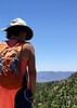
. The ruins are so pretty in white and of course the views are awesome toward Lake Pleasant. We spotted what we think was a spring way over and across the river bed to the SE. I zoomed in to see if it was water seeping or shiny rock; still can't tell. And then off to the west are the spectacular looking Hieroglyphic Mountains, I took several photos of them including a pano.

We wandered around a bit before walking the whole outside of the mesa and peering over the edge from time to time. You can also see the New River Mountains to the NE. From here we spotted the two palm trees we had seen across the river bed and you could look way yonder to see the the Little Grand Canyon Rancho. It was a bit windy on the east end so we headed back to where we started where we lingered a bit more before our hike back down the mountain, by the river bed and to the truck. We got a treat as Wade spotted a herd of burros through the trees in the river bed so we jumped the fence to get a closer look-see. They didn't stick around long so we continued on our way.

We finished off the day with lunch at BCC. Thank you Wade! The bad news is my camera lens seems to have a permanent spot, maybe two BUT only in movie mode and only when the sunlight hits a certain way. I think my warranty company may disown me but I've got to see if they can fix it. I sure hope so.

hiking the road near the Agua River bed https://youtu.be/tt ... XmPU
Roads by the River Bed and the roads https://youtu.be/bU ... xTSM
Road and hike to the Mesa https://youtu.be/of ... sX8s
The Mesa and the Ruins - in production 12/4/2015, done 12/7/2015 https://youtu.be/mf ... 6dtU
The Mesa & Ruins and Burros done 12/7/2015 https://youtu.be/Qs ... mFeg
 Fauna
 Fauna [ checklist ]
[ checklist ]  Wild Burro
_____________________
For me, sometimes it's just as much about the journey as the destination.
Oh, and once in awhile, don't forget to look back at the trail you've traveled.
  1 archive
Feb 09 2015
avatar

 Routes 297
 Photos 6,928
 Triplogs 552

49 male
 Joined Dec 30 2007
 Avondale,Az
Agua Fria to Indian Mesa High Tide, AZ 
Agua Fria to Indian Mesa High Tide, AZ
 
Hiking avatar Feb 09 2015
StoicTriplogs 552
Hiking7.56 Miles 1,498 AEG
Hiking7.56 Miles   4 Hrs   19 Mns   2.22 mph
1,498 ft AEG      55 Mns Break
 
1st trip
Partners none no partners
I took the dogs out to the Agua Fria River, with Indian Mesa as a possible destination. The hike started out great. It was an easy path to follow and plenty of water for the dogs to play in. Everything changed around 1.25 miles into the hike. The water levels where to high to continue on the trail. We had to move to higher ground. At this point, I wasn't sure if we where going to make our destination. I didn't want to take the dogs off trail in the middle of the desert. We continued anyway. It took about 2 miles of off trail hiking to get back on track. We then hiked up to Indian Mesa. The ruins and the views where amazing. We hiked around the top then back down. We took a similar trail back to get to the river. We did take a few breaks along the way back. It was getting warm and the terrain was a little rough on my bigger dog. My little dog was unfazed. She finally fell asleep 6 hours after we got home. Overall both dogs did great.
I wouldn't recommend taking dogs off trail here, and I wont do it again. If water levels are low, taking a dog would be fine.
 Named place
 Named place [ checklist ]
[ checklist ]  Indian Mesa
_____________________
 
Nov 24 2014
avatar

 Routes 297
 Photos 6,928
 Triplogs 552

49 male
 Joined Dec 30 2007
 Avondale,Az
China Damn/ Tule Ruins/ Indian Mesa, AZ 
China Damn/ Tule Ruins/ Indian Mesa, AZ
 
Hiking avatar Nov 24 2014
StoicTriplogs 552
Hiking2.60 Miles 918 AEG
Hiking2.60 Miles   3 Hrs   35 Mns   1.11 mph
918 ft AEG   1 Hour   15 Mns Break
 
1st trip
Linked   linked  
Partners none no partners
I went out and played North of Lake Pleasant. I hit a couple ruins sites that I have been wanting to visit.
My first destination was the old China damn and tunnel. The damn is collecting a lot of debris behind it. I did stumble across a Geo Cache at this site. If I was to do the damn again, I would have parked off the main road and hiked the 4x4 trail in. It would add a 1/2 mile round trip. The road is rough and narrow. I hiked about .41 miles and spent 20 minutes in the area.

Next stop was the Tule Creek Fort and Creek ruins. I walked the site, looking at the house, dogs grave, and the shed. Pooch lived to be 10 years old, impressive for a dog in the 1930s. I then hiked up to Tule Fort. Its an easy off trail hike. I took my time going up and coming down. I hiked 1.15 miles and spend almost 2 hours in this area.

I then drove to Indian Mesa. This section of the road was worse than the rest. There where a couple of challenges on this section of the drive. Half way up the trail, I started hearing voices. First human contact of the day. There where two hikes from AZOTC at the top. The wind had picked up and was blowing hard. The hikers and I took shelter in one of the ruins and talked for a while. They ate their lunch and we talked about other hikes in the area. Over all I was impressed with this site. I wasn't expecting the amount of rooms here. I hiked a little over 1 mile, and spend 1hour 20 minutes here. Overall a good day. There are a couple more things I want to see in the area, so I will be back.

**All the roads from the Cow Creek Rd turn off are rough roads. Experience with 4x4s and high clearance vehicles is a must. Some parts of the road put my experience and my truck to the test.
 Culture
 Culture [ checklist ]
[ checklist ]  Grave - Identified
_____________________
  1 archive
Sep 28 2014
avatar

 Routes 7
 Photos 273
 Triplogs 234

54 male
 Joined Jul 16 2011
 Phoenix, AZ
Indian Mesa RuinsPhoenix, AZ
Phoenix, AZ
Hiking avatar Sep 28 2014
EartheistTriplogs 234
Hiking7.00 Miles 1,055 AEG
Hiking7.00 Miles
1,055 ft AEG
 no routesno photosets
1st trip
Linked   linked  
Partners partners
Uberdroog
Started at the Table Mesa trailhead, the trail follows the Agua Fria west to the Indian Mesa. Pretty much level all the way until the Mesa. Lots of growth everywhere from all the rain we got the last few months. There was surprising little water in the river though. The ruins were a treat, several rooms, great views. Very cool hike.
_____________________
 
May 22 2014
avatar

 Routes 1
 Triplogs 16

male
 Joined Dec 28 2013
 Scottsdale
Indian Mesa RuinsPhoenix, AZ
Phoenix, AZ
Hiking avatar May 22 2014
A76100Triplogs 16
Hiking6.70 Miles 600 AEG
Hiking6.70 Miles   4 Hrs      1.68 mph
600 ft AEG
 no routesno photosets
1st trip
Linked   none no linked trail guides
Partners none no partners
I don’t know if you can still take the motor route from the West. A good description of reaching the message from the East is found in Dave Wilson's Hiking Ruins Seldom Seen. Reference Trial 2: Indian Mesa. Basically follow Dave Wilson's description to get from the trailhead to Cow Creek Road. Park at N33 58.780 W112 11.519. There is a $6 park fee. Leave the parking lot and hike along the road you came in on, through the gate, across the dry Aqua Fria River, and on the obvious trail, past the White Bluffs, about 2.0-2.2 miles to Cow Creek Road. (N33 57.953 W112 13.103) Turn Right toward W/NW.

At this point, I recommend a deviation from Wilson’s description. Follow Cow Creek to about 3.0 miles from the start. You will reach a ridge where you can go down, but you will also see an obvious trail that goes up and to left. (N33 58.060 W112 13.737). Follow this track up a steep path up and to the S/SW to the Ruins. (N33 57.917 W112 13.673) Enjoy exploring this area.

I enjoyed this hike. I saw no other hikers (although I did see some riders on horseback in the distance). The ruin is on the top of the mesa and the views are pretty wonderful. The ruins are very large with many buildings and rooms.
_____________________
 
Feb 22 2014
avatar

 Guides 4
 Photos 542
 Triplogs 573

46 male
 Joined Oct 19 2010
 Mesa, AZ
Indian Mesa RuinsPhoenix, AZ
Phoenix, AZ
Hiking avatar Feb 22 2014
Charger55Triplogs 573
Hiking7.00 Miles 150 AEG
Hiking7.00 Miles   4 Hrs   30 Mns   1.56 mph
150 ft AEG
 no routesno photosets
1st trip
Linked   none no linked trail guides
Partners none no partners
_____________________
"I've driven across deserts, driven by the irony, that only being shackled to the road could ever I be free"
- Frank Turner "The Road"
 
Feb 01 2014
avatar

 Routes 189
 Photos 7,244
 Triplogs 1,742

57 male
 Joined Apr 25 2011
 Goodyear, AZ
Indian Mesa RuinsPhoenix, AZ
Phoenix, AZ
Hiking avatar Feb 01 2014
NightstalkerTriplogs 1,742
Hiking7.08 Miles 847 AEG
Hiking7.08 Miles   3 Hrs   25 Mns   2.07 mph
847 ft AEG12 LBS Pack
 
Linked   none no linked trail guides
Partners none no partners
Great hike! Awesome ruins! Beautiful views!
_____________________
 
Dec 19 2013
avatar

 Guides 27
 Routes 61
 Photos 2,620
 Triplogs 700

69 male
 Joined Jan 23 2008
 Phoenix, AZ
Indian Mesa RuinsPhoenix, AZ
Phoenix, AZ
Hiking avatar Dec 19 2013
AZWanderingBearTriplogs 700
Hiking7.00 Miles 750 AEG
Hiking7.00 Miles   2 Hrs   25 Mns   2.90 mph
750 ft AEG14 LBS Pack
 no routes
1st trip
Linked   none no linked trail guides
Partners none no partners
I've had a hankering lately to visit Indian ruins. Last week was the ones just north of Chalk Canyon. Today I headed to the northeast corner of Lake Pleasant to visit Indian Mesa. Drove the Jeep to the remote but well signed (WE WANT YOUR MONEY) Lake Pleasant trailhead via Table Mesa Road. Cowboys were corralling cattle just east of the trailhead. This area is still a working ranch.

Dropped into the very dry Aqua Fria for a short distance and then took the old jeep road, still used by the ranchers and various ATVers. The road parallels the river and for the first half mile or so looks a lot like a park, someplace you'd like to camp perhaps. The trail then breaks into an open and sandy area that can be flooded by Lake Pleasant when it is high. Cockle burrs love the sand and are here in abundance. Indian Mesa looms straight ahead. Along the north side of the trail a grove of eucalyptus trees interspersed with a cottonwood or two offered a shady and aromatic resting spot.

Just beyond this little oasis the white bluffs flank the north side of the hike. The soft limestone and sands of these bluffs erode easily. The harder cap rock at the top protect the soft material below until the cap rock itself erodes, or more likely, enough of the softer material below it collapses and undermines the entire structure. Hmmm, seems a fitting metaphor for whats happening to our own country these days. But back to the hike.

The familiar sound of four big propellers broke the silence as I trudged along. A USAF C-130 aircraft was on a low level training mission roaring ever so clumsily up the Agua Fria river valley from west to east. I've ridden in the back of these beasts in a previous life. They are slow, loud and massively uncomfortable, far more suited to hauling beans and bullets to end-of-the-line forward operating bases than people, especially THIS fighter flying, missile launching, bomb dropping, gun shooting people. The guy flying it probably had a spoon stuck in the pencil pocket of his flight suit, too. Trash haulers! God love 'em cause no one else will. (OK, wife says enough of the pilot rivalry stuff, get on with the real story.)

Soon after the sandy bottom, the trail turns back northwest and begins to climb up towards the mesa. Ran into about two dozen hikers, probably some kind of a hiking club, headed opposite to my direction. Footprints later told me they'd visited the mesa ruins earlier.

Two cairns mark the foot trail up to the mesa's top and the ruins. A short steep climb brings you to the entry to the ruins, a small notch in the vertical walls that comprise the "castle" of the mesa. Besides the obligatory government sign at the top of the entry way, you notice small windows in the protective walls of the ruin. I half expected to see a pair of dark suspicious eyes peering at me as I scaled the entry into this ancient site.

The top of the mesa is spacious and has a commanding view of the river valley below and the surrounding desert, mesas and hills. Many of the fortification walls and those of some of the rooms are very well preserved. Most of the structures are along the northern side of the mesa. I explored a bit and then worked over to the southern end with its fantastic view of the river below and lake to the west. Snacked, listened to the wind and admired the view, wondering how it had changed in the hundreds of years since the site was occupied. Was the rock upon which I now rested my modern posterior a favorite sitting and thinking place for a Hohokam resident a century ago? If I could have a conversation with him/her I think I'd ask how the fishing was back then. I suspect he/she'd want to know what the heck those paddle boarders thought they were doing anyway.

Explored a bit more finding plenty of pottery shards in the main area. Nice to find them, but they belong here. Found a grinding hole, but no metates or petroglyphs. I don't think the porous easily eroding limestone lends itself to petroglyphs.

Time marches on, and so then must I. Began working my way back to the Jeep. Sidetracked across the dry river bed to explore what I think is an old rock and mortar cistern on the south side of the river. There is lots of old fencing in this area and some pretty much unused jeep trails. If there once was a cabin or ranch line shack here, I found no evidence of it. About 150 feet east I found a spring seeping under a large sandstone bluff. Lots of tracks in the sand of critters and cows watering here.

Visiting these types of ruins has always inspired me while simultaneously reminding me of my very small and very fleeting place in this vast universe. Rocks stacked well remain after a century. What evidence of me will some wanderer find a 1000 years into the future? Anything?
 Flora
 Flora [ checklist ]
[ checklist ]  Common Cocklebur
 Culture
 Culture [ checklist ]
[ checklist ]  Aircraft
foliage observationfoliage observationfoliage observationfoliage observationfoliage observation
Autumn Foliage Observation Light
_____________________
All you have is your fire...
And the place you need to reach
 
average hiking speed 2.02 mph
1, 2  Next

WARNING! Hiking and outdoor related sports can be dangerous. Be responsible and prepare for the trip. Study the area you are entering and plan accordingly. Dress for the current and unexpected weather changes. Take plenty of water. Never go alone. Make an itinerary with your plan(s), route(s), destination(s) and expected return time. Give your itinerary to trusted family and/or friends.

helpcommentissue

end of page marker