|
| | | |
| |
|
| Hiking | 18.28 Miles |
2,993 AEG |
| | Hiking | 18.28 Miles | | | |
| 2,993 ft AEG | | | | |
|
|
| |
| Linked |
|
none
[ show ]
| no linked trail guides |
| Partners |
|
none
[ show ]
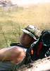
| no partners | | This was suppose to be the first of two overnight trips I had planned for my four days in the Primitive Blue Range. I knew it was going to be hot at the Blue River, so I made sure to be ready to leave by pretty early in the morning. However, I completely negated that plan by deciding to visit Rose Peak first thing in the morning. My start time ended up being just past 7 in the morning, but I was already way behind the mental calculations I had did in my head for getting myself and Blanco to camp, before the warm temperatures reached their might at the Blue.
Despite the late start, the hike immediately began to pay dividends as I heard a crash through the woods and looked up in time to see a big brown bear running down the canyon. However, oddly enough the bear only ran about 25 meters or so and then stopped, enabling Blanco and I to catch up to her again. We shared eye contact for a few minutes and I tried to snap some pictures with the Iphone, but with no great shots I pulled Blanco down the trail about 20 feet and the bear just went back to her routine. At this moment I noticed she also had a cub with her, so I did not press for a good shot and from a safe distance I got as many horrible Iphone pics as I could and then left. But it was by far and away my most rewarding/complete bear encounter. We watched her go about a routine of itching herself on a tree and foraging on various leaves and ferns for what seemed like at least five minutes, before basically leaving out of boredom, as nothing overly exciting was happening, the bear had no intentions of leaving and I was not willing to get any closer for a better shot with her cub near.
Although it will start to sound like a fish story from here, Blanco and I ran into two more bears at the old cabin ruins, probably less than a mile up the trail. This time the sow was not in the mood for a photo shoot, but she did seem very annoyed by the fact that her cub ran left and she ran right, somewhat putting Blanco and I between the two of them. I literally attempted one picture and then just headed down the trail, trying to convey indifference to the big sow, in hopes of not agitating her. We left the old cabin area and the real hiking seemed to begin. The trail was in generally good shape and there was ample amounts of water in Strayhorse Creek. However, I began to realize that I was already a little warm and so was Blanco. I checked my G.P.S and it still showed a solid 4 miles to the Blue, plus another 3.5 down the Blue and another one to camp. At this moment, I decided that I was not willing to death march Blanco and myself across some pretty rugged terrain in the mid 90s. As much as it annoyed me to know that I was now signing up for an 18 mile day hike with a full pack, I headed back to the TH. The upper elevations were simply too nice and there was now opportunities to maximize my time in the Blue Range, by adding in some day hikes for Friday.
One more boring bear sighting on the way back and a lot of digging in deep to make the nearly 3000 feet climb back to the TH. Still annoyed about carrying my heavy pack all day, I found some silver linings, cool bear sightings, good training for the Colorado Trail, Cavs v. Warriors on XM radio and chances to cover more new ground with a slack pack the next day.
Final Notes
The trail was generally in pretty good shape, but as you near the Blue the route can become more faint and easy to lose at times. Some stretches are cairned or blazed well and the creek crossing may take a second look or two in order to locate the trail.
I ran into the fire watch after my hike and he said the reason I saw so many bears may be attributed to the fact that they dump problem bears from parks up north at that very trailhead. I have no idea if what he said was true, but could be something there, who knows? It might explain why the first sow did not seem to mind our presence. |
| _____________________
| | |
|
|
|
 Route Editor