|
| | | |
| |
|
| Hiking | 10.50 Miles |
3,500 AEG |
| | Hiking | 10.50 Miles | 6 Hrs | | 1.75 mph |
| 3,500 ft AEG | | | | |
|
|
| |
| Linked |
|
none
[ show ]
| no linked trail guides |
| Partners |
|
none
[ show ]
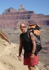
| no partners | | I drove to the Grandview trailhead and started down around 7:45 in the morning. As usual, there was hardly anyone around in the parking lot area at this time of the morning. Kept up a steady pace on the descent until finally running into a husband and wife who were hiking out, about 15 minutes before reaching the cave above Horseshoe Mesa. They told me it was incredibly windy the previous day so I'm glad I postponed this day hike. I hadn't been out to the western (left) arm of the mesa before, so I decided this would be the route for a decent day loop. Scrambled down the loose scree from the arm to the junction of the Tonto trail. The path of this descent was a bit obscure in some areas, mostly near the bottom third, but in general it was fairly easy to follow the route. I hit the junction of the Tonto without actually knowing it, as I don't believe there was a sign. It may have been at the location of a steel rod that was pounded into the dirt. My plan was to hike the Tonto to the west and I sort of defaulted to this without realizing it. Had I wanted to go east, I would have realized the error pretty quickly and turned around.
This section of the Tonto over to Cottonwood Creek is pretty flat and hiking along at 2.5 - 3 miles per hour is doable. There is a lot of cactus afoot and a bit of care needs to be exercised to avoid a spiny confrontation. It didn't take long to reach the creek itself, probably about 30 minutes or so after leaving the Grandview trail junction. The creek was running nicely but I had brought a gallon of water for the day so I didn't need to refill here. There is a sign for the trail junction of the Tonto and the west arm of the Grandview trail going back up to Horseshoe Mesa, but there are also a lot of smaller trails leading to various campsites. After a false start, I finally figured out the actual route out, which is west of the creek drainage. It crosses back over the drainage a bit higher up and then shortly starts the lung busting climb out of Cottonwood Canyon. The footing on the lower section of the trail through the Bright Angel shale is pretty loose. It's probably easier to ascend, and you'd want to take a bit of care if you're going in the opposite direction. At the base of the Redwall, the trail levels off a bit and traverses northwards to the actual Redwall break. From there it follows a fairly well trodden switchback up to a neat saddle area where there is a fine view of Cottonwood Creek below. Ten more minutes of easier uphill brings you back to the mesa itself. I think if you're camping on the mesa and are trying to decide on getting water at Cottonwood Creek (west) or going to Page Spring (east), I'd probably choose the latter since it's a shorter distance and less of an elevation drop as well. After a short lunch break, it was just a matter of retracing my route back to the parking lot. I only ran into perhaps a dozen people all day. |
| _____________________
| | |
|
|
|
 Route Editor