username
X
password
register
for free!
help
ArticlesGuidesRoutes
 
Photosets
 
 Comments
triplogs   photosets   labels comments more
2 triplogs
login for filter options
Dec 24 2016
avatar

 Triplogs 2

49 male
 Joined Dec 18 2016
 Tucson, Arizona
Miller Creek Trail #28Tucson, AZ
Tucson, AZ
Run/Jog avatar Dec 24 2016
SwanTriplogs 2
Run/Jog23.00 Miles 6,394 AEG
Run/Jog23.00 Miles   5 Hrs   48 Mns   3.97 mph
6,394 ft AEG
 no routesno photosets
1st trip
Headed over to Happy Valley on Christmas Eve to get up in the high country ahead of the big weather system that was predicted to dump a bunch of snow. No cars at Miller Creek, perfect clear cold weather. Miller Creek trail in good condition, a little confusing in a spot or two as it crosses some drainages. Headed up Heartbreak Ridge, my first time on that trail - wasn't sure what to expect as I figured it didn't get much traffic. Trail in excellent condition, surprised to see tons of steps build on a trail so far in the backcountry - a total contrast to the brushy thrash-fests on all the trails on the "back side" of the Santa Catalinas (like Samaniego Ridge or CDO). I guess the National Parks have a much larger budget for trail maintenance... Lots of water along the way to Devil's Bathtub, which I had never visited, which was also flowing strong. Headed up to Manning Cabin, nobody there either except for a few deer, think I had the whole mountain to myself. (Plenty of water at Manning, as always...)

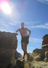
Ran up to Spud Rock, and the weather started changing fast, was suddenly in a windy cloud with the temps dropping fast and smoky wisps of fog blowing through the forest. Put on some layers (tights, windshirt, buff), ran up to the summit and didn't even stop, and bailed down the Bonita trail, and by the time I hit Heartbreak, I was beneath the cloud ceiling that was enveloping Micah and back in the sun, but the temp kept dropping. Crazy wind along the ridge, literally pushed me off the trail a few times, lots of birds flitting around, couldn't figure out how they don't get blown off the mountain. Made time to run up to the Lookout on the way out, another first - incredible views of Rincon and San Pedro Valley, worth the side trip.

Tried to keep a strong pace coming down Miller, but that is one steep, boulder-filled descent. Returned to the truck in a total time a bit under six hours for 23mi and 6400aev, and cracked a beer just as the sky went black and that huge weather system hit, exciting drive back to Tucson rocking down the freeway in the old 4x4 truck with high winds, sideways precip, and wrecks here and there...
_____________________
  2 archives
Dec 17 2016
avatar

 Triplogs 2

49 male
 Joined Dec 18 2016
 Tucson, Arizona
Agua Caliente Trail #140Tucson, AZ
Tucson, AZ
Run/Jog avatar Dec 17 2016
SwanTriplogs 2
Run/Jog14.91 Miles 5,236 AEG
Run/Jog14.91 Miles   4 Hrs   28 Mns   3.34 mph
5,236 ft AEG
 no routesno photosets
1st trip
Partners none no partners
Followed Agua Caliente from trailhead from FS183 up to Agua Caliente Saddle, continued on to Josephine Saddle, and then took Old Baldy trail to Mt. Wrightson Summit. Temps were in the 30s most of the day, sunny. Was comfortable in shorts, windshirt, and gloves, but was moving fast the whole time.

Forest Service 183 is well graded, and even low passenger cars shouldn't have any trouble as of the time of this writing. Was expecting trail to be much more overgrown with the Lehman's Lovegrass that has taken over the high country of the Catalinas and the Chiricahuas this year, but was pleasantly surprised to find the trail remarkably clear of stickers, grass, or deadfall. A bit of scrub for the first half mile, but the trail is beat down. I had a .gpx from Alltrails.com, and while the trail was clear and easy to follow, it did not track along the gps route for much of the way to Agua Caliente saddle. USGS topo shows two springs on the way to AC saddle, but I saw no water. Lots of bear scat and game trails, one fresh. All trail intersections well marked and signed (except cairned turn off for Carrie Nation trail, which is not signed).

First two miles are steep, covering about 2k elevation gain in short order, then a few miles cruising flat, and then another steep 2k feet in a few short miles to the summit.

The long cruise across the N side of Mt. Hopkins (from Agua Caliente saddle to Josephine saddle) was the highlight of the trip, with fantastic views of the valley and Mt. Wrightson summit formation.

Small amount of water at Bellows Spring, right on the trail before the switchbacks up to Baldy saddle. Plenty of snow dusting Old Baldy trail, and final push to the summit had significant snow and ice accumulated - enough to keep things interesting, but not to slow travel too much. Returned the same way, 4h28min including a few breaks.

Excellent route to reach Baldy, it was nice to have the trail to myself, then a little socializing on the "busy" section from Josephine Saddle to summit, and then blast back into the solitude for the trip down...
_____________________
 

WARNING! Hiking and outdoor related sports can be dangerous. Be responsible and prepare for the trip. Study the area you are entering and plan accordingly. Dress for the current and unexpected weather changes. Take plenty of water. Never go alone. Make an itinerary with your plan(s), route(s), destination(s) and expected return time. Give your itinerary to trusted family and/or friends.

helpcommentissue

end of page marker