Overview
An alternate approach to the forested inner bowl of Madera Canyon via a less-often visited western canyon, passing through a dense scrub forest then into the Madera pine country en route to Agua Caliente Saddle. From here an easy jaunt along the flanks of Mt. Hopkins and Jack Mountain to Josephine Saddle. This hike offers plenty of shade, and in the summer there are tons of flowers.
Hike
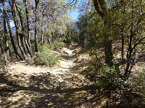
From the signed trailhead this trail heads off east into scrub country and basically follows the north flank of Agua Caliente Canyon most of the way. Right away you can see the differences of this side of the range - the peaks are more rocky and severe. Periodic breaks through the trees afford wonderful views northeast towards Mt. Hopkins and the huge MMT telescope. There are no route-finding issues on this trail, it can be a little overgrown but that's about it. The trail up to Agua Caliente Saddle is basically a nonstop climb of varying severity. It's about 2.3 miles to the saddle. The first half generally stays north of the canyon bottom. There are a couple of canyon crossings thereafter, mostly over northern drainages feeding into Agua Caliente. These are easy to navigate and generally forested so that it just seems like you are crossing back and forth over the main canyon. The climbing is much more severe once this starts. A little over halfway you may notice a couple of mine shafts beneath you to the right. There are three and they are uncovered so please be careful. One of them is labeled Treasure Vault Mine on the maps. Soon thereafter you make a nondescript grassy canyon crossing (truly over Agua Caliente this time) then the last 1/3-1/2 mils is up the south flank of the canyon. At this point, you also transition into the pine forest. And then you are at Agua Caliente Saddle - marked by an old rusty sign. There are some great huge juniper here, perfect for resting under.
The rest of the hike is simple, the hard over being achieved on the climb up. From here, follow the sign and head right or southeast on the Agua Caliente trail to Josephine Saddle. There are magnificent views over Madera Canyon and to Wrightson and the Santa Rita ridgeline for much of the way, sometimes forested and sometimes wide open. The trail is a narrow little path along the northern flanks of Mt. Hopkins and then Jack Mountain. It's fairly level, with constant little ups and downs but no major climbs. Within 1/3 mile from the saddle, the Vault Mine trail will come up from your left. Just stay on Agua Caliente the whole way. It is almost 2.5 miles to Josephine Saddle, the last stretch being through a magnificent pine forest.
WARNING! Hiking and outdoor related sports can be dangerous. Be responsible and prepare for the trip. Study the area you are entering and plan accordingly. Dress for the current and unexpected weather changes. Take plenty of water. Never go alone. Make an itinerary with your plan(s), route(s), destination(s) and expected return time. Give your itinerary to trusted family and/or friends.
Permit $$
None
Coronado Forest MVUMs are rarely necessary to review unless mentioned in the description or directions Coronado Motor Vehicle Use Maps (MVUMs)
Directions
Road
High Clearance possible when dry
To hike From Tucson, Leave Interstate 19 at the Canoa Road Exit. Take the east frontage road, 3 miles south to Elephant Head Road, and turn east 1.6 miles to Mt. Hopkins Road. Drive 4.5 miles to Forest Road 183, turn north on this dirt road about 2.4 miles to the trailhead at the canyon. There is a small pull-out to the left just before the signed trailhead. Park here and walk a few hundred feet up the road to the trailhead on the right.
page created by fricknaley on Nov 23 2009 11:22 am
 Route Editor


 Overview