|
| | | |
| |
|
| Hiking | 14.80 Miles |
2,748 AEG |
| | Hiking | 14.80 Miles | 11 Hrs | | 2.47 mph |
| 2,748 ft AEG | 5 Hrs Break | 30 LBS Pack | | |
|
|
| |
| Linked |
|
none
[ show ]
| no linked trail guides |
| Partners |
|
none
[ show ]
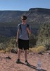
| no partners | | I arrived at the trail around 8:30 AM, parking lot was almost full. I would recommend arriving before 8:00 AM to guarantee parking at the Peralta Trail Head. Starting on Bluff Springs Trail you get a nice warm up ascending cardiac hill. I found the trail to be easy to find even when crossing washes. This is mainly due to the rock stack markers. My hiking partner and did this trail clock-wise, taking Terrapin Trail to Dutchman Trail. By the time my partner and I arrived to the base of weavers needle, the clouds started to get dark. I set up the tarp to keep us dry in case it started to pour. It only seemed to sprinkle so we continued on. Arriving at Dutchman Trail from Terrapin the clouds started to lower making for great pictures. From here to Charlebois Springs the trail become somewhat flat. Crossing wash to wash it was easy to loose the trail due to a lot of of shoots to dispersed camping. My buddy and I collected some water from the upper pool of CharleBois Springs and continued to music canyon. There were a bunch of campers the the springs so we decided to stay at music canyon. We found a camp spot at 4:30 about 5 yards off the trail, however we started to notice that since the wood is wet, we wont be able to start a fire. We noticed it was going to be a miserable night so we decided to continue the trail and not camp. Complete darkness fell upon us at Holmes Springs and we were felling discouraged about making it back to the trail head. We kept a 3.2 mph pace all the way back to the car. By the time I started my descend upon cardiac hill my feet felt like they need to be amputated. I really recommend this hike for people are not far to over their heads as I am.  |
| | |
|
|
|
 Route Editor