 Route Editor

| Guide | ♦ | 416 Triplogs | 23 Topics |
details | drive | permit | forecast | 🔥 route |
stats |
photos | triplogs | topics | location |
| 3.6k | 416 | 23 |
Kakatak Tamai by joebartels  Route RouteUp Siphon Draw passing the Flatiron, across the ridgeline, over to Superstition Peak 5057, down to West Boulder Saddle, down to the old Carney Springs Trailhead and finish on the Lost Goldmine Trail to Peralta Trailhead(2026 route ends @ Lost Goldmine Trailhead). A vehicle shuttle is necessary for a day hike. A 2-3 day backpack might be to loop down to Weaver's Needle or further. Other Routes You might consider a 12.5mi route from the free Crosscut Trailhead to Peralta Trailhead via Siphon Draw and Carney Springs / Lost Goldmine. A reverse Flatiron beginning with a Cave Trail ending is the ultimate journey.
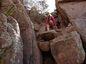
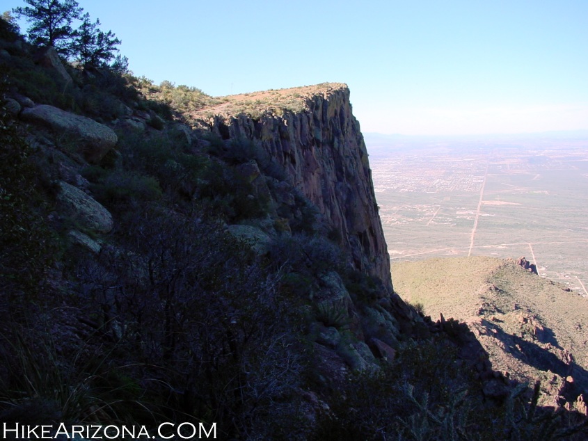
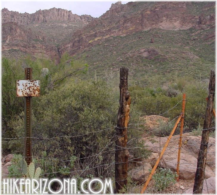
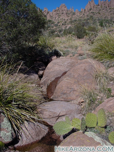
This is a hardy day hike. There are a couple of escape routes to keep in mind. Hog Canyon has a couple of options but leaves you in an area that is difficult to access without prior knowledge. Hieroglyphics Canyon is more worthy. Better thinking is to be prepared to complete the hike. The escape routes would likely cause more trouble without previous experience. Prepare Unless you're a skilled route finder, I suggest hiking both ends first to get familiar with the area. Hike the "Flatiron" end, then on another day, hike to West Boulder Saddle on the "Dacite Super Loop." I think you'll agree. Both of these hikes fall into the strenuous category. Of course, you'll only need to go up one of these trails and come down on the other. Plus, you'll need to set up a car shuttle at one end. You can hike this trail in either direction. Either direction starts shaded from the morning sun. I prefer to go from the Flatiron end to Peralta Trailhead. It seems like less head-on sun, especially at the end of the hike. If you're not into the shuttle thing, then split it up into two hikes. I do not believe this hike is a route finding nightmare. My personal opinion is it's more of an endurance issue. When you go beyond your limits, you start making mistakes on any trail. I enjoyed being up on the northwestern ridge. I found several sections of trail coupled with rock cairns in indistinct areas. Not once was I worried about getting lost. The views are stunning in all directions. Let's Hike! From Siphon DrawHike up to towards the Flatiron. (see Flatiron hike for more details) When you break from the canyon, on to the deck, leading over to the Flatiron itself, do not go towards the Flatiron. Instead, continue UP and over the saddle above you. Over the saddle, you're likely looking into unseen territory. Any unseen territory in the Superstitions is always a pleaser. It only gets better. You will notice there is a trail going down and out the other side. This is it, the Ridgeline Trail, now how hard was that? At the saddle, you could take a left and go up to the top of Superstition Mountain and bag the peak. The side excursion can be time-consuming if you are not familiar with the route. Continuing on the trail is fairly overgrown for a short section. This reminds me, throughout this hike, pay close attention to the cacti lining the trail. This is not a maintained trail. I hiked it in Teva sandals. Leather boots might be a better choice. Jeans aren't necessary as there's little bushwhacking, and they're not much defense against needles. Wedge Rock Saddle to the Ridge The trail goes down to a group of pine trees. It appears the trail will go in-between two pines. In reality that's a campsite.( between trees 2 & 3 in the photo) The trail goes around the right. Looking back on the area is a good idea. You will notice there are five pines in all. Four mature and a fifth small pine as of 2001. Wedge Rock Saddle is seen further beyond the pines. So... if you return this way or hike the trail in the opposite direction, you'll be going left of the trees. It's a good idea to often check the trail and scenery behind you to keep orientated. If you do this in reverse, it is important to know your way back to the Flatiron since you can't see it from the ridge. The trail curves back north before actually jumping on the ridge. Between Monument Canyon and Hog Canyon fanning down below to your right is another canyon (I'm not sure of the name) coming up to this indent in the ridge. Here I crossed over a small stream that comes down from Superstition Mountain. I was shocked to find running water up here, especially over a week since the last rain. Before the stream was a very lush section of trail. Felt like I was near Parson's Spring more than on the rugged ridge of the Superstitions. Okay, maybe not that extreme, but it was quite the contrast. I encountered a couple of seeps along the way too. On the Ridge This is the section most likely feared. On the contrary, it's the most soothing worry-free section of the hike. You can make good time across a majority of this terrain, or you can easily let the hours melt away. The route is well worn or cairned across. A few sucker trails may tempt or swindle. However, you really can't go over five minutes in the wrong direction. When you hear about people getting lost in the Superstitions, it's not on this ridgeline. It's in Barks Canyon or the Red Tanks Trail. Enjoy the views and take your photos here, or you'll end up with photos everybody has seen on either end. Superstition Peak 5057 to West Boulder Saddle This is the route finding section. As you are coming across the ridgeline approaching Peak 5057, cairns are your guide. Coming around the west side of topo mark 4790 is a maze of boulders. The cairns lead you up towards Peak 5057, then skirt the peak on the east. Here it looks all downhill. It is, and it seems never-ending at times. If you wish to bag Peak 5057, it's a short side excursion. Route finding is relatively easy until you level out northeast behind the Three Sisters. The terrain turns to a smooth rock slab, and you cross a ravine. This is the origin of West Boulder Creek, which eventually empties into Canyon Lake ten miles away. Finding the proper route out of the ravine is critical, or you'll end up on an old alignment that's a total bushwhack. Continue through the cairn maze. If you're on the proper route, it's not a bushwhack, and before reaching West Boulder Saddle, you'll pass near a stumpy pipe with a brass cap. This is a general land corner section-marker. You'll know you're at West Boulder Saddle as you come around a huge bathroom sized boulder onto a saddle. West Boulder Saddle to Peralta Trailhead From here, it's down West Boulder Trail to the old Carney Springs Trailhead. I suggest checking out the Dacite Super Loop prior to attempting this hike. First, you head down to the false saddle. Next, it's a cairn route and a practical slide down to the old Carney Springs Campground. This is followed by a mild brushy flat hike to the fence (old Carney Springs Trailhead). From the fence, you turn east on the unmarked Lost Goldmine Trail and follow it to Peralta Trail. Be forewarned. There is no signage to guide you in this section. Trails run rampant. At worst, you'll end up on the road to Peralta Trailhead or at the Lost Goldmine Trailhead, which means a slightly longer hike. Wrap up If you have the endurance, you will enjoy this trail. Be careful, stay calm in comprising situations, and know when to turn around. You would be wise to know the surrounding area before attempting this hike. This should not be your introduction to the Superstitions, or it could be your last. There is a cell signal from the whole trail. Keep in mind an air rescue is expensive. There's no shade up on the ridge. I got a nasty sunburn here in the winter. Sunscreen is necessary for February. I wouldn't recommend hiking this trail in weather over eighty degrees. Be sure to take plenty of water, 5-6 quarts in 70-degree weather. -- Summary edited 2008-02-04 --
Check out the Official Route and Triplogs. Note This is a difficult hike. Arrive fit and prepared or this could get ugly. Leave No Trace and +Add a Triplog after your hike to support this local community. | |||||||||||||||||||||||||||||||||||||||||||||||||||||||||||||||||||||||||||||||||||||||||||||||||||||||||||||||||||||||||||||||||||||||||||||||||||||||||||||||||||||||||||||||||||||||||||||||||||||||||||||||||||||||||||


