Overview
Here is a hike worthy of excitement for inaugural hikers! But, first and foremost, be realistic; are you ready for Humphreys! Okay, so this isn't Mt. Whitney or Everest, but this baby will push most desert dwellers to the edge.
History
An extinct volcano, Humphreys Peak, is the highest in Arizona. It is one of three peaks forming a rough U-shaped valley known as the Inner Basin or Interior Valley. G.K. Gilbert, in 1873 named the peak for his superior officer, Brig. Gen. Andrew Atkinson Humphreys, who had been with the Ives Expedition as a captain in 1851.
Hike
Welcome to Snow Bowl. That's right! The first section of the trail crosses winter wonderland. Wildflowers and warm air will keep skiing off your mind. Pass under the ski lifts on towards the forest. Soon after entering the woods, you will pass the Kachina Peaks Wilderness boundary. The trail is consistently uphill all the way.
After 3 miles of hiking, you are near the timberline. Stunted bristlecone pines take over. The forest thins out, and at the saddle, you will pass the junction with the Weatherford Trail at 3.75 miles.
From here on, pay attention to the trail. There is no vegetation. The vaguely defined path in areas makes it easy to get off track.
Weather changes in a flash up here. Summer of '98, I got pounded by a hail storm. Excitement builds as you pass a couple of false peaks along the way, soon after reaching the summit. Wow, what a feeling!
Lightning Kills
Stay off the mountain when thunderstorms are forecasted. July and August are notorious for quick unexpected storms. Lower the risk by being OFF the mountain before 11am on a clear morning. Stay safe, read the NOLS Backcountry Lightning Safety Guidelines.
Coconino FS Details This steep mountain trail leads to the highest point in Arizona. If you consider it merely as a means to that end, however, you'll miss much of the reason to come here. Along its 4.5 mile course, a thriving alpine forest streaked with huge rock slides and avalanche tracks hugs the mountain's slopes. Scenic Hart Prairie stretches out the base of the incline and the Grand Canyon is easily visible on the horizon.
As the elevation increases, trailside vegetation shows more and more evidence of the extreme harshness of this environment. Near tree line what's left of the forest consists entirely of bristlecone pines bent and twisted by wind and frost. This hardy tree manages to live one of the longest lives on earth in one of the planet's most inhospitable environments. Above tree line the only plants that can survive are small tundra shrubs and wildflowers that huddle for shelter among the rocks. Some are found nowhere else in the world. Overhead, above Arizona's highest ridge, white-throated swifts dive and flash like miniature fighter planes as they feed on nearly invisible insects borne on the wind.
Humphreys Trail is steep and long and extremely rocky in its higher reaches. Above treeline it exposes you completely to the whims of nature. Here it may snow during any month of the year. In late summer monsoon storms can set the high country snapping with lightning. Be prepared to turn around and head for lower ground if a thunderstorm is brewing!
Once you do reach the summit ridge you'll feel like you're standing on top of the world. Off in the distance, the Grand Canyon, the Painted Desert, the mesas that are home to the Hopi Indians the Verde Valley and Oak Creek Canyon form a 360deg. panorama. And after you've seen it you'll be able to say you've been as high as you can get in Arizona.
WARNING! Hiking and outdoor related sports can be dangerous. Be responsible and prepare for the trip. Study the area you are entering and plan accordingly. Dress for the current and unexpected weather changes. Take plenty of water. Never go alone. Make an itinerary with your plan(s), route(s), destination(s) and expected return time. Give your itinerary to trusted family and/or friends.
Permit $$
Special Use
Special If you are hiking in the winter you may need a permit. Check this thread.
Directions
Road
Paved - Car Okay
To Humphries Trailhead From Flagstaff follow Highway 180 West 7 miles to FR516. Turn right onto FR516 (N. Snow Bowl Rd) and follow 6.2 miles to the first large signed parking lot on the left.
From PHX (I-10 & AZ-51) 164 mi - about 2 hours 41 mins From TUC (Jct 1-10 & Grant) 269 mi - about 4 hours 9 mins From FLG (Jct I-17 & I-40) 16.0 mi - about 31 mins
 Route Editor

 Overview
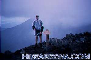


