 Route Editor

| Guide | ♦ | 78 Triplogs | 4 Topics |
details | drive | no permit | forecast | 🔥 route |
stats |
photos | triplogs | topics | location |
| 795 | 78 | 4 |
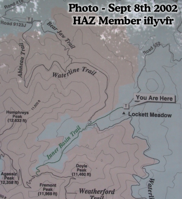
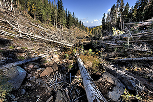
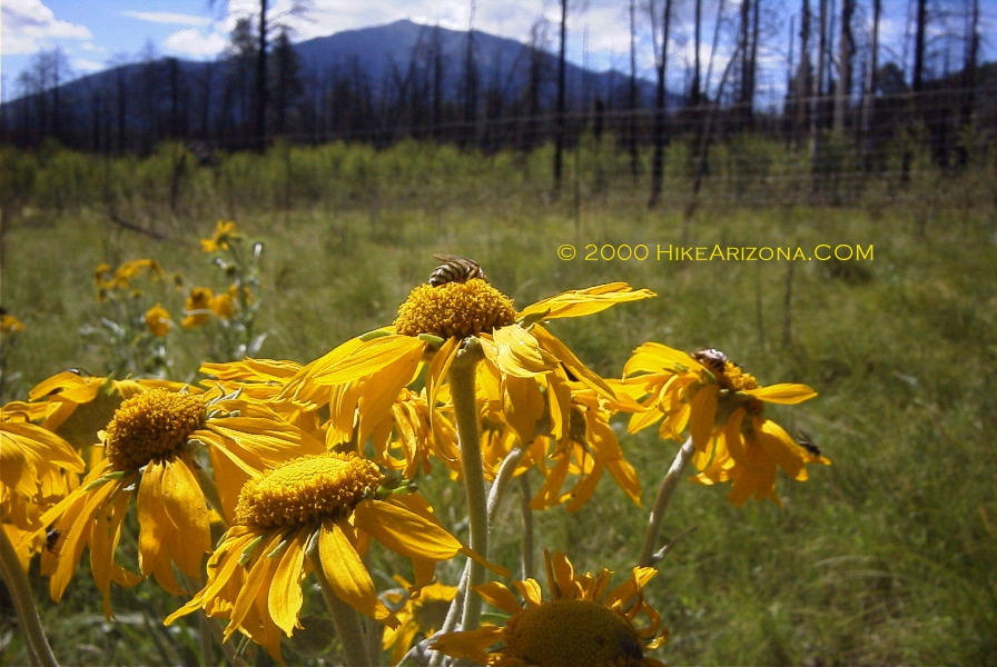
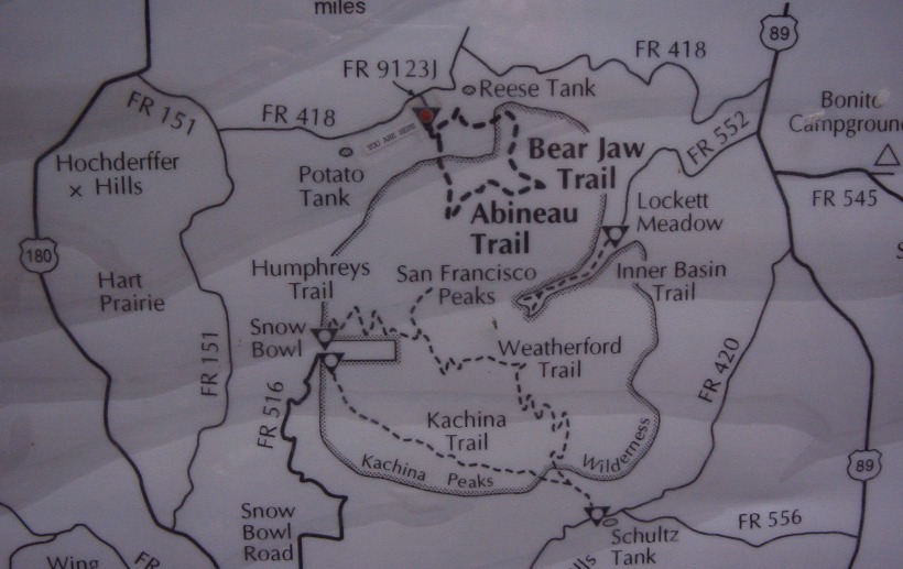
Real Forest in Arizona by joebartels  Arizona is a desert. Wait a minute. It's a gift from mother nature! One trip up Abineau Canyon will surely convince a desert dweller. The drive to the trailhead is spectacular in itself. You'll pass stands of Aspen engulfed by fields of bracken fern. There is a great view of the peaks along the way too. Park your vehicle and head on over to the trail signage in the distance. It's another quarter mile of easy hiking to the official trailhead junction for Abineau and Bear Jaw trails. As you can see from the map this could also be a great loop hike. If you're looking for an easier venture, take the Bear Jaw Trail. Arizona is a desert. Wait a minute. It's a gift from mother nature! One trip up Abineau Canyon will surely convince a desert dweller. The drive to the trailhead is spectacular in itself. You'll pass stands of Aspen engulfed by fields of bracken fern. There is a great view of the peaks along the way too. Park your vehicle and head on over to the trail signage in the distance. It's another quarter mile of easy hiking to the official trailhead junction for Abineau and Bear Jaw trails. As you can see from the map this could also be a great loop hike. If you're looking for an easier venture, take the Bear Jaw Trail.Okay, now it's on up the Abineau Trail. The lower sections include large stands of Ponderosa Pines. Several stands of Quaking Aspen are encountered along the way. Carvings in the aspen dating back to the fifties are everywhere. Please refrain from the act. There was slim reason for cattlemen, long ago, to mark these trees. There is no good reason to leave a beautiful tree susceptible to disease and death these days. In the upper reaches, you will be hiking next to picturesque Douglas fir. This is a great hike. The air is real, and the views are beautiful.
 Be careful as the footing is loose in the upper reaches. The trail is steep. It's easy to see how an avalanche might roll down this canyon in the winter. Once again, the views are excellent. If you've hiked Humphreys Summit Trail #151 you expected views like this without reward. Unless you're looking to bag the peak, I recommend this trail. Be careful as the footing is loose in the upper reaches. The trail is steep. It's easy to see how an avalanche might roll down this canyon in the winter. Once again, the views are excellent. If you've hiked Humphreys Summit Trail #151 you expected views like this without reward. Unless you're looking to bag the peak, I recommend this trail.Ending at the Waterline Road (FR 146), I opted to turn around. You can turn east and do the popular loop hike down Bear Jaw Trail. Be cautious of lightning in the upper sections of Abineau Canyon. Lightning Kills Stay off the mountain when thunderstorms are forecasted. July and August are notorious for quick unexpected storms. Lower the risk by being OFF the mountain before 11am on a clear morning. Stay safe, read the NOLS Backcountry Lightning Safety Guidelines.
Coconino FS Details Click to View Forest Service Map Check out the Official Route and Triplogs. Note This is a moderately difficult hike. Leave No Trace and +Add a Triplog after your hike to support this local community. One-Way Notice This hike is listed as One-Way. When hiking several trails on a single "hike", log it with a generic name that describes the hike. Then link the trails traveled, check out the example. | |||||||||||||||||||||||||||||||||||||||||||||||||||||||||||||||||||||||||||||||||||||||||||||||||||||||||||||||||||||||||||||||||||||||||||||||||||||||||||||||||||||||||||||||||||||||||||||


