 Route Editor

| Guide | ♦ | 10 Triplogs | 0 Topics |
details | drive | permit | forecast | map |
stats |
photos | triplogs | topics | location |
| 96 | 10 | 0 |
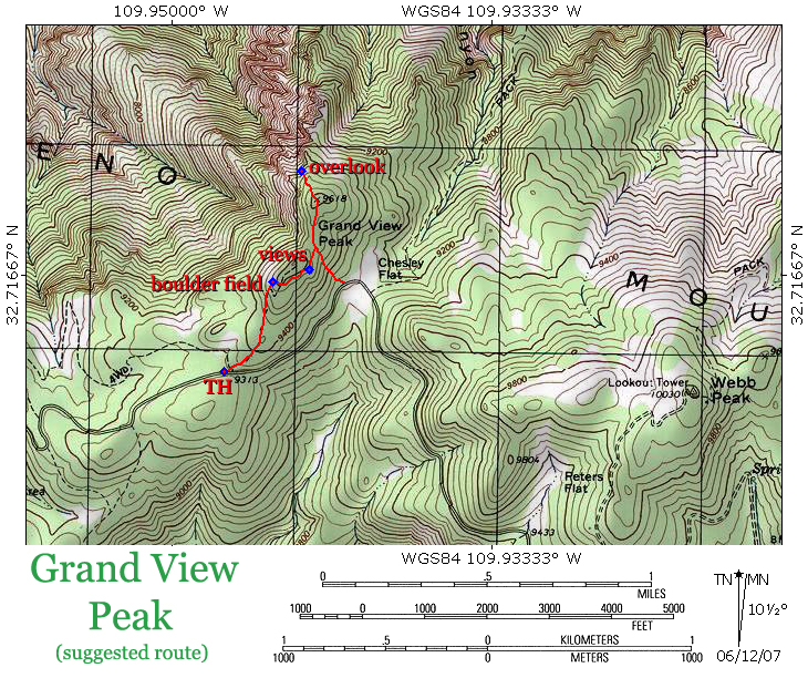
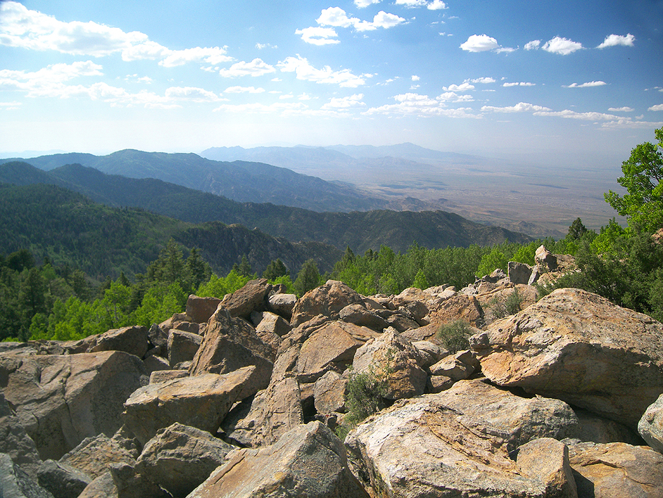
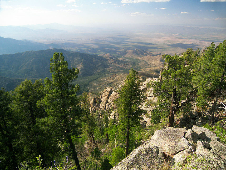
Heavenly views of Hell's Hole by PrestonSands  Grand View Peak, the sixth-highest named summit in the Pinaleno Mountains, was named by early Gila Valley residents for the grand views from its rounded top. Although trees have grown up on its twin summits in the ensuing years, there are still grand views to be found if you search for them. At one time, a trail led to the southern summit, but the forest has long since reclaimed it. A few ancient blaze marks chopped into widely separated trees are all that remain of the trail. Although the summits are easier to reach via Chesley Flat to the east, the ridge route provides the best views. The ridge route basically follows the route of the abandoned trail, starting on the north side of the Swift Trail (forest road 803/state highway 366). The 2004 Nuttall Fire burned in this area, but the forest is mostly intact. Start early during the monsoon season to avoid thunderstorms. Grand View Peak, the sixth-highest named summit in the Pinaleno Mountains, was named by early Gila Valley residents for the grand views from its rounded top. Although trees have grown up on its twin summits in the ensuing years, there are still grand views to be found if you search for them. At one time, a trail led to the southern summit, but the forest has long since reclaimed it. A few ancient blaze marks chopped into widely separated trees are all that remain of the trail. Although the summits are easier to reach via Chesley Flat to the east, the ridge route provides the best views. The ridge route basically follows the route of the abandoned trail, starting on the north side of the Swift Trail (forest road 803/state highway 366). The 2004 Nuttall Fire burned in this area, but the forest is mostly intact. Start early during the monsoon season to avoid thunderstorms.From the small parking area next to the Swift Trail, a short distance west of Chesley Flat in a little pass, begin hiking up the ridge on the north side of the Swift Trail. Try to stay on the top of the ridge, and follow it northeast into the forest. There is no trail here; choose the path of least resistance along the ridge. Around the 9500 foot level, large granite boulders begin to emerge among the aspens. The route becomes much steeper now and turns into a boulder hopping experience. Suppose you are not comfortable with the terrain here, just contour to the east, where the route is easier. Use caution here so as not to dislodge any boulders. Soon you'll arrive in a large boulder field near the 9640-foot summit of the south peak, where spectacular views to the west await (this boulder field is visible as a bare spot on Google Earth's satellite photos). If you cross over to the east side of the rolling summit, you will come across a granite outcropping with views to the south and east, including Webb Peak and Fort Grant.
Once you have had your fill of mountaintop views, head back to the saddle. From there, you can return the way you came or make an easier return hike by dropping down to Chesley Flat and following the Swift Trail back to your vehicle.
Check out the Triplogs. Leave No Trace and +Add a Triplog after your hike to support this local community. | ||||||||||||||||||||||||||||||||||||||||||||||||||||||||||||||||||||||||||||||||||||||||||||||


