 Route Editor

| Guide | ♦ | 23 Triplogs | 0 Topics |
details | drive | permit | forecast | 🔥 route |
stats |
photos | triplogs | topics | location |
| 247 | 23 | 0 |
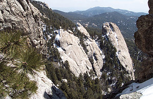
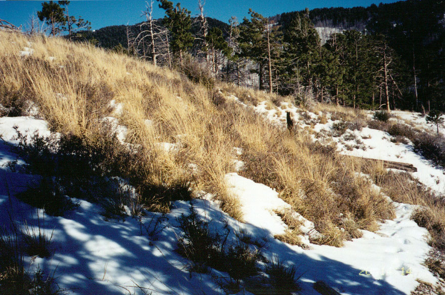
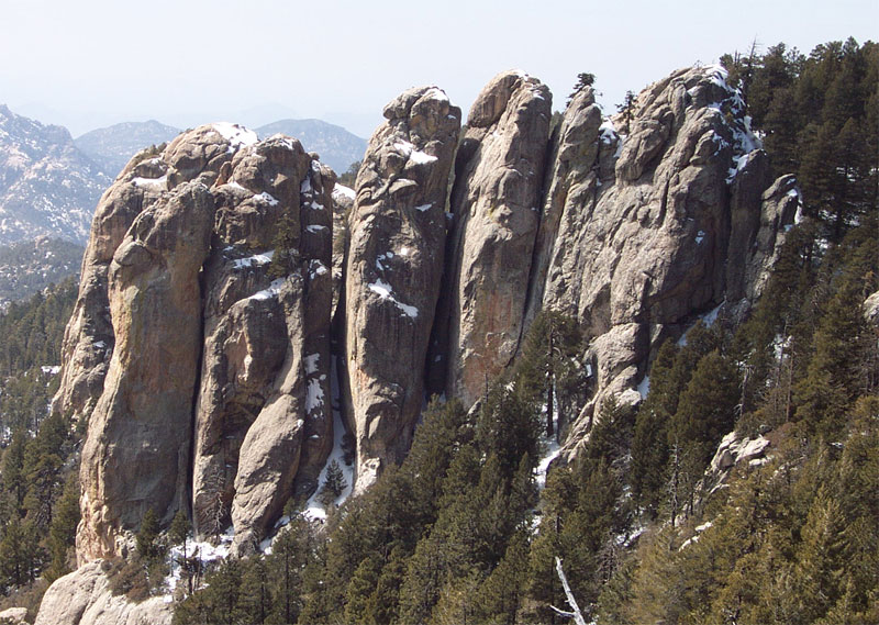
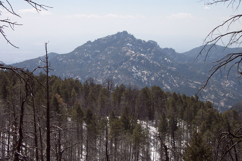
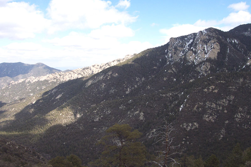
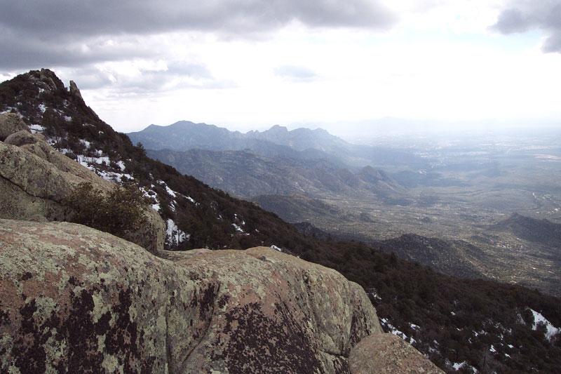
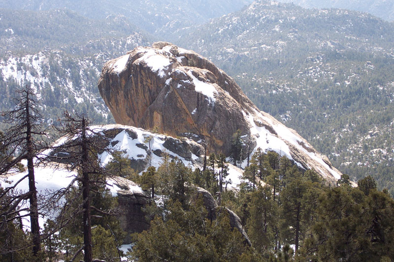
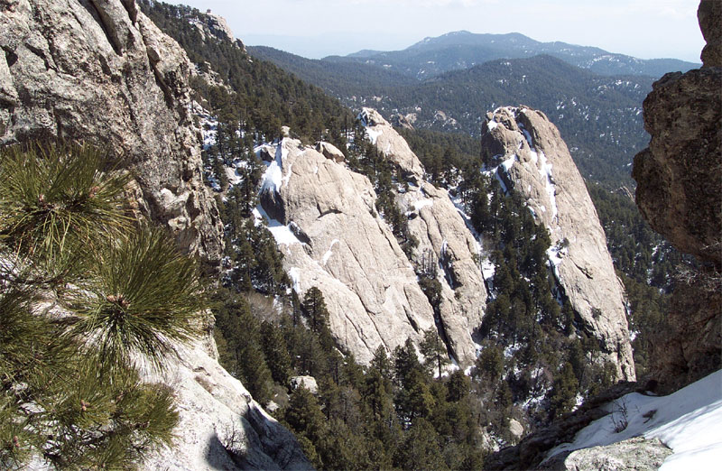
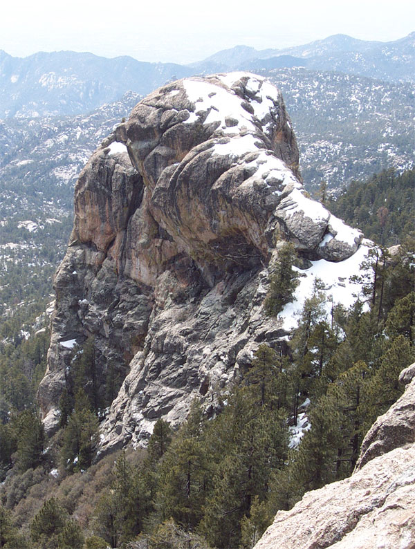
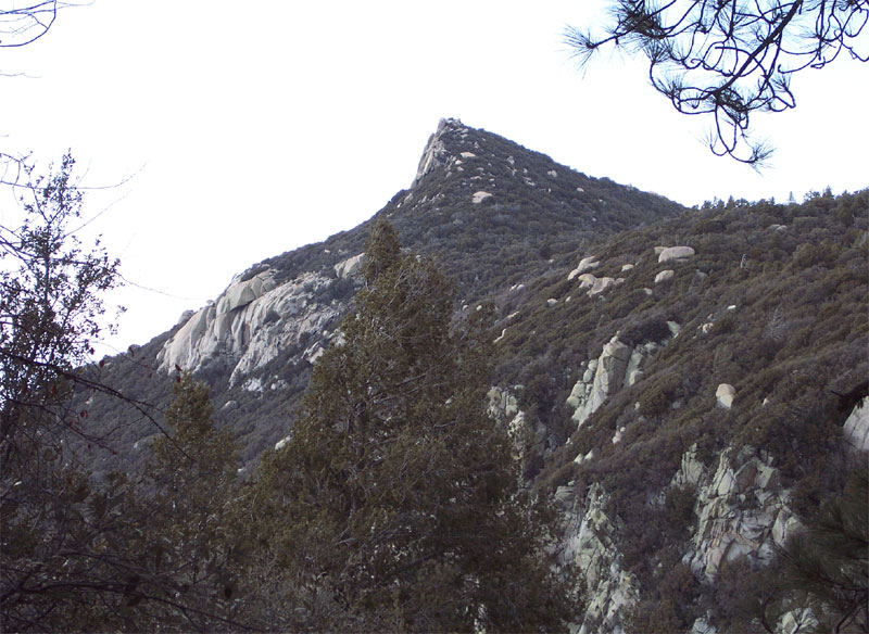
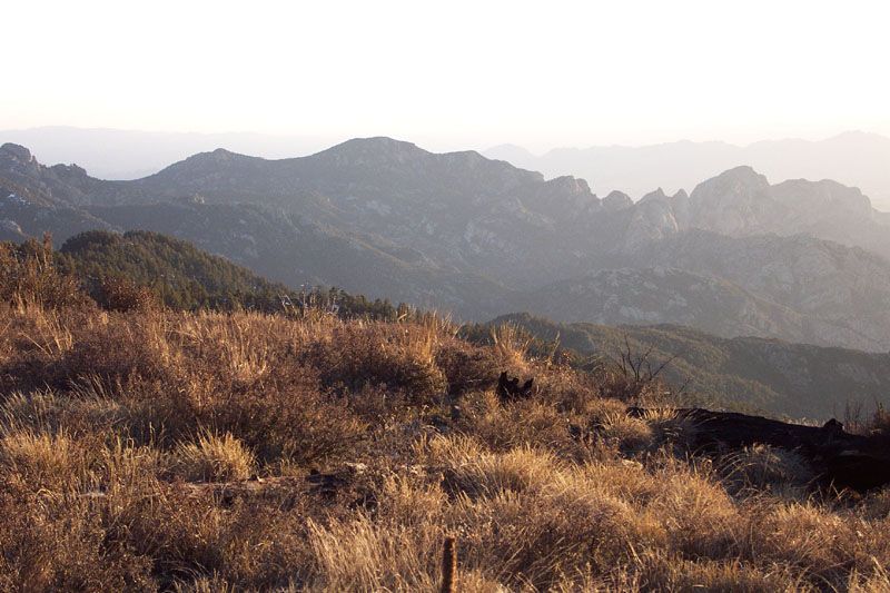
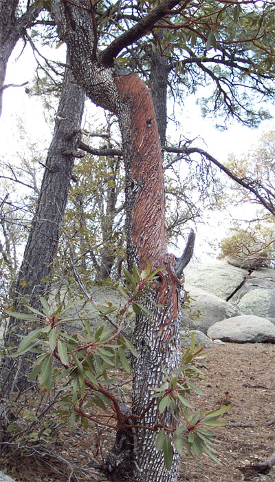
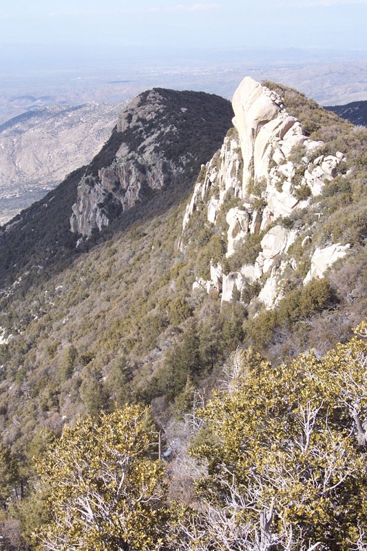
Forest adventure with a view! by brianb  Overview OverviewThis is an awesome trip that seems to get little mention, perhaps because there is no trail directly to the summit of Samaniego Peak. It's a wonderful exploration of alpine and sub-alpine forest (7000 - 9000 feet), with pines and junipers on the Mt. Lemon side, manzanita, and oak on the Samaniego Peak side, and beautiful grassland meadows in between. Perhaps most notable about the Samaniego Ridge Trail is its collection of striking, red Arizona Madrone Trees (similar to Manzanita Bush, but this is a tree and much larger) - I've never seen so many of these beautiful and seemingly rare trees in one place. This route also offers some of the most incredible views in the Catalinas. Just a few paces off the Lemon trail at the top of Mt. Lemon, you're offered views of the entire south side of the Catalinas from 8500 feet in the sky. Just a few more paces place you atop towering sheer rock formations, which are so prominent that they're visible to the naked eye from Tucson 6000 feet below. Traveling down the west side of Mt. Lemon yields unique views (from the north) of Catalina landmarks like Cathedral Rock and Mount Kimball. From points along the Samaniego Ridge Trail, you're treated to rare views of the northwest side of Mount Lemmon and the 'Reef of Rock' area.
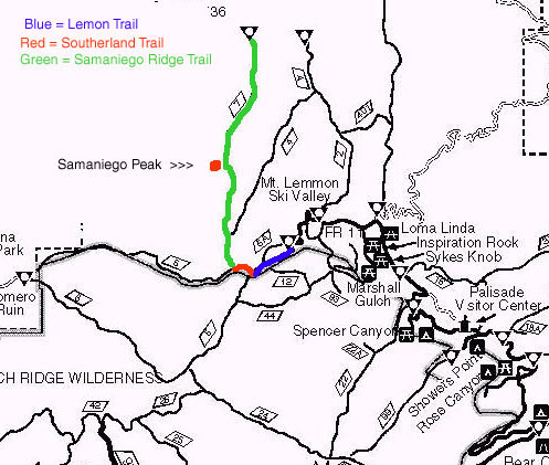
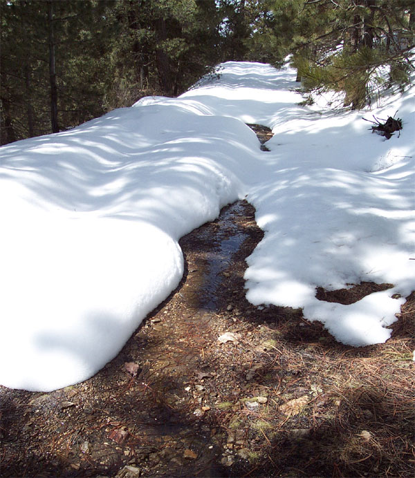
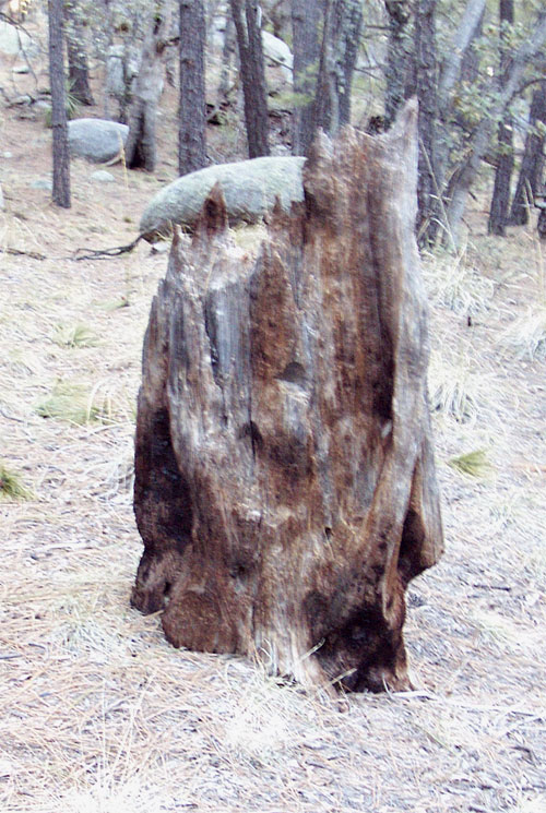
Caution There is no trail from the Samaniego Ridge Trail to Samaniego Peak. The relatively short route (approx. 1/2 mi.) from the trail to the peak is difficult due to dense patches of pine and manzanita and very limited visibility (you're in a forest). Finding your way back to the trail is also hazardous due to the aforementioned factors and because the Samaniego Peak Trail is almost invisible in that area. Finding your way from the summit back to the trail can be like looking for a needle in a haystack, and it would be very easy to get lost. You should be confident in your route-finding skills (through a forest) and pay very close attention to your landmarks in this section. 1st Note The 2000 ft. elevation gain is deceptive. The trail goes up and down hundreds of feet several times and is very steep in places as well. This is a strenuous hike. 2nd Note There is often 1-2 feet or more of snow on Mount Lemmon (and most of this route) from the first snowfall until May or so. Even when I did this trip in March, there was snow most of the way, including two feet at the top! 3rd Note BTW, Samaniego Peak is also accessible from the north end of the Samaniego Ridge Trail, but access to that end of the trailhead is remote, and I haven't gone that way before. This route would make the trip closer to 10 miles round-trip. Hike From the parking lot at the power station, enter the Lemon Trail at the trail sign just opposite the fence. Follow this trail (which travels briefly back on the road) through a brown metal gate onto an old dirt road/jeep trail (this is the upper part of the Lemon Trail). The trail will fork left after a while, leading to the Lemon Lookout Trail. Stay to the right along the old jeep trail. After a while, you'll pass a little metal storage hut. Along this area, peek over to the left (south) through the trees. This is where you can jump off the trail (just a few hundred feet) and catch awesome views of the south side of the Catalinas and Tucson below. Take note of the huge rock formations you'll see - map out where, further down the trail, you'll want to jump off again to access the top of some of these rock formations. Two or three of them are easily accessible and offer incredible views. You'll see one large rocky peak which is several hundred feet lower than the rest. You can scramble down to it and climb all the way to the top! (It's not as difficult as it looks from above, but be careful!) After about 1.5 miles from the top, the Lemon Trail intersects with the Southerland Trail and the lower portion of the Lemon Trail. The intersection is marked with large signs, so you can't miss it. Turn right on the Southerland Trail 0.8 miles to the Samaniego Ridge Trail. Follow the very steep trail down the side of the mountain. You'll get your first glimpse of Samaniego Peak to the northwest here. The trail heads back uphill to the west and through beautiful grassy meadows. Here you'll have views of the central and west Catalinas. The trail begins to get a little spotty at times, so keep an eye out for it. If you find yourself without a trail, backtrack and pick it up again. Continue to a small sign indicating the intersection of the Samaniego Ridge Trail and the rest of the Southerland Trail. Jump on the Samaniego Ridge Trail. After 0.6 miles through the woods on the Samaniego Ridge Trail, the trail splits off to the Canada del Oro Trail - stay on the Samaniego Ridge Trail. You are now about 3 miles from Samaniego Peak. The Samaniego Ridge Trail is very thin and can be hard to follow throughout much of the rest of the trail. The ground may be covered with leaves and pine needles, making the already thin trail hard to follow. The trail is sparsely cairned in many parts, however, so keep an eye out for them. You will travel up and down through a distinctly different forest ecosystem with deciduous trees like the gorgeous Manzanita Tree. It's a beautiful trek through the woods with lots of intriguing fallen trees and such. You'll also get some better views of Samaniego Peak along the way. After a while, however, the peak will be largely out of sight. Take note of its relative location so you know when you're getting close - there are no signs or trails going up there. You'll be fairly close (w/in a mile?) to the peak when you see a beaten-up and illegible metal sign that says something about Walnut Spring. I'll tell you how I got to the peak from here, but it may not be the best or easiest way - I've only been there once and had to 'wing it' (if you know a better way, let me know!!) You have to jump off the trail and head for the peak at some point: I jumped off where this stump is just next to the trail. I headed up towards the peak long enough to catch a glimpse of it, and just headed uphill in that direction. You can't see the peak anymore, but if you know roughly where it is, just keep heading uphill and you'll find it, right? ;-) The trek up was nasty as it was thick with trees, bushes, and boulders - especially towards the top. As it turns out, I reached the peak that is just north of Samaniego Peak. That was cool because this peak was at the top of a much more prominent cliff, and had more rock surface to run around on. Samaniego peak was just a short scramble away. From Samaniego peak, I headed down to the valley below and then further back down towards the trail in the direction from which I came. I managed, somewhat luckily, to end up right back at the stump in the trail - but I felt lucky to have found it, as the trail is almost imperceptible in that area. One thing to remember is that this section of the trail is atop a steep ridgeline. If you begin to head steeply down the ridge to where you can see the Reef of Rocks to the east, head back up to the top of the ridgeline and you should eventually find the trail again. As I said, this part could get pretty hairy without careful planning and vigilance. I did it one way, but I would strongly recommend trying to find a second opinion on how to do it. Someone may have a more clearly defined route, but I couldn't find one. I also strongly recommend a topo/trail map! Gate Policy: If a gate is closed upon arrival, leave it closed after you go through. If it is open, leave it open. Leaving a closed gate open may put cattle in danger. Closing an open gate may cut them off from water. Please be respectful, leave gates as found. The exception is signage on the gate directing you otherwise.
Check out the Official Route and Triplogs. Note This is a moderately difficult hike. Leave No Trace and +Add a Triplog after your hike to support this local community. | ||||||||||||||||||||||||||||||||||||||||||||||||||||||||||||||||||||||||||||||||||||||||||||||||||||||||||||||||||||||||||||||||||||||||||||||||||||||||||||||||||||||||||||||||||||||||||||||||||||||||||||


