 Route Editor

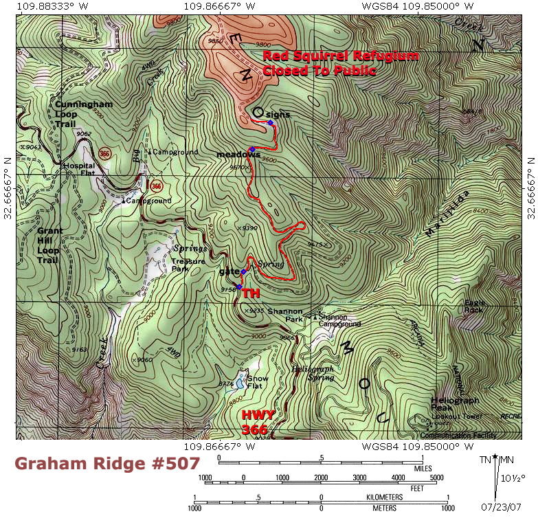
| Guide | ♦ | 76 Triplogs | 1 Topic |
details | drive | permit | forecast | 🔥 route |
stats |
photos | triplogs | topic | location |
| 443 | 76 | 1 |
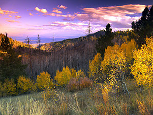
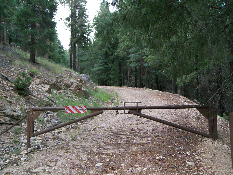
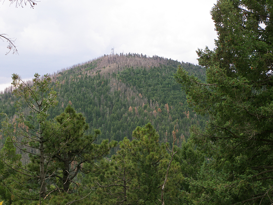
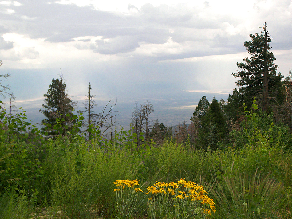
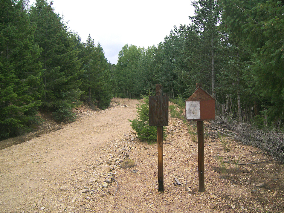
southern Arizona's roof by PrestonSands  Here is another short hike you can do in the Pinaleno Mountains if you feel like walking right up to the edge of forbidden territory. This one follows a seldom-used fire control road that runs along the ridgeline between Heliograph Peak and Mt. Graham. Great views of 10,000-foot Heliograph Peak exist and a few glimpses of the Gila Valley to the east and the Sulphur Springs Valley to the west. This fire road runs up to the summit of Mt. Graham. It would be wise to turn around at the 1.9-mile point, where the Mt. Graham Red Squirrel Refugium boundary is encountered, at the 9800-foot contour (I believe the standard forest service all-purpose fine exists for entry into the Refugium: 6 months in jail, and or a $5000 fine). Another word of caution: this is NOT a hike you want to do during a thunderstorm! The trees next to you along the road are the highest points in the area! Anyway, this is a beautiful little ridge hike that gives you a sample of the very top of the Pinaleno Mountains. Here is another short hike you can do in the Pinaleno Mountains if you feel like walking right up to the edge of forbidden territory. This one follows a seldom-used fire control road that runs along the ridgeline between Heliograph Peak and Mt. Graham. Great views of 10,000-foot Heliograph Peak exist and a few glimpses of the Gila Valley to the east and the Sulphur Springs Valley to the west. This fire road runs up to the summit of Mt. Graham. It would be wise to turn around at the 1.9-mile point, where the Mt. Graham Red Squirrel Refugium boundary is encountered, at the 9800-foot contour (I believe the standard forest service all-purpose fine exists for entry into the Refugium: 6 months in jail, and or a $5000 fine). Another word of caution: this is NOT a hike you want to do during a thunderstorm! The trees next to you along the road are the highest points in the area! Anyway, this is a beautiful little ridge hike that gives you a sample of the very top of the Pinaleno Mountains.From the large paved pull-off area at the end of the paved portion of the Swift Trail highway, head northeast on the dirt road heading uphill. Before long, you'll come to a locked, brown metal gate across the road. Walk around the gate and keep going.
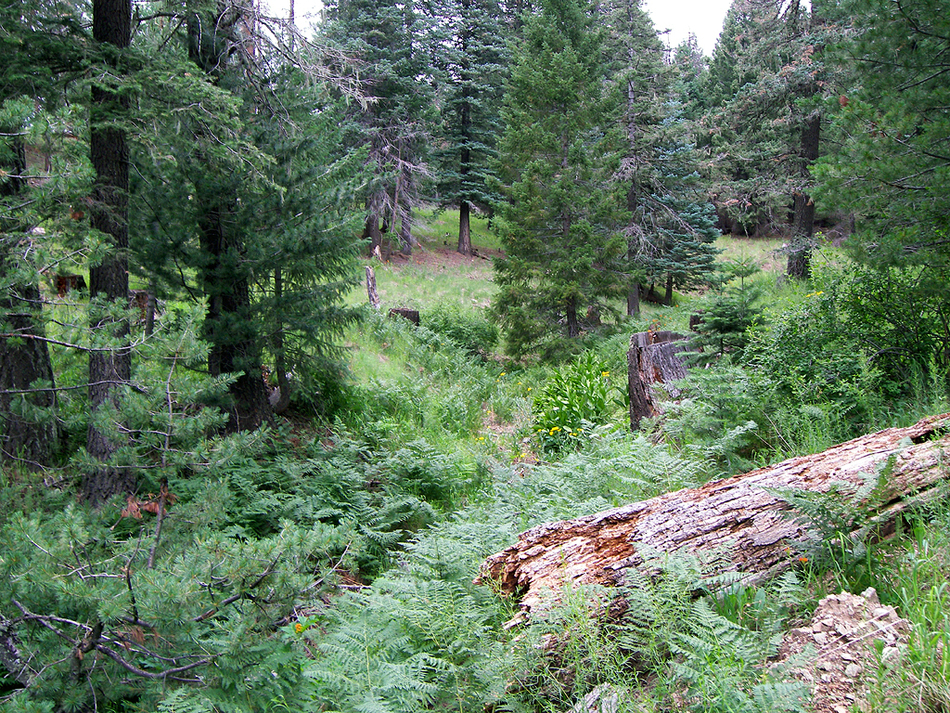
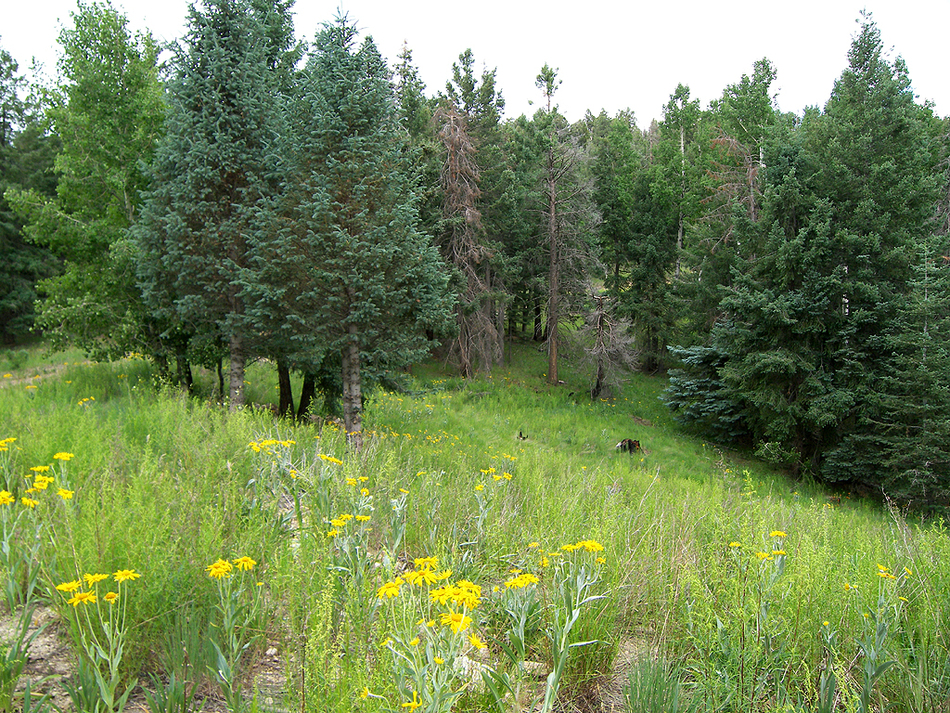
From here up, the fire road was used as part of the fire line to stop the westward spread of the 2004 Nuttall Fire. There are some burned patches of trees along the right side of the road, but it isn't a depressing scene of total devastation. There are still a lot of greenery and healthy trees to delight mountain lovers. Plus, summertime adds many wildflowers to this hike. Around the 9600 foot level, the hike passes through a little grassy park, surrounded by aspens and dense firs. Shortly after, the route encounters a second little meadow full of wildflowers, where the road turns east. Now the views to the east down Marijilda Canyon start to open up a little more. The Gila Valley, almost 7000 feet below, and the barren Peloncillo Mountains seen in the distance. Where the road bends west, you will come across a couple of blank wooden signs. As of this writing, there are no markings, but these signs may be the boundary markers for the Red Squirrel Refugium. The actual 9800-foot contour/Refugium boundary lies another 0.1 miles to the west, however. Be sure to turn around and head back at this point. Enjoy the views from the roof of southern Arizona on the way down! Gate Policy: If a gate is closed upon arrival, leave it closed after you go through. If it is open, leave it open. Leaving a closed gate open may put cattle in danger. Closing an open gate may cut them off from water. Please be respectful, leave gates as found. The exception is signage on the gate directing you otherwise.
Check out the Official Route and Triplogs. Leave No Trace and +Add a Triplog after your hike to support this local community. | ||||||||||||||||||||||||||||||||||||||||||||||||||||||||||||||||||||||||||||||||||||||||||||||||||||


