 Route Editor

| Guide | ♦ | 4 Triplogs | 0 Topics |
details | drive | permit | forecast | map |
stats |
photos | triplogs | topics | location |
| 15 | 4 | 0 |
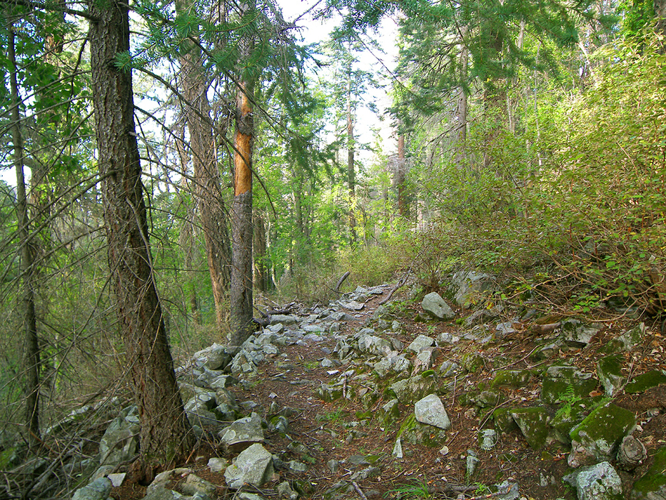
Arcadia Mystery Route by PrestonSands  Marijilda Cutoff is an abandoned trail on the north side of Heliograph Peak. It may have been an old segment of the Arcadia Trail or possibly a remnant of the historic logging operation at Shannon Park. This is not a destination hike, rather an alternate route that can be explored while hiking the Arcadia Trail. This hike's points of interest include scenic overlooks of rugged Marijilda Canyon and a short riparian stretch below Shannon Park. Some route-finding ability is required, but overall this old trail is in decent shape. Marijilda Cutoff is an abandoned trail on the north side of Heliograph Peak. It may have been an old segment of the Arcadia Trail or possibly a remnant of the historic logging operation at Shannon Park. This is not a destination hike, rather an alternate route that can be explored while hiking the Arcadia Trail. This hike's points of interest include scenic overlooks of rugged Marijilda Canyon and a short riparian stretch below Shannon Park. Some route-finding ability is required, but overall this old trail is in decent shape.At the trailhead at the end of the road in Shannon Campground, there is a restroom. The signed Arcadia Trail takes off to its right, while this hike follows a faint trail to the left of it. Follow it down the canyon. It soon becomes apparent that you are following an old road as you hike through the tall conifers and lush ground cover along Marijilda Creek. This peaceful little stream races through a typical alpine riparian area here, with the usual large, leafy plants and alder thickets.
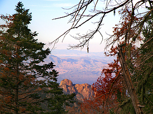
A short distance later, the trail offers up a view of the rugged walls of Marijilda Canyon as it rounds a corner into a deeply shaded side drainage. At the bottom of this drainage, a small spring bubbles up from the ground next to the trail. Just beyond the drainage, the trail arrives at a large fallen log, where the first of several switchbacks is encountered. If you hop over the log and contour along the slope for another 300 feet, you'll arrive at an overlook with views of Deadman Peak and the precipitous 10,000 foot mass of Mt. Graham. A shelf-like rock provides a pleasant perch to kick back and enjoy the view. Back at that first switchback, the trail begins its ascent up the mountainside. Ancient cut logs and occasional cairns continue to mark the way. After a handful of switchbacks, the old trail suddenly stumbles onto the Arcadia Trail, around the 9100 foot level (32.65990 N, -109.84981 W) From here, you can hike to Arcadia, Heliograph Peak, or back to Shannon Campground. Check out the Triplogs. Leave No Trace and +Add a Triplog after your hike to support this local community. | ||||||||||||||||||||||||||||||||||||||||||||||||||||||||||||||||||||||||||||||||||||||||||||||


