 Route Editor

| Guide | ♦ | 11 Triplogs | 0 Topics |
details | drive | permit | forecast | 🔥 route |
stats |
photos | triplogs | topics | location |
| 98 | 11 | 0 |
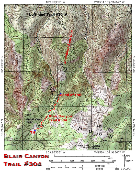
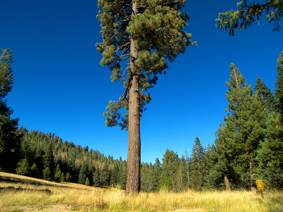
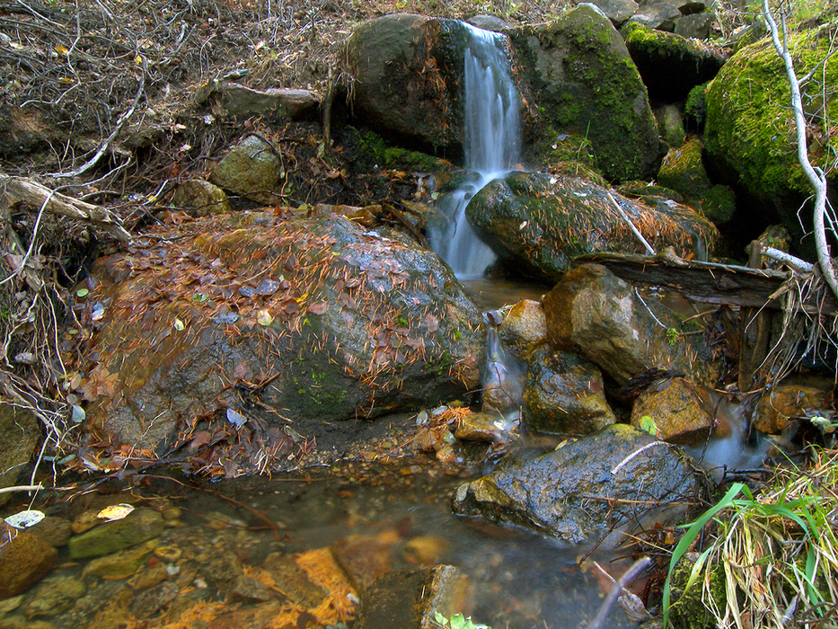
The Blair Trail Project by PrestonSands  This old trail in the Pinaleno Mountains originally connected the mountain top meadow of Chesley Flat to the Lefthand Trail on the north slope of the range. Two major wildfires and subsequent regrowth in the last thirty years have completely destroyed the lower 1.7 miles of the Blair Canyon Trail and rendered it impassable. The upper section of this trail, although primitive, remains intact. Unburned spruce-fir forest, two perennial creeks, a scattering of massive old-growth firs, and solitude are the attractions here. This old trail in the Pinaleno Mountains originally connected the mountain top meadow of Chesley Flat to the Lefthand Trail on the north slope of the range. Two major wildfires and subsequent regrowth in the last thirty years have completely destroyed the lower 1.7 miles of the Blair Canyon Trail and rendered it impassable. The upper section of this trail, although primitive, remains intact. Unburned spruce-fir forest, two perennial creeks, a scattering of massive old-growth firs, and solitude are the attractions here.The statistics and round trip mileage listed here are for the upper section of the trail. Round trip mileage on the entire trail would have been about 5.9 miles. Some route-finding ability is required on this hike. You must be able to recognize a primitive trail; otherwise, bring a GPS unit.
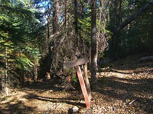
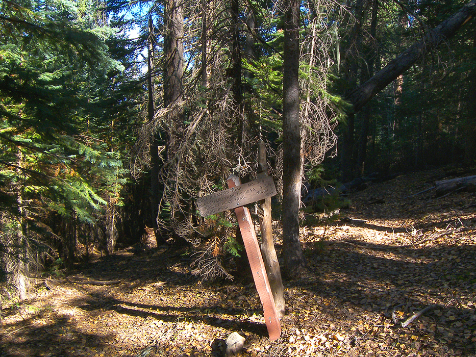
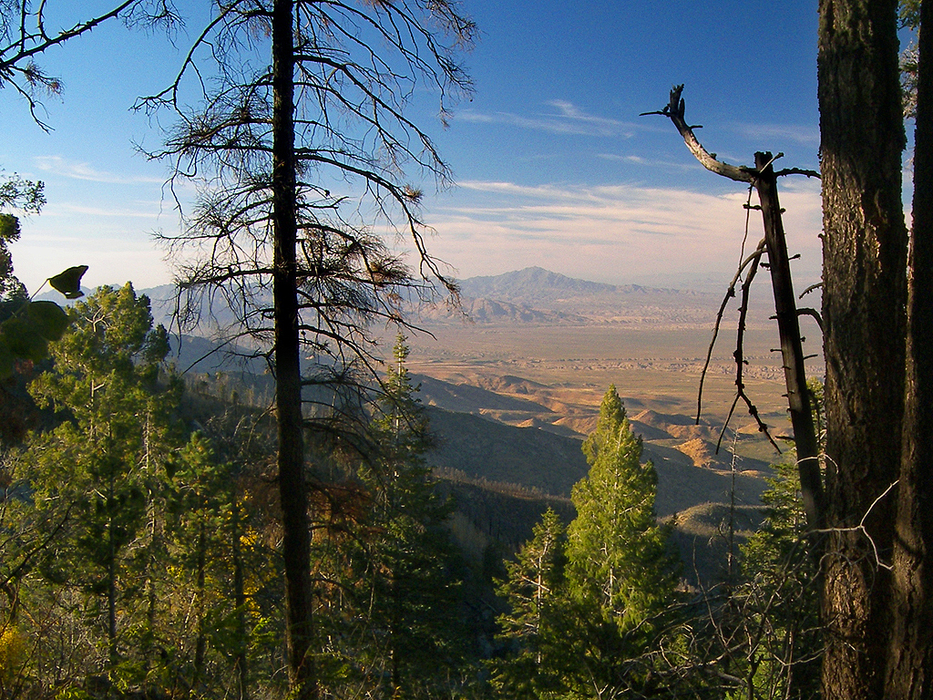
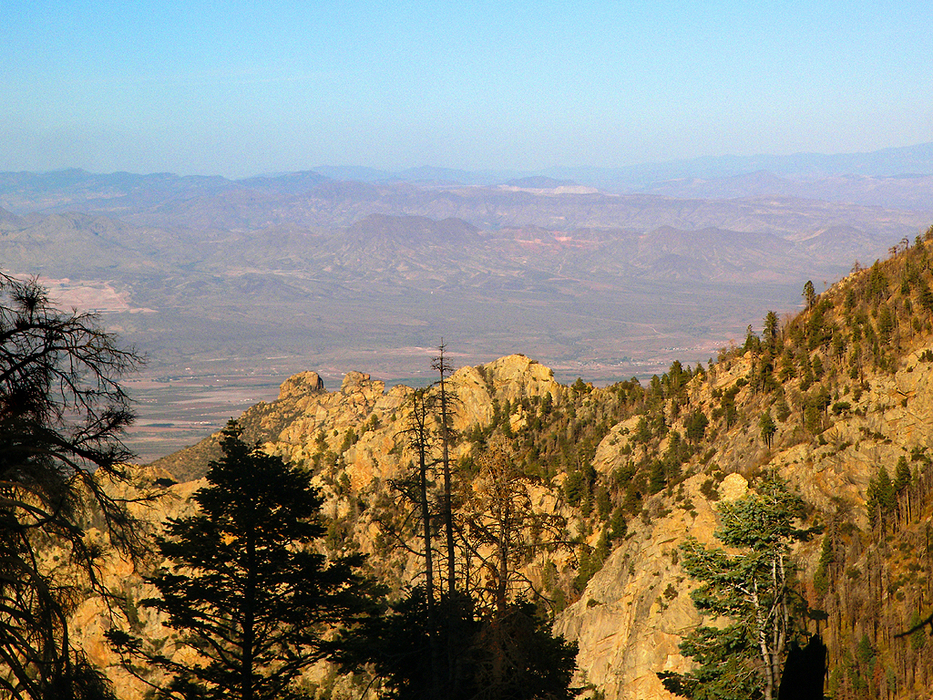
At 0.3 miles, the trail reaches a hollow at the head of Lefthand Canyon. At this point, the trail becomes more primitive, and pink tape begins to mark the route where it becomes indistinct. The Blair Canyon Trail now heads down the heavily forested canyon while staying on the west side of perennial Lefthand Creek. A few small pools can be found as the creek races toward the desert below. At about 0.65 miles (32.72104 N, 109.93510 W), the trail crosses over to the east side of the creek. You'll have to scramble over the remains of several fallen trees and keep an eye out for the pink tape marking the crossing. A solitary cairn marks the beginning of the trail on the east side of the crossing. The trail becomes a bit more distinct now and contours north along the canyon's east side. This section of trail around the 8800-foot contour is shown incorrectly on the Webb Peak topo map. Around 0.75 miles the trail crosses an unnamed, cascading creek coming down from Webb Peak. Soon after, the canyon begins to open up, and the trail passes by a rock outcrop on the left. From the top of the rock, one can see the Gila Valley in the distance. Continuing, the canyon floor drops away, and the trail contours along the mountainside. The sound of falling water floats up from the canyon's depths. Shortly after passing through an aspen grove growing in the middle of the trail, you'll be able to see Mount Turnbull and the Santa Teresa Mountains through breaks in the tree cover. Near the 1.1 mile point, the trail rounds a corner to the right and arrives at the top of the ridge that divides Lefthand Canyon from Blair Canyon. At this point, the trail enters the Nuttall Fire burn area, starts to switchback down the top of the ridge, then ceases to exist. In theory, you could continue down the ridge following the former route of this trail, but dense, flesh-ripping, shoulder-high locust and raspberry bushes will fight you all the way. A little bit of painful bushwhacking down the ridge to the 8640 saddle will give you a view of the rugged cliff face along Blair Canyon's eastern wall, along with the Gila Valley in the distance. When you have had your fill of this interesting area, return the way you came.
Check out the Official Route and Triplogs. Leave No Trace and +Add a Triplog after your hike to support this local community. | |||||||||||||||||||||||||||||||||||||||||||||||||||||||||||||||||||||||||||||||||||||||||||||||||||||||||||||||||||||||||||||||||||||||||||||||||||||||||||||||||||||||||||||||||||||||||||||


