 Route Editor

| Guide | ♦ | 29 Triplogs | 3 Topics |
details | drive | permit | forecast | 🔥 route |
stats |
photos | triplogs | topics | location |
| 257 | 29 | 3 |
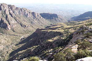
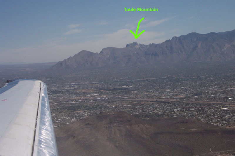
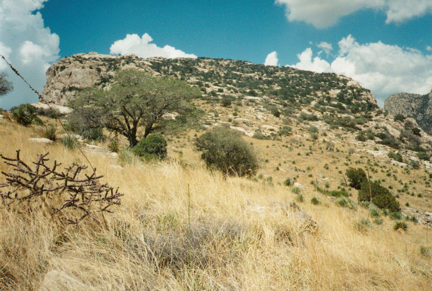
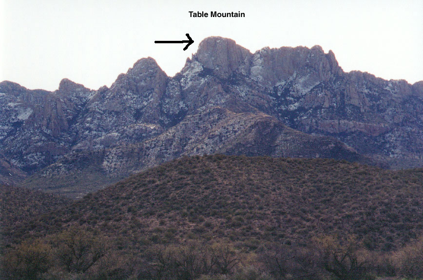
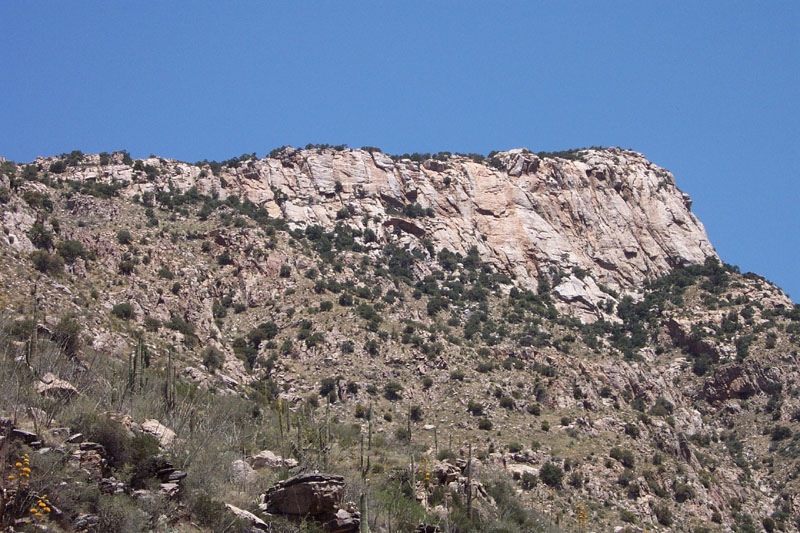
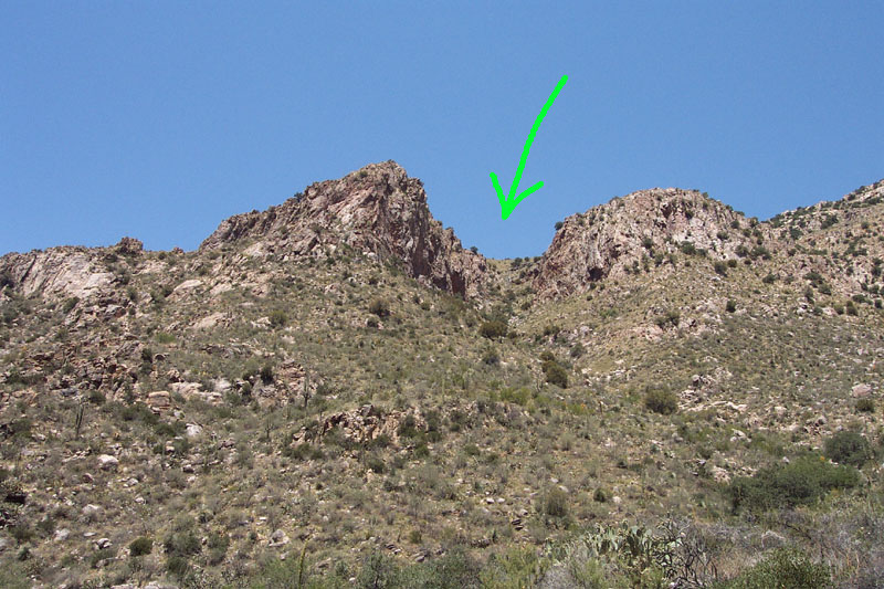
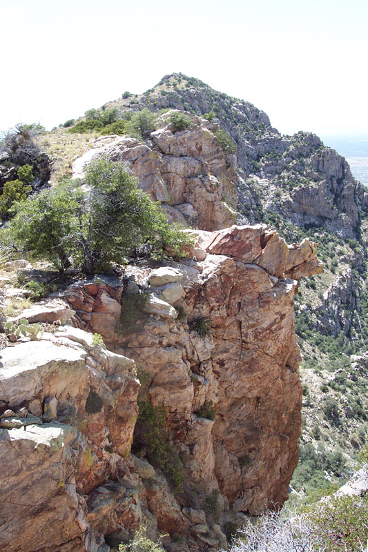
Torture by brianb  Caution - No trail exists along much of this route - rough bushwhacking required! Caution - No trail exists along much of this route - rough bushwhacking required!Table mountain is the third peak from the West when looking at the Catalina range from the South (i.e. from most of Tucson). It's rather distinct from the other peaks in the range in that it has a prominent, 'flat', rocky sloping surface at the top - which is unusually grassy and speckled with trees and shrubs. From the South, the top of the mountain looks flat and rocky and slopes upward to its summit. The other three sides of the peak are sheer cliffs dropping hundreds of feet straight down. I'd always been curious about this peak because it's so prominent and unusual (it sticks out from the range like a sore thumb) - and because there is no trail leading up there.
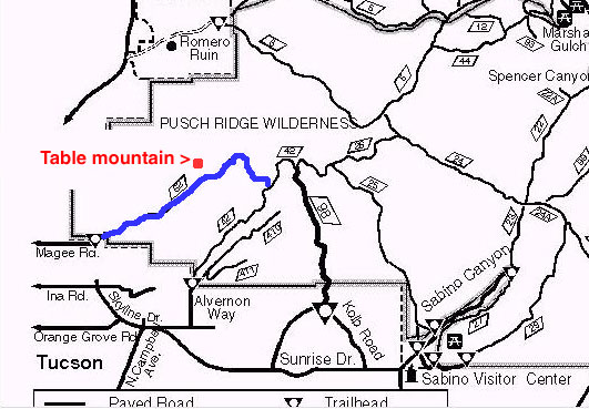
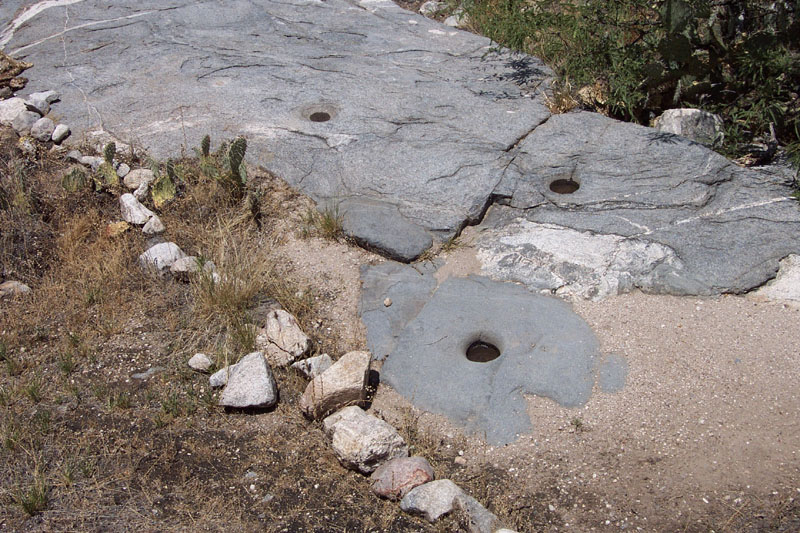
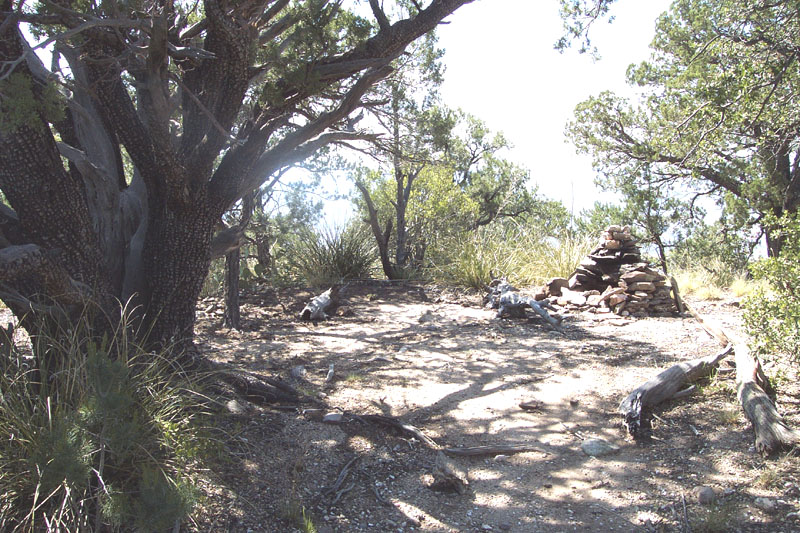
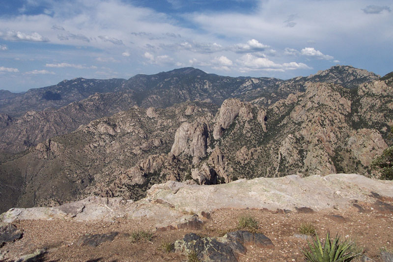
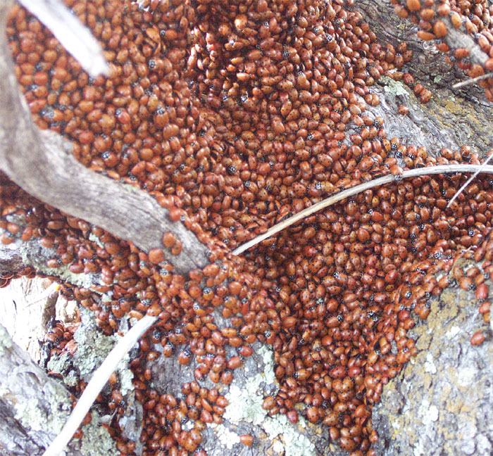
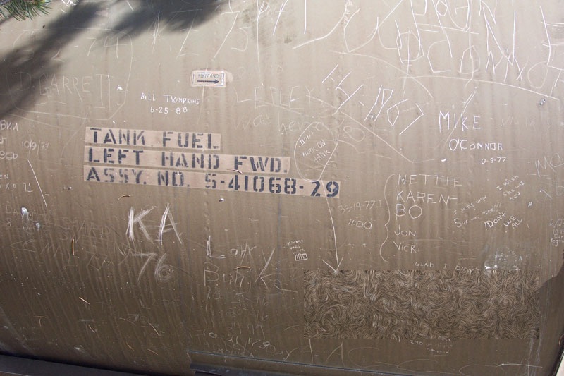
So, bear in mind that I'm not recommending this trip as a pleasant hike - I'm rather providing information about how to do it for those who might be curious and willing to do what it takes to get there. (Table Mountain might also be accessible from the North, but I'm not sure. Note - wear jeans and sturdy (preferably leather) footwear on this trip. You will be quite sorry if you don't. Head out on the Pima Canyon Trail for approximately three miles. When you begin to catch glimpses of the cliffs on the East side of the mountain, you are getting close. When you pass the old Indian grinding holes on the trail, you are very close - within 1/4 mile. Watch carefully for these. You want to look for a steep canyon, coming down from the West side of the valley you've been traveling through, with a grassy slope at the very top - this grassy slope is contiguous with the grassy top of Table Mountain that you can see from Tucson below. Here's where the 'fun' begins. You've got to climb up through that canyon to the top where you can see the grassy slope, and then you can continue the ascent to the top of Table mountain itself. Jump off the trail and bushwhack to the creek that comes out of the canyon at the point where it's closest to the trail. You want to enter the creek bed as soon as possible because you'll have to follow it up eventually, and you don't want to have to descend into it from above when it starts getting steep. The creek bed is pregnant with prickly pear cactus and boulders, but there's no other way to the top. If this part looks too unappetizing for you, you may want to bail out here. Although this is the most unpleasant part of the trip, it's not necessarily the most difficult. Once up and out of the canyon and onto the grassy slope, continue straight ahead and uphill. It's pretty neat to leave the riparian canyon and enter this strange, out-of-place grassland in the Catalinas. But watch your step here - the grass is punctuated with lots of 'shindagger' plants - step into one and find out why they're so-called... At this point, you are at the base of the 'flat', sloping top of Table Mountain. If you continue straight ahead (West), you will emerge at a point at the top of the cliffs situated right between Table Mountain and the peak just to the South. The peak to the South is readily accessible from here. You can scramble up to the top of that peak if you have the time and the energy, or if you don't feel like going all the way to the top of Table Mountain. It's a pretty neat destination in itself. The easiest way to the top of Table Mountain, however, is to travel along the East side of the mountain all the way to the top. The further West you go, the more you have to backtrack to avoid openings in the cliffs, and it's generally less open than the east side. If you went all the way West to the cliffs between the two peaks, you will want to backtrack to the east side to begin the ascent upward. Ascend the slopes of Table Mountain as close to the east side as possible. You don't want to be all the way over to the East all the way up, but rather keep the Eastern edge in view and you should be able to negotiate a decent path to the top. At times, you will have to climb up some boulders and squeeze through some tight spots between trees and stands of manzanita. Nothing is approaching a trail up there, so you'll have to use your mountaineering skills. This part of the hike is longer and more difficult than it looks from below. And being constantly surrounded by trees, shrubs, and large boulders, you'll rarely be able to see very far ahead. You might see some cairns when you get close to the top. Go ahead and follow them if you can, but don't worry if you lose them. There's really no 'good' way up there. Eventually, the journey will begin to level out a bit when you get near the top. There are a couple of faint, short trails leading to the very top of the summit. And you'll see a large, cairned campfire under a big juniper tree at the summit itself. At the summit, you're rewarded with absolutely breathtaking views of, IMO, the most spectacular part of the Catalinas - the Northwest side - from the only point which offers this incredible view. You might also enjoy looking hundreds of feet straight down the sheer cliffs that you're standing on top of. You can also follow along the top of the cliffs in either direction (East or West) for more great views. Look around the summit for trees blanketed with thousands of ladybugs - they were all over when I was there in June. When you're ready to turn back, head back down the East side of the mountain. Don't get hung up on finding the exact same way down - that's nearly impossible. Just keep your eye on the top of the canyon that brought you up. If you see an old fuel tank on the way down, scratch your initials on it. When you've descended through the canyon back towards the bottom of the valley, just head straight towards the other side of the valley and you'll find the Pima Canyon Trail. Don't worry about finding your exact jumping-off point on the trail, either. If you keep heading east, you'll run right over it. Head back on the Pima Canyon Trail.
Check out the Official Route and Triplogs. Note This is a difficult hike. Arrive fit and prepared or this could get ugly. Leave No Trace and +Add a Triplog after your hike to support this local community. | ||||||||||||||||||||||||||||||||||||||||||||||||||||||||||||||||||||||||||||||||||||||||||||||||||||||||||||||||||


