 Route Editor

| Guide | ♦ | 10 Triplogs | 0 Topics |
details | drive | permit | forecast | 🔥 route |
stats |
photos | triplogs | topics | location |
| 40 | 10 | 0 |
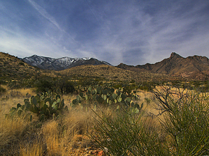
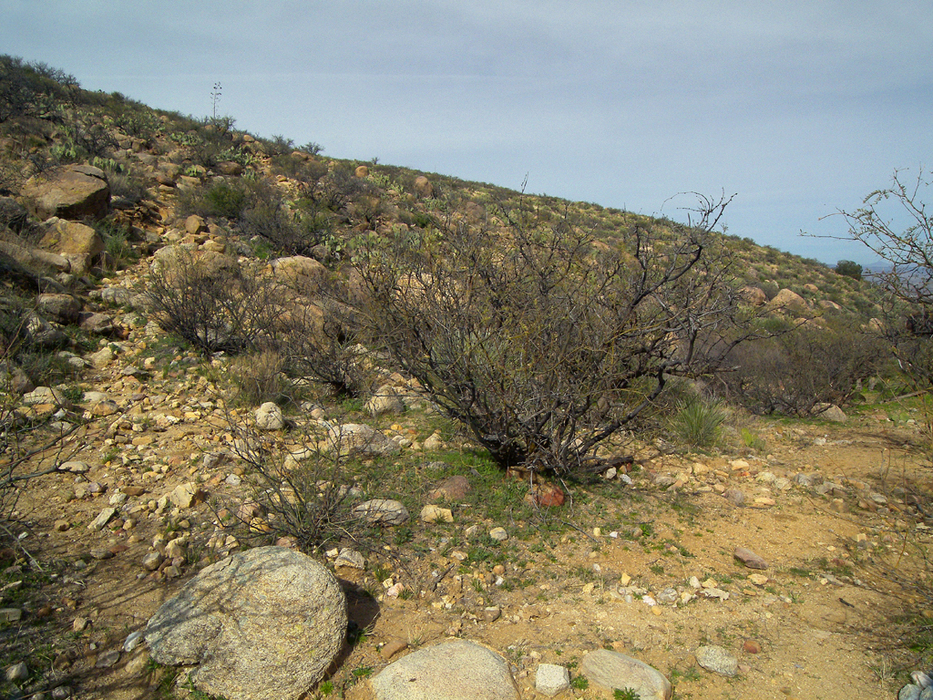
A tough trail to nowhere by PrestonSands   This old trail doesn't have a name, but Rincon Spring is its terminus, so the name seems fitting. The trail rolls along the lower slopes of the Pinaleno Mountains between Marijilda Creek on the south, and a steep-walled basin or "rincon" below Deadman Peak on the north. Periods of wet weather or spring snowmelt are the best times to hike this trail, as the small seasonal waterfalls near Rincon Spring are likely to be flowing. This old trail doesn't have a name, but Rincon Spring is its terminus, so the name seems fitting. The trail rolls along the lower slopes of the Pinaleno Mountains between Marijilda Creek on the south, and a steep-walled basin or "rincon" below Deadman Peak on the north. Periods of wet weather or spring snowmelt are the best times to hike this trail, as the small seasonal waterfalls near Rincon Spring are likely to be flowing.The Rincon Spring Trail may have been a decent trail at one time, but today it exists only as a cairned route, due to lack of maintenance. Even with numerous cairns scattered along the route, it is extremely easy to lose the trail in the tall grasses and boulders of the area. If you choose to hike this trail, definitely bring a topographical map and/or a GPS unit, and allow yourself more time than you think you will need.
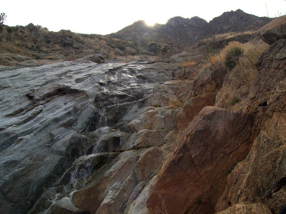
Starting at 0.15 miles, there are some ruins on the right side of the road. First up is a single room of Ancestral Puebloan origin, behind it are a few more rooms scattered among the mesquites. Only low, collapsed walls and a few pottery sherds remain. A little ways further down the road, just before it bends to the left, are some low rock walls that are visible about a hundred feet to the right of the road. The walls make up a single room. Rusted artifacts seem to identify this as a historical, rather than a prehistorical structure. The road now turns southwest to head up Marijilda Canyon. At 0.65 miles, turn right on a short side road to a corral. Walk about 75 feet past the corral (to the southwest). The Rincon Spring Trail begins here (32.70529 N, 109.78354 W), and is marked by a cairn. The trail heads up the hillside above the corral as a deeply worn trench. This is as defined as the Rincon Spring Trail gets. It soon crests the hilltop, then begins a gentle descent to the north. At the one-mile point (from Marijilda Creek crossing), the trail briefly curves to the west to cross a nameless creek. Once across, the trail turns north again and enters a rugged, boulder-covered landscape, below a small peak. Around 1.6 miles, the trail turns west and reaches the top of a rise, where the jagged cliffs of Deadman Peak come into view. The trail has now entered the watershed of Rincon Creek, whose endless series of side drainages will test your route finding ability. The cairns continue though, as the trail works its way northwest toward Deadman Peak. Finally, at about the 3-mile point, the trail arrives (32.72354 N, 109.79396 W) at the creek that flows out of the rincon below Deadman Peak. A few hundred feet upstream is Rincon Spring. A couple of hundred feet downstream are several cascades or waterfalls, that drop through the dark, convoluted, Precambrian gneiss. The largest one drops about 30 feet, at perhaps a 60-degree angle. Safford and the Gila Valley are spread out in the distance. Deadman Peak keeps watch over all, some 3000 feet above you. Return the same way, and keep a sharp eye out for cairns! Check out the Official Route and Triplogs. Leave No Trace and +Add a Triplog after your hike to support this local community. | ||||||||||||||||||||||||||||||||||||||||||||||||||||||||||||||||||||||||||||||||||||||||||||||||||||||||||||||||


