Florida (pronounced floor-EE-da in this part of the country) is in this case, the Spanish word for "flowered". A hike or ride in this canyon in any season, except late fall and winter, will allow it to live up to its name. Riparian areas seeps, and springs, even the desert hillsides that make up a good portion of the habitat here, can be positively blanketed with wildflowers during a year of good rainfall. Higher up in the canyon, other notable vegetation includes some large, gnarly Arizona sycamores that serve as natural arbors for high climbing wild grapevines. These prolific food producers provide favorite foraging areas for raccoons, an animal one usually doesn't think of as a desert dweller. Numerous other critters use them as well, including coatimundis, a southwestern cousin of the raccoon. At the head of the canyon, near Florida Saddle, there are several stands of large Douglas fir that provide a cool canopy to shade you along your way.
Views along the trail, especially along its higher stretches, are big and broad. Looking back toward the trailhead, the Santa Cruz Valley, the community of Green Valley, and a couple of large copper mines stand out. Up canyon, the Santa Rita Crest, and the summit of Mt. Wrightson beckons users headed beyond Florida Saddle.
In addition to those features already listed, the Florida Canyon Trail provides the most uncrowded access to the upper reaches of the Santa Rita Range of any trail with an easily accessible trailhead. Usually, trails that are this lightly used require bouncing over bone-jarring 4-wheel drive roads to the trailhead. Not so with this one. It's just a short three miles of all-weather gravel from the paved access route to Madera Canyon. With that in mind, you may choose this trail as your access route to the Crest, Cave Canyon, Old Baldy, or Super trail. All of them either branch out from Florida Saddle or are just one junction removed from it.
4.2 miles of this trail are within the Mt. Wrightson Wilderness. Mechanized vehicles, including mountain bikes, are not permitted in Wilderness areas.
When hiking several trails on a single "hike", log it with a generic name that describes the hike. Then link the trails traveled, check out the example.
WARNING! Hiking and outdoor related sports can be dangerous. Be responsible and prepare for the trip. Study the area you are entering and plan accordingly. Dress for the current and unexpected weather changes. Take plenty of water. Never go alone. Make an itinerary with your plan(s), route(s), destination(s) and expected return time. Give your itinerary to trusted family and/or friends.
Permit $$
no fees or permits reported
if incorrect tell us about it
Coronado Forest MVUMs are rarely necessary to review unless mentioned in the description or directions Coronado Motor Vehicle Use Maps (MVUMs)
Directions
Road
To hike From Tucson, Leave interstate 19 at Continental Exit 63. Turn east and follow the signs to Madera Canyon, about 7.3 miles to the Forest Road 62 cutoff. Bear right onto Forest Road 62A, and continue about 3.6 miles to the Florida Canyon trailhead on the left, just outside the entrance to the Florida Work Center.
 Route Editor


 Florida (pronounced floor-EE-da in this part of the country) is in this case, the Spanish word for "flowered". A hike or ride in this canyon in any season, except late fall and winter, will allow it to live up to its name. Riparian areas seeps, and springs, even the desert hillsides that make up a good portion of the habitat here, can be positively blanketed with wildflowers during a year of good rainfall. Higher up in the canyon, other notable vegetation includes some large, gnarly Arizona sycamores that serve as natural arbors for high climbing wild grapevines. These prolific food producers provide favorite foraging areas for raccoons, an animal one usually doesn't think of as a desert dweller. Numerous other critters use them as well, including coatimundis, a southwestern cousin of the raccoon. At the head of the canyon, near Florida Saddle, there are several stands of large Douglas fir that provide a cool canopy to shade you along your way.
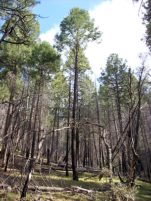


