 Route Editor

| Guide | ♦ | 11 Triplogs | 0 Topics |
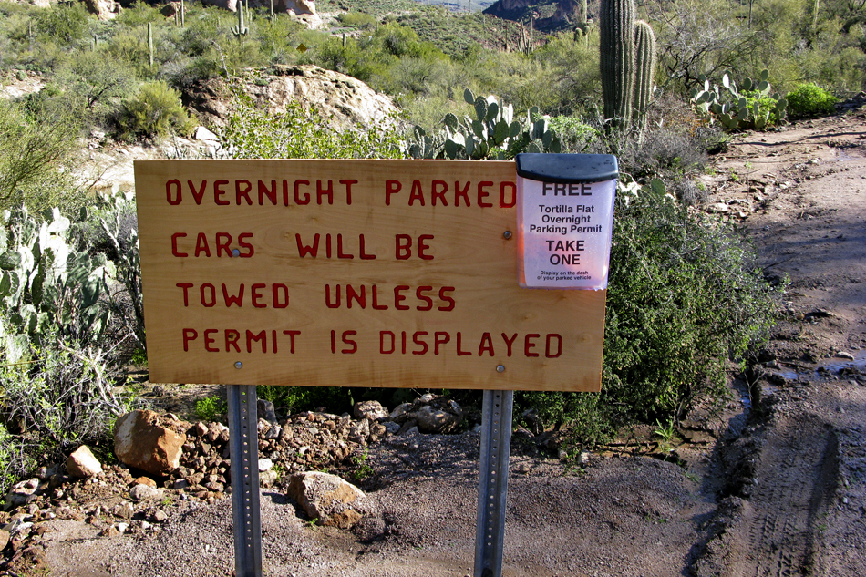
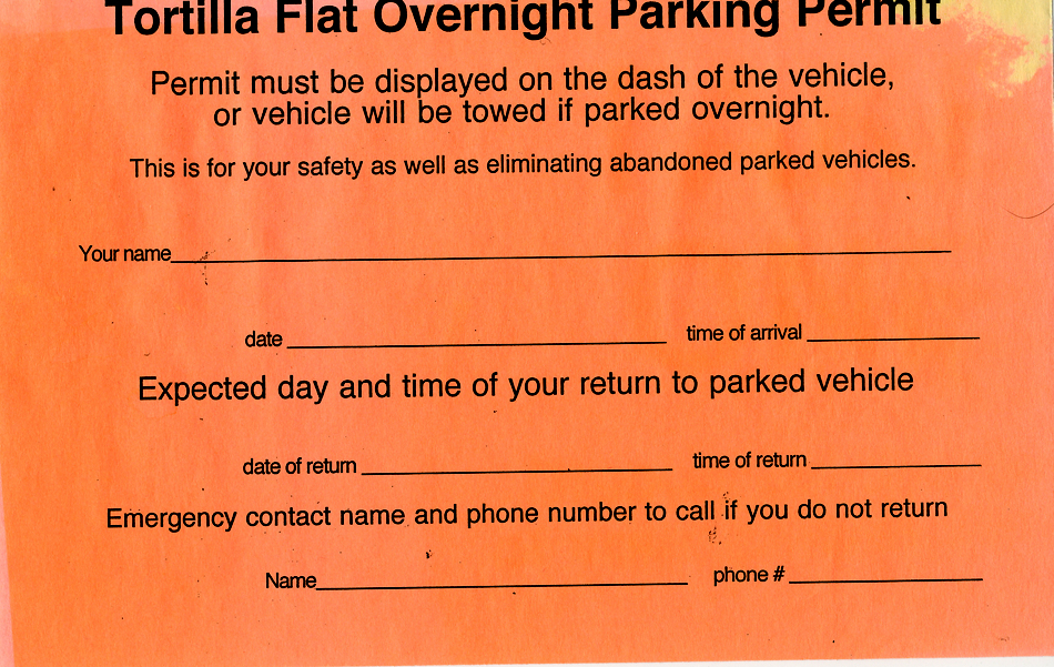
details | drive | no permit | forecast | 🔥 route |
stats |
photos | triplogs | topics | location |
| 50 | 11 | 0 |
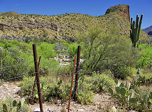
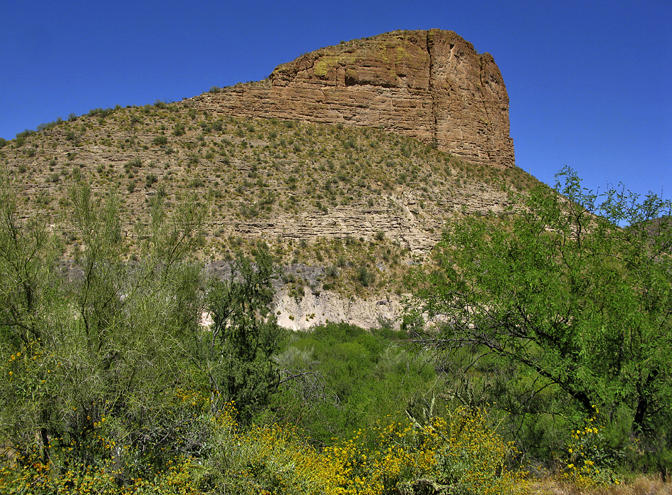
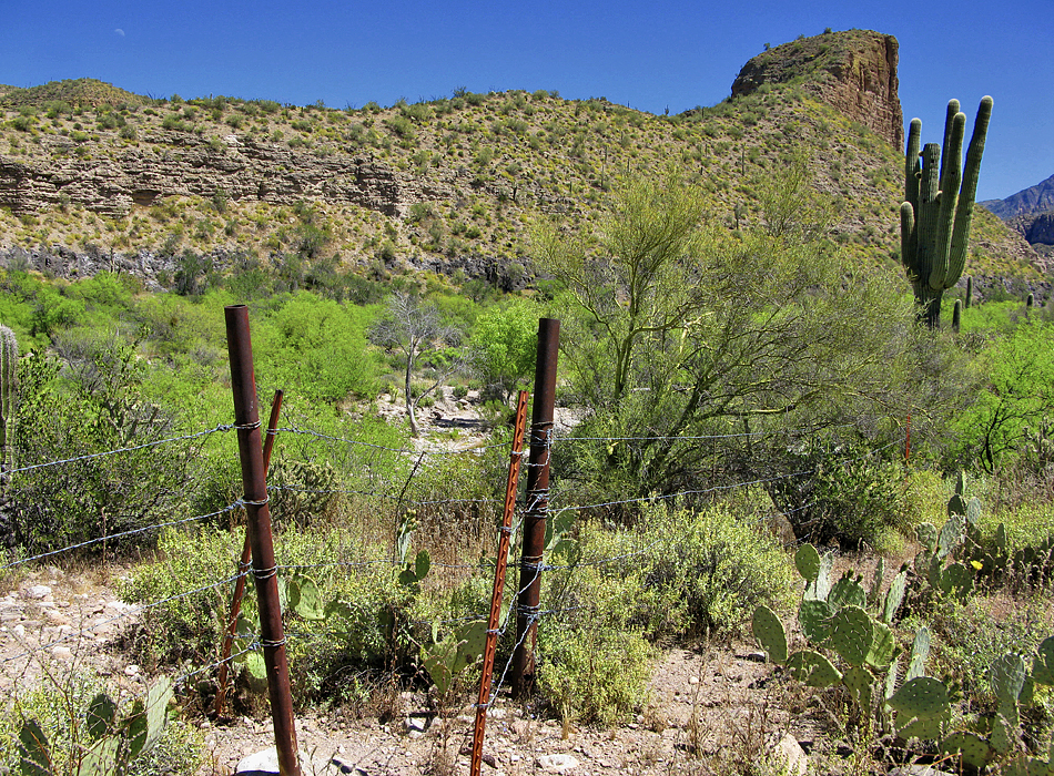
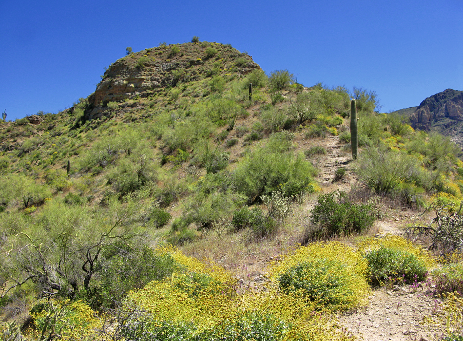
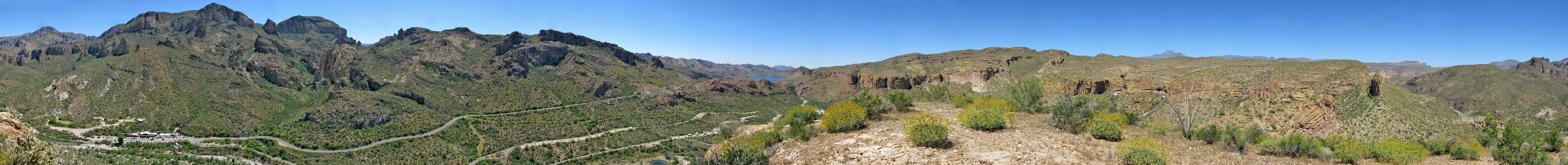
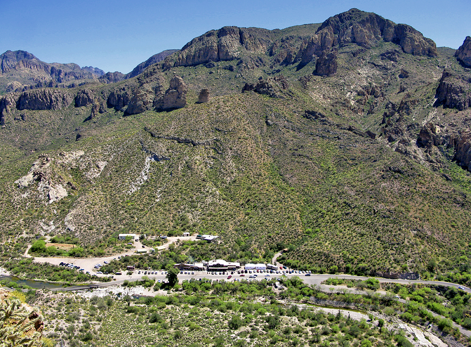
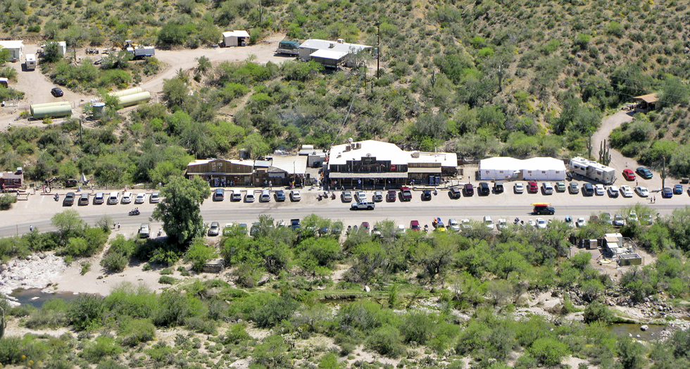
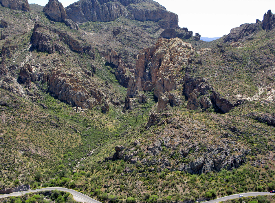
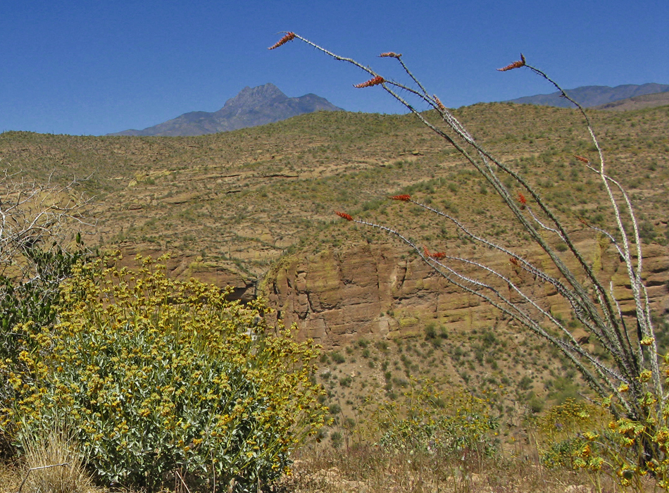
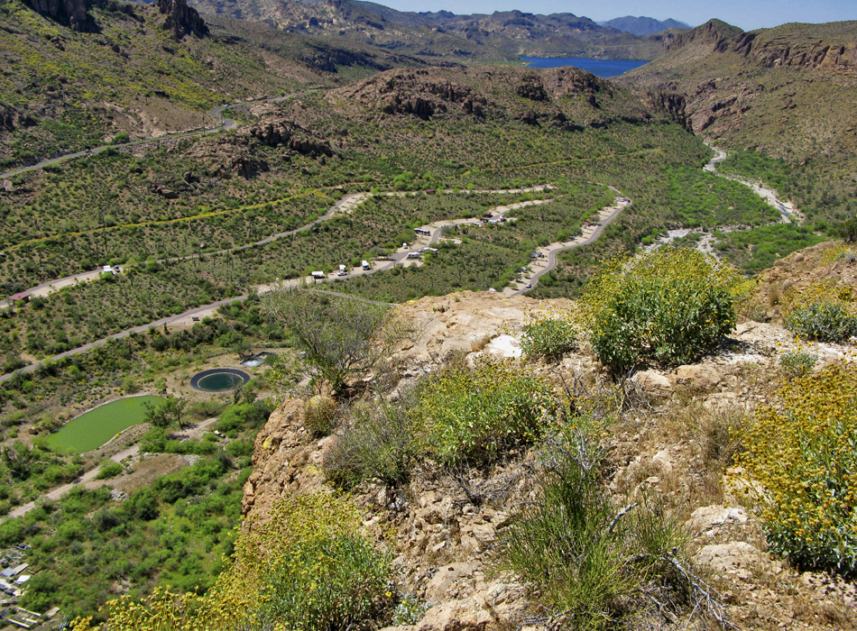
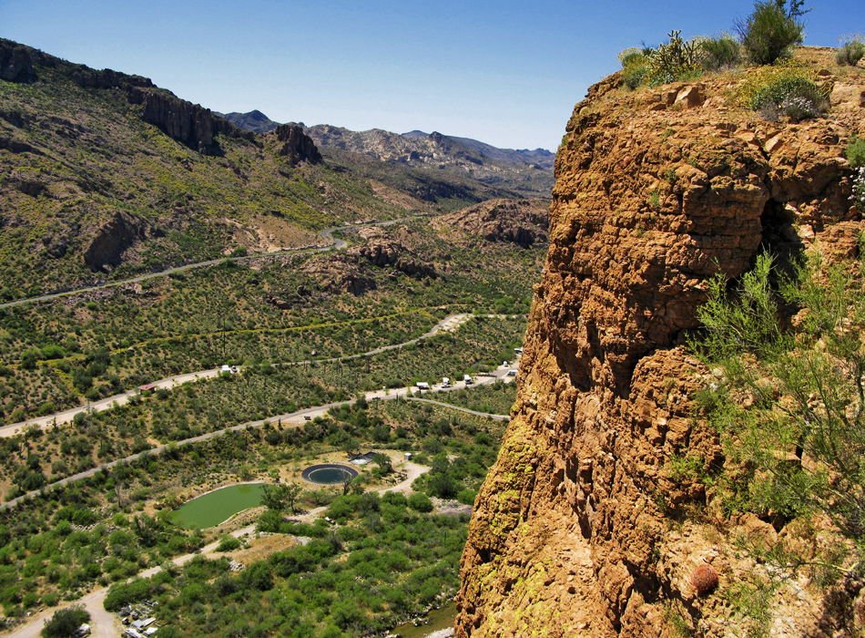
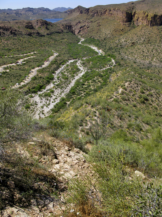
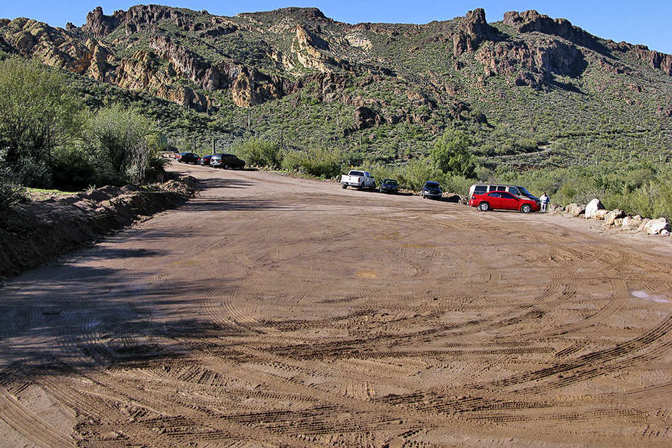
Spying Geronimo by joebartels  Overview OverviewThe looming wedge formation overlooking Tortilla Flats is certainly a landmark most have pondered. The massive sheer rock wall appears unattainable. Having looked down on the wedge from nearby Geronimo Head I knew it was more illusion than bite. Here's a borderline easy out-n-back hike. The elevation gain is a mere third of popular valley destinations Camelback and Piestewa Peak. Note The data figures on this page start from the hiker's parking lot on the east side of Tortilla Flats. There are ways to shorten the hike if you're determined to make an easy hike easier. The hike described here follows the road. You can follow the creek if you wish. It's more slow-going than exciting in my opinion so I left it out.
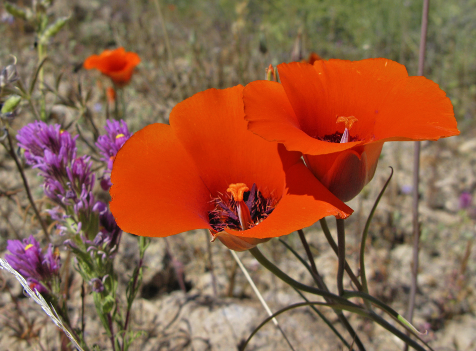
I do not recommend taking dogs or children on this hike due to the dangerous cliff. I do not recommend checking out "the edge" on top. As with all hikes you go at your own risk. Hike From the parking head west back across Tortilla Flats. Take the campground road forking off immediately to your right. Follow the signs passing the administrative turnoff continuing past the water treatment ponds. Fork right onto the "Do Not Enter" one-way. As you're walking down the road passing car-camp spots you'll pass a restroom. They're remarkably clean and have running water. Continue. The goal should be obvious as you're working to the end of the wedge to attain access. There is a well-defined trail that shoots off from the road and down through heavy vegetation. I didn't get the camp lot # it's across from but you really can't miss it. It's a good tenth of a mile before the tail end of the wedge. The trail soon reaches a pass through in a fence. After the pass-through, it takes you down to Tortilla Creek. On this trip, white faded spray paint arrows led the way. If not, fear not as it's easy. The creek is double wide in that it has a sliver of an island in the middle. Cross over and head left. Common sense will kick in and you'll see the path leading to the tail-end of the wedge. A well-defined use-trail takes you to the top. Midway up, on the northern slope I witnessed dozens of Desert Mariposa wildflowers. They were scattered but considering I've only seen a single one in all my years of hiking I was impressed! Continuing up is easy until the end where you encounter knee-high steps. The steepest section takes you right up under an ocotillo. It'll be interesting hearing how this plant fairs over the next ten to twenty years. On top you want to check out all the views. You have a birds eye view of Tortilla Flats and a sweet head on view of Geronimo's Lower Ravine. The Four Peaks and Canyon Lake are also in view. Whatever you do, be careful! I stepped out on a ledge and nearly lost my lunch. You really don't feel high up until you look over the edge. I looked from a perch on the east end. It's probably down right dangerous on top with loose debris. Return by the same route. Going down is a tad more difficult in that it requires more attention in the upper reaches. You could make a loop of sorts going off-trail. If you desire you'll figure it out. Bear in mind, that would put this hike into a higher level of difficulty. Check out the Official Route and Triplogs. Leave No Trace and +Add a Triplog after your hike to support this local community. | |||||||||||||||||||||||||||||||||||||||||||||||||||||||||||||||||||||||||||||||||||||||||||||||||||||||||||||||||||||||||||||||||||||||||||||||||||||||||||||||||||||||||||||||||||||||||||||


