 Route Editor

| Guide | ♦ | 11 Triplogs | 0 Topics |
details | drive | permit | forecast | 🔥 route |
stats |
photos | triplogs | topics | location |
| 101 | 11 | 0 |
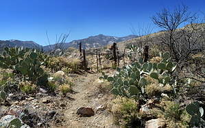
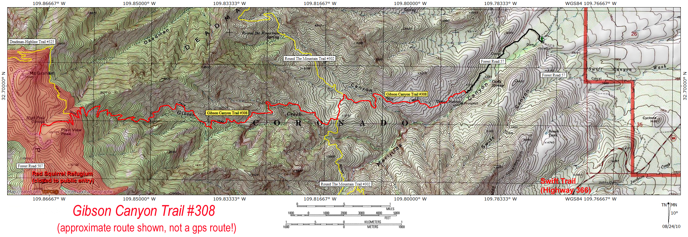
Nutt all there: Frye(d) by HAZ_Hikebot   This is an abandoned trail starting on Marijilda Creek at the base of Mount Graham, that climbs the Gibson Creek drainage up to Forest Road 507 (closed to the public), near 10,370 foot Plain View Peak, just south of Mount Graham itself. The top 0.8 miles of this trail (above 9800 feet) are within the Mount Graham Red Squirrel Refugium, which is closed to all public entry. The Gibson Canyon Trail is likely very difficult to follow, due to extensive damage from the 2004 Gibson Fire (Nuttall Complex), and lack of maintenance. Connects with the Round The Mountain Trail #302 at the 5600-foot level, and the Deadman-Highline Trail #325 at the 10,000-foot level. Starts in mesquite and prickly pear, and ends in (burned) spruce-fir forest, passing a 100-foot seasonal waterfall along the way. Statistics listed include a 1.2-mile hike on Forest Road 57 at the bottom, due to Forest Road 57 being washed out at the Marijilda Creek crossing. This is an abandoned trail starting on Marijilda Creek at the base of Mount Graham, that climbs the Gibson Creek drainage up to Forest Road 507 (closed to the public), near 10,370 foot Plain View Peak, just south of Mount Graham itself. The top 0.8 miles of this trail (above 9800 feet) are within the Mount Graham Red Squirrel Refugium, which is closed to all public entry. The Gibson Canyon Trail is likely very difficult to follow, due to extensive damage from the 2004 Gibson Fire (Nuttall Complex), and lack of maintenance. Connects with the Round The Mountain Trail #302 at the 5600-foot level, and the Deadman-Highline Trail #325 at the 10,000-foot level. Starts in mesquite and prickly pear, and ends in (burned) spruce-fir forest, passing a 100-foot seasonal waterfall along the way. Statistics listed include a 1.2-mile hike on Forest Road 57 at the bottom, due to Forest Road 57 being washed out at the Marijilda Creek crossing.
Check out the Official Route and Triplogs. Note This is a difficult hike. Arrive fit and prepared or this could get ugly. Leave No Trace and +Add a Triplog after your hike to support this local community. One-Way Notice This hike is listed as One-Way. When hiking several trails on a single "hike", log it with a generic name that describes the hike. Then link the trails traveled, check out the example. | |||||||||||||||||||||||||||||||||||||||||||||||||||||||||||||||||||||||||||||||||||||||||||||


