 Route Editor

| Guide | ♦ | 20 Triplogs | 1 Topic |
details | drive | no permit | forecast | route |
stats |
photos | triplogs | topic | location |
| 174 | 20 | 1 |
Canyons are inherently risky. Flash floods occur without notice on sunny days. Technical skills & surrounding topography knowledge required yet does not eliminate risk.
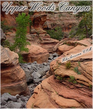
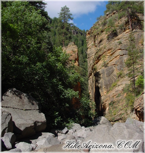
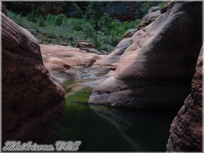
Painfully beautiful by joebartels  This trip exceeded my high expectations. Woods Canyon spans fifteen miles. Starting up at mile marker 316 on I-17 down to just south of the Village of Oak Creek. I estimate a one-way trek at seven to ten hours if you're in good shape. Perhaps twelve hours if you're not speedy on the rocks. I'm breaking this up into day hikes. The first was "Lower Woods Canyon". This description covers the upper section where the canyon originates. This trip exceeded my high expectations. Woods Canyon spans fifteen miles. Starting up at mile marker 316 on I-17 down to just south of the Village of Oak Creek. I estimate a one-way trek at seven to ten hours if you're in good shape. Perhaps twelve hours if you're not speedy on the rocks. I'm breaking this up into day hikes. The first was "Lower Woods Canyon". This description covers the upper section where the canyon originates.I write here with nearly every muscle in my body aching. Poison ivy itching head to toe. A couple of blisters, and yes... I'm dying to go back! The excursion was awesome, only comparable with the Superstition Ridgeline east of Phoenix. These two trail-less treks are Arizona at its finest.
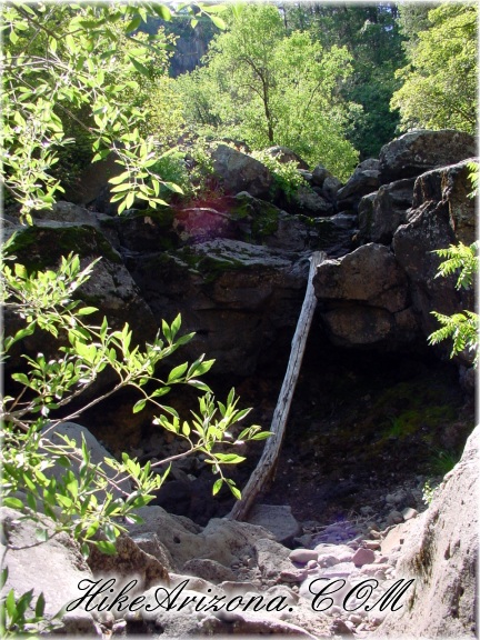
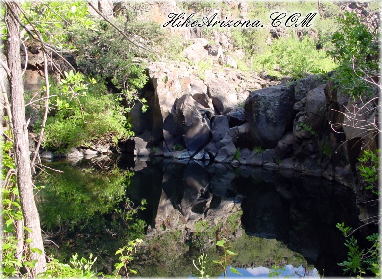
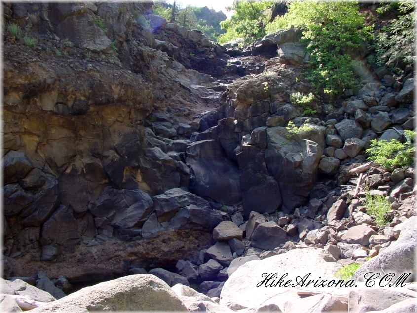
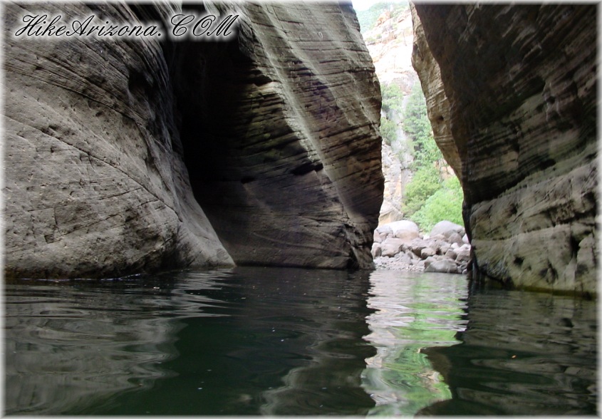
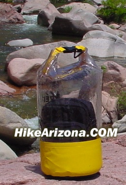
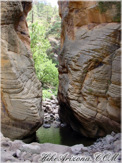
From the end of FR#80, you have to work your way into the canyon. No trail exists. You will need a topographical map of the area, and I highly recommend a GPS receiver. (It saved our lives on this trip) Luckily I soldered a new internal memory battery in my GPS unit the night before. This was after it had sat around for over a year in pieces cause I was too lazy to work on it. According to the map, FS#80 stops near Robbers Roost at about N 34 51.521', W 111 37.862'. Woods Canyon is barely noticeable zig-zagging west. I didn't notice anything significant along the way, and the road fizzled out. All of a sudden, we were driving out in the middle of the woods. I'd say we drove maybe an eighth of a mile on a faint road until we came to a barbed-wire fence. Instead of going north to Woods Canyon, we went southwest to a tributary. We started at N 34 51.315', W 111 38.306' at 7:23am "The Dip" - the first destination. 1.1 miles from start - 8:43am We walked through the forest southwest into a shallow drainage. Followed this drainage a short distance where it met a shallow canyon heading northwest to Woods Canyon. This was easygoing in the beginning. Soon we were knee-deep in wild grape, thorn bush, and poison ivy. As it turned out, this was the section we dreaded most of all. You can avoid this by studying a topographical map more than I did! The tributary coming up from the south dumps into Woods Canyon at what we called "The Dip". The water temp was 63.8 degrees. This is a depression at N 34 51.357', W 111 39.127' We continued on downstream for 0.2 miles to what "Canyoneering Arizona" calls a 70ft sloping fall in the basalt. We didn't have any problems going straight down the center of the falls (or coming back up, for that matter). I guess if the creek is flowing, you need to scramble on the left. Coconino Sandstone - 1.6 miles into the hike 9:21am 0.3 miles from the 70ft sloping fall the Coconino Sandstone appears. I guess this is where things start to get good as Tony whipped out the camera and said, "wow". Tony is yet another employee I've conned into tagging along. Also, a Marine, I figured he'd be able to carry me out if things got ugly! (nearly did!) The canyon gets mighty narrow for a short distance. Don't turn around; it just gets better! Mandatory swim through the narrows - 2.32 miles into the hike I gotta note that the bouldering in this canyon is more intense than Pumphouse Wash. The boulders are bigger and consistent throughout. No real open stretches. We did get a good running-across-the-boulders rhythm going a couple of times (not recommended, unless you're good at running on the small rocks on Camelback). Okay... Continue on 0.72 miles from the beginning of the Coconino Sandstone to what "Canyoneering Arizona" calls the "liquid pool of ice". Temperature being.....tada.... 68 at worst. (70 on the shallow edge) It's cold at first but nothing compared to the California coast. However, we both agreed it's the coldest 68! I guestimate the length across around fifty yards (using the ol' quarterback eye). It's a mandatory swim as the canyon walls stretch high into the sky. You can barely see straight through as the canyon walls interweave. As of this writing, there's a high point in the middle of the pool where you can catch your breath. I recommend a drybag ($10 - $30) from REI for anything you wish to keep dry. 15-second MPEG Video from center pool | Comedian Tony version Here are a couple of cool location reports... Schnebly Hill is the mountain rising to the north (you'd never know it because the canyon walls are too steep). The Merry-Go-Round is only about 2.5 air miles from the liquid pools. So you're out in the middle of nowhere, but not really. There is a second narrow with a pool shortly after the first. This one is much shorter and mostly a wade. The water temperature here was 58 degrees in the middle. Now that's cold! We continued. As we'd been traveling at a snail's pace up until now, I quit tracking so much data to speed things up. Constant boulder hopping continued into the Supai layer (red rock). We traveled to N 34 50.866', W 111 40.236' Here, maybe a half-mile into the Supai layer, we ran into a small waterfall. The waterfall is just shy of being negotiable. A very inviting pool is below. We both wanted to jump, but I didn't think we could get back up. We scrambled up the wall on the left and looked ahead. The red rock is beautiful here, and I'm sure there are treasures further on. At 12:12 pm, about five hours into this hike and only 3.25 miles progress, I decided to turn around. Tony was disappointed (so was I). He offered to carry me a few more miles to the ruins (for a small $10 raise, that is). However, judging the circumstances, it was the appropriate choice. I was running on only two hours of sleep after a twelve-hour shift with another lined up. The pools on the way back were awesome and refreshing. We both felt like we were in basic training.... running, climbing, swimming, over and over. We made excellent time back to "The Dip" in only 2 hrs. On the lift back up I started cramping. I took probably five breaks in the next half mile. Then we couldn't find our cairns where we entered the canyon. Luckily, GPS led us back safely. It took another 1.5 hours from "The Dip", making for a 4-hour return and a 9-hour trip. I believe I could easily go out and back in 6 to 7 seven hours now, knowing the obstacles and better prepared.
Check out the Official Route and Triplogs. Leave No Trace and +Add a Triplog after your canyon trip to support this local community. | |||||||||||||||||||||||||||||||||||||||||||||||||||||||||||||||||||||||||||||||||||||||||||||||||||||||||||||||||


