 Route Editor

| Guide | ♦ | 4 Triplogs | 0 Topics |
details | drive | permit | forecast | 🔥 route |
stats |
photos | triplogs | topics | location |
| 15 | 4 | 0 |
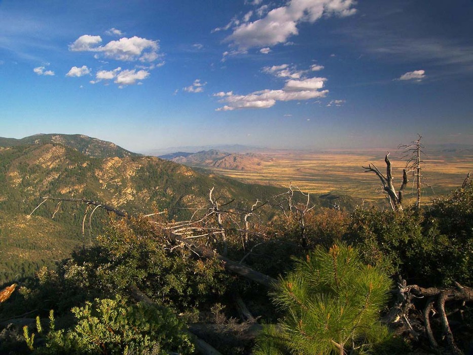
Please Jesus, send a trail crew. by PrestonSands  Overview OverviewThe Jesus Goudy Ridge Trail #298 is a scenic "trail to nowhere", on the west end of the Pinaleno Mountains. Once a connecting route between the top of the range and the Sulphur Springs Valley below, the Jesus Goudy Ridge Trail was reduced to its current length by severe damage resulting from the 1996 Clark Peak Fire. Route finding ability is required on this unmaintained and rather faint old trail. State highway 366, which provides access to this hike, is closed yearly due to snow from November 15 through April 15, about 10.8 miles before the trailhead.
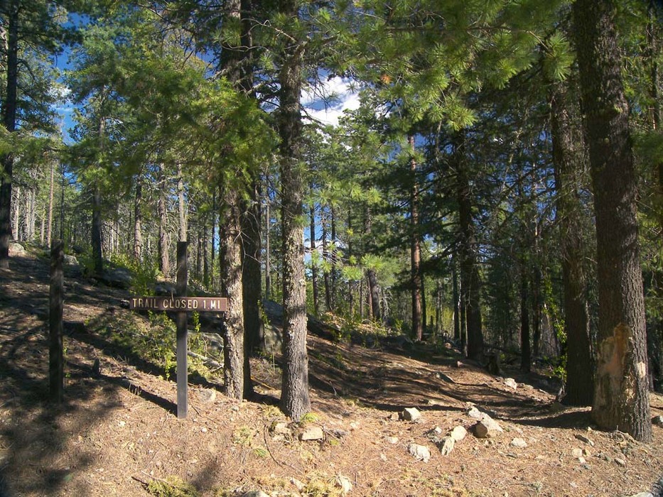
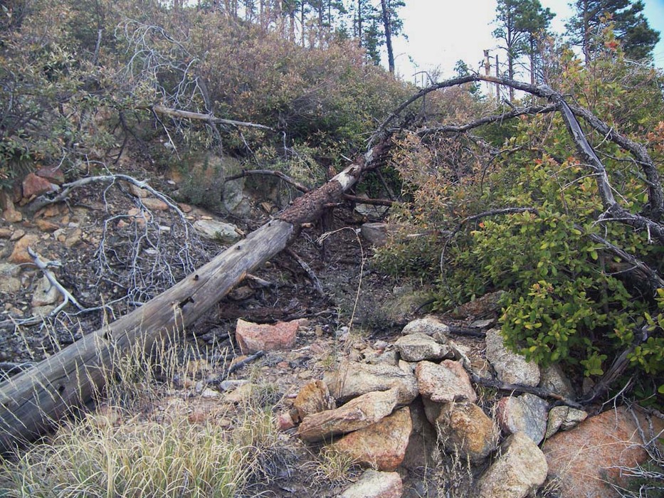
In 1878 soldiers from nearby Fort Grant constructed a wagon road up Jesus Goudy Ridge to obtain logs for use in constructing the fort's buildings. This old wagon road can be seen paralleling the Jesus Goudy Ridge Trail in many places. Hike The trail begins on a switchback above Riggs Lake, behind a sign that says "trail closed 1 mile". The faint Jesus Goudy Ridge Trail leaves the road behind and gradually descends along a forested hillside. Fallen trees frequently block the trail. The overgrown route of the 1878 wagon road is barely visible, slightly downslope of the trail. A third of a mile in, the trail reaches a "T" junction, where a wooden sign indicates "trail". Go right (southeast). The left fork is an old trail alignment that leads back to the Swift Trail and is very hard to follow. As you head southeast from the "T" junction, stay on course by watching carefully for faded blazes in the towering fir trees. The Jesus Goudy Ridge Trail almost immediately reaches a saddle, where it turns south to descend the east side of Jesus Goudy Ridge. The trail makes a gradual descent along the ridge, where occasional breaks in the lightly burned forest allow for views of the south slope of the Pinaleno Mountains. In some places the old wagon road can be seen, about thirty feet upslope from the trail. Just after the one-mile point, the tree cover gives way to outstanding panoramic views, as the trail enters a heavily burned area. The trail grows faint in the post-fire chaparral, but cairns mark the way. Finally, at 1.2 miles, the Jesus Goudy Ridge Trail encounters a "trail closed" sign, where the hike effectively ends, in a disaster area of fallen logs, chaparral, and thorny brush. Continuing further is a painful and pointless bushwhack, as the trail has reverted to nature. Check out the Official Route and Triplogs. Leave No Trace and +Add a Triplog after your hike to support this local community. | |||||||||||||||||||||||||||||||||||||||||||||||||||||||||||||||||||||||||||||||||||||||||||||||||||||||


