 Route Editor

| Guide | ♦ | 24 Triplogs | 2 Topics |
details | drive | no permit | forecast | 🔥 route |
stats |
photos | triplogs | topics | location |
| 162 | 24 | 2 |
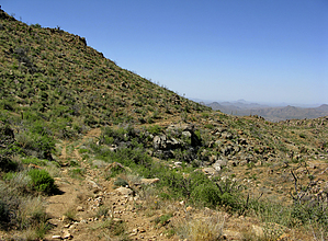
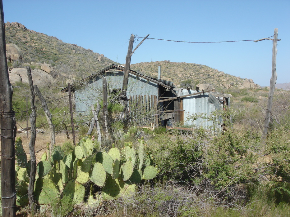
an old road by joebartels   Overview OverviewAn old pipeline road that goes to Ballantine Cabin. Accessing the area is more difficult than hiking. Page data listed is for the actual section of the trail from the end of FR1704 to Ballantine Cabin. A more logical means for stock 4x4 is to hike the last 1.5mi of road. There is a backup space just before some gnarly tight-n-steep switchbacks in the road at 33.8146 -111.455. This is also the start/end of Boulder Bob's Cabin Trail. Road Hike If you are hiking the final 1.5mi of the road it's pretty straightforward. One thing to note is when the road stops ascending and comes to a fork. You want to continue right. A left will take you to a coral and Boulder Mountain Spring is near. I'm not sure but presume this is the most dependable spring in the area as it appears the pipeline was put in place to access it.
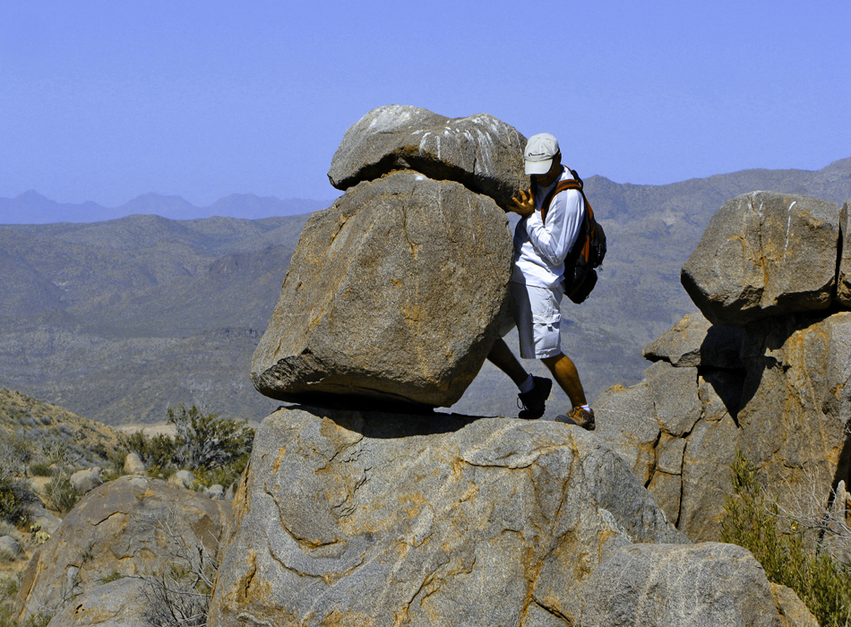
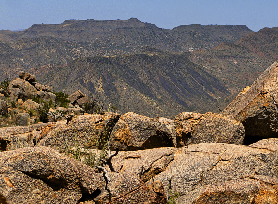
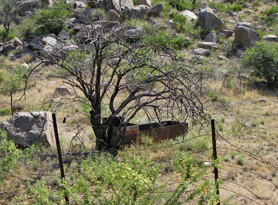
The actual trailhead near Mud Springs isn't noticeable in any way other than the road going up turns beyond gnarly. As of this writing, an approximately ten-year-old black tube weaves in and out of the road. I assume it was metal back in the mid-1900s. The entire hike is an old road. From Mud Springs on it appears to be too rough for anything but ATVs. We noticed fairly fresh tracks throughout so it appears to get used. The road contours the mountain over to Ballantine Cabin. It dips and ascends between each ravine making for a slight roller coaster of a hike. It's nothing strenuous. The footing gets a little loose (borderline dangerous) as it's pea-sized gravel. Several interesting rock formations are passed along the route. Views looking out and down are pretty nice. Especially Black Mesa across SR87 (Beeline Highway) in the distance. Although the hike goes up and down the pipeline once worked. Boulder Mtn Spring is just above 4,300ft and Ballantine Cabin is at 3,750ft. A couple steel troughs are passed on route to the cabin. Summary This hike was better than anticipated. However, I wouldn't go out of my way to return. Check out the Official Route and Triplogs. Leave No Trace and +Add a Triplog after your hike to support this local community. One-Way Notice This hike is listed as One-Way. When hiking several trails on a single "hike", log it with a generic name that describes the hike. Then link the trails traveled, check out the example. | ||||||||||||||||||||||||||||||||||||||||||||||||||||||||||||||||||||||||||||||||||||||||||||||||||||||||||||||||||||||||||||||||||||||||||||||||||||||||||||||||||||||||||||||||||||||||||||||||||||||||||||


