Route Editor

| Guide | ♦ | 8 Triplogs | 2 Topics |
details | drive | permit | forecast | 🔥 route |
stats |
photos | triplogs | topics | location |
| 93 | 8 | 2 |
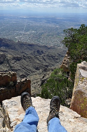
It hurts so good! by bikeandhike  Overview OverviewProminent Point is visible from almost anywhere in Tucson as two big rock slabs immediately to the west of Finger Rock. Despite being a highly noticeable feature, it is rarely visited. No trails lead to it, but there are a few doable bushwhacks. Here, I will cover a route that goes over the ridge south of Pima Canyon over to the western summit. This is a very difficult route, but it's the most scenic way to get there. Restrictions in the Pusch Ridge Wilderness Dogs are not allowed (except service dogs, but you probably should not attempt this hike if you need a service dog). Off-trail hiking is not permitted between January 1 and April 30.
Don't do this hike if there's any chance of rain. Don't do this hike in warm weather. Don't do this hike without sturdy clothing that fully covers your body and thick-soled footwear. Don't do this hike if you're an inexperienced off-trail hiker. Don't do this hike if you are uncomfortable with extended and exposed stretches of class 2-3 scrambling. Route Go down the Pima Canyon Trail #62 until you pass Rosewood Point (the high point of the ridge that's to your right as you enter Pima Canyon). As you pass Rosewood Point, you'll notice a canyon on your right. Once you're immediately across from the low point of the canyon (about 1.6 miles from the trailhead), hack your way over to it and start climbing. There are some cairns, but you don't need to follow them closely; just go up. As you approach the saddle that's southeast of Rosewood Point, you'll see that the canyon sharply bends to the northeast. You'll want to keep following the canyon as it bends. This is where things start to get tough. After you pass the bend, the canyon gets much steeper, and the flora gets much nastier. Watch out for spiky things, especially cholla and shindagger. As you approach the top of the canyon, curve up onto the ridge to your left to avoid the cliffs in front of you. Once you're near the top of the ridge, follow it past the cliffs at the end of the canyon. Once you're past those cliffs, continue heading northeast into the shindagger-choked wash that feeds the canyon. Follow this wash until it ends, and then climb straight out of it onto a ridgeline. Once you've reached the ridge, you'll see that it climbs to a high point with some trees on it. That high point is the western summit of Prominent Point. Getting there is as straightforward as it looks; just follow the ridge until you get up there. Keep an eye out for game tracks and follow them when possible. When the ridge starts to seem sadistically steep, you're almost there. When you reach the summit (a flat area with some boulders and pinon pines), make sure to walk over to the eastern edge. From there, you'll have a great view of Finger Rock Canyon and the eastern summit of Prominent Point. The eastern summit is a few feet higher, but there aren't any easy routes over there. When you're ready to go, head back the way you came up. Check out the Official Route and Triplogs. Note This is a difficult hike. Arrive fit and prepared or this could get ugly. Leave No Trace and +Add a Triplog after your hike to support this local community. | ||||||||||||||||||||||||||||||||||||||||||||||||||||||||||||||||||||||||||||||||||||||||||||||||||||||||||||||