| Guide | ♦ | 4 Triplogs | 0 Topics |
details | drive | permit | forecast | 🔥 route |
stats |
photos | triplogs | topics | location |
| 0 | 4 | 0 |
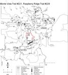
 Monte Vista Trail #221 & Raspberry Ridge Trail #228 provide different access routes to Monte Vista Peak, one of the best viewpoints in the southern Chiricahuas. The Monte Vista Trail begins at the wilderness boundary in North Fork Canyon at the end of an old jeep road and immediately begins switchbacking up the mountain's south slope. Views are good along much of the route and, as the trail gains elevation, they just keep getting better. At the summit, reached via a 0.2 mile spur trail, the panorama includes much of southeastern Arizona including several of its Sky Island mountain ranges. Raspberry Ridge Trail provides another access route to Monte Vista Peak as well as to the extensive trail network connected by the Crest Trail #270. Forest shaded Raspberry Ridge Trail starts at the upper end of Rucker Forest Campground and stays within Bear Canyon for the first half of its route. From Bear Canyon, it switchbacks steeply to razorback Raspberry Ridge, which it follows to its junction with the Crest Trail near Monte Vista Peak. After completing your journey, you can either return the way you came, or make a loop by using about 0.7 mile of the Crest Trail #270 to connect the two trails. If you choose this latter option, you'll also have to travel approximately 2.6 miles on the North Fork and Rucker Roads to get back to your starting point. Monte Vista Trail #221 & Raspberry Ridge Trail #228 provide different access routes to Monte Vista Peak, one of the best viewpoints in the southern Chiricahuas. The Monte Vista Trail begins at the wilderness boundary in North Fork Canyon at the end of an old jeep road and immediately begins switchbacking up the mountain's south slope. Views are good along much of the route and, as the trail gains elevation, they just keep getting better. At the summit, reached via a 0.2 mile spur trail, the panorama includes much of southeastern Arizona including several of its Sky Island mountain ranges. Raspberry Ridge Trail provides another access route to Monte Vista Peak as well as to the extensive trail network connected by the Crest Trail #270. Forest shaded Raspberry Ridge Trail starts at the upper end of Rucker Forest Campground and stays within Bear Canyon for the first half of its route. From Bear Canyon, it switchbacks steeply to razorback Raspberry Ridge, which it follows to its junction with the Crest Trail near Monte Vista Peak. After completing your journey, you can either return the way you came, or make a loop by using about 0.7 mile of the Crest Trail #270 to connect the two trails. If you choose this latter option, you'll also have to travel approximately 2.6 miles on the North Fork and Rucker Roads to get back to your starting point.Check out the Official Route and Triplogs. Note This is a more difficult hike. It would be unwise to attempt this without prior experience hiking. Leave No Trace and +Add a Triplog after your hike to support this local community. One-Way Notice This hike is listed as One-Way. When hiking several trails on a single "hike", log it with a generic name that describes the hike. Then link the trails traveled, check out the example. | ||||||||||||||||||||||||||||||||||||||||||||||||||||||||||||||||||||||||||||||||||||||||||||||
 Route Editor


