 Route Editor

| Guide | ♦ | 11 Triplogs | 0 Topics |
details | drive | permit | forecast | map |
stats |
photos | triplogs | topics | location |
| 81 | 11 | 0 |
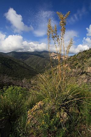
  Summary SummaryThis is a hike starting from the Oracle Ridge trail and descends to Dan Saddle, then cuts west on the Catalina Camp Trail #401 down to an old abandoned mine and settlement site complete with old cabins and relics. From here you can continue down a short way to the intersection with the Red Ridge trail to return up to the Ski Valley road, or simply turn around and climb back up the way you came. Hike The first leg of this trail takes off from the Oracle Ridge trailhead, which is located on the Oracle Control road, just a short way past the fire station. The Oracle Ridge trail #1 takes off from the signed trailhead and immediately skirts west around the base of Peak 8077. The trail is exposed the whole way down to the saddle. The area near the trailhead was heavily burned in the fire and is now slowly making its comeback. In the summer this area, especially on the west flank of 8077, will just be blanketed with wildflowers. As you descend more, you will run the ridgeline with expansive views out both east and west. The trail is a little overgrown but never hard to follow. After passing 8077 and descending a further way you can see Marble Peak out to your right sitting at 7654 feet, notice the trail heading along its west flank. You will come to a level saddle called Stratton Saddle before cutting along the west flank of Marble Peak. Just past Marble Peak, an old jeep track cuts back to your right and heads north up towards the top. Continue down Oracle Ridge. You are more than halfway to Dan Saddle. To your left are outstanding views of the rugged Reef of Rock, and Red Ridge one ridge closer. You can see out forever east, north, and west to sections of the Catalinas rarely seen. Soon thereafter the trail will intermittently break off the jeep track on the left and will be signed with small trail markers. The more narrow path drops down some switchbacks to rejoin the jeep track. It will break off to the left one more time and then dump you back on the track at Dan Saddle, an intersection sitting at roughly 6880 feet. The Oracle Ridge trail continues north straight ahead. A gated road breaks off to your right and heads east ultimately descending to Oracle Control Road. You want the signed Catalina Camp Trail #401 which heads to your left and descends west.
Gate Policy: If a gate is closed upon arrival, leave it closed after you go through. If it is open, leave it open. Leaving a closed gate open may put cattle in danger. Closing an open gate may cut them off from water. Please be respectful, leave gates as found. The exception is signage on the gate directing you otherwise. Check out the Triplogs. Leave No Trace and +Add a Triplog after your hike to support this local community. One-Way Notice This hike is listed as One-Way. When hiking several trails on a single "hike", log it with a generic name that describes the hike. Then link the trails traveled, check out the example. | ||||||||||||||||||||||||||||||||||||||||||||||||||||||||||||||||||||||||||||||||||||||||||||


