| Guide | ♦ | 64 Triplogs | 0 Topics |
details | drive | permit | forecast | route |
stats |
photos | triplogs | topics | location |
| 872 | 64 | 0 |
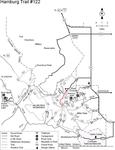
 Many people refer to this as the Ramsey Canyon Trail. It starts at the parking lot of the Nature Conservancy's Ramsey Canyon Preserve, which is famous around the world for its fabulous birdwatching. You'll have to obtain a free permit to cross the Preserve (available at the visitor center at the trailhead) and, if you're coming on a weekend or holiday, you'll want to call in advance to reserve a spot in their parking lot. The only parking in this canyon is at the Preserve, where spaces are extremely limited and in very high demand. Once you've taken care of your vehicle and have your hiking permit, you're ready to head up-canyon. About the first mile of the trail is on Nature Conservancy property, where you'll no doubt have a lot of birdwatchers for company. You might want to join them, at least for a while, as this canyon boasts one of the most diverse bird populations in the U. S. At the upper limit of the Preserve, some steep switchbacks take you into the Coronado National Forest and the Miller Peak Wilderness. Your reward for climbing this far is a good overlook of lower Ramsey Canyon and the San Pedro Valley. Above the switchbacks, the trail drops back down to the creek and follows it through a riparian zone as lush and as pleasant as any you will find in the Southwest. Hundreds of small waterfalls and rocky cascades tumble past gnarly sycamores and lacy-limbed firs to add to the picturesque nature of this outstanding area. The trail crosses the stream more times than you'll want to count as you climb toward the upper elevations of the Huachucas. (This can cause problems if the water level is high.) Farther along, you'll pass the remains of old mining digs and leveled homesites that once were occupied by the cabins of the old mining settlement of Hamburg. The trail then follows Wisconsin Canyon to good views, broader horizons and a junction with the Crest Trail #103 at Bear Saddle. Many people refer to this as the Ramsey Canyon Trail. It starts at the parking lot of the Nature Conservancy's Ramsey Canyon Preserve, which is famous around the world for its fabulous birdwatching. You'll have to obtain a free permit to cross the Preserve (available at the visitor center at the trailhead) and, if you're coming on a weekend or holiday, you'll want to call in advance to reserve a spot in their parking lot. The only parking in this canyon is at the Preserve, where spaces are extremely limited and in very high demand. Once you've taken care of your vehicle and have your hiking permit, you're ready to head up-canyon. About the first mile of the trail is on Nature Conservancy property, where you'll no doubt have a lot of birdwatchers for company. You might want to join them, at least for a while, as this canyon boasts one of the most diverse bird populations in the U. S. At the upper limit of the Preserve, some steep switchbacks take you into the Coronado National Forest and the Miller Peak Wilderness. Your reward for climbing this far is a good overlook of lower Ramsey Canyon and the San Pedro Valley. Above the switchbacks, the trail drops back down to the creek and follows it through a riparian zone as lush and as pleasant as any you will find in the Southwest. Hundreds of small waterfalls and rocky cascades tumble past gnarly sycamores and lacy-limbed firs to add to the picturesque nature of this outstanding area. The trail crosses the stream more times than you'll want to count as you climb toward the upper elevations of the Huachucas. (This can cause problems if the water level is high.) Farther along, you'll pass the remains of old mining digs and leveled homesites that once were occupied by the cabins of the old mining settlement of Hamburg. The trail then follows Wisconsin Canyon to good views, broader horizons and a junction with the Crest Trail #103 at Bear Saddle.Check out the Official Route and Triplogs. Note This is a moderately difficult hike. Leave No Trace and +Add a Triplog after your hike to support this local community. One-Way Notice This hike is listed as One-Way. When hiking several trails on a single "hike", log it with a generic name that describes the hike. Then link the trails traveled, check out the example. | ||||||||||||||||||||||||||||||||||||||||||||||||||||||||||||||||||||||||||||||||||||||||||||||||||||||||||||||||||||||||||||||||||||||||||||||||||||||||||||||||||||||||||||||||||||||||
 Route Editor


