| Guide | 0 Triplogs | 0 Topics |
details | drive | permit | forecast | 🔥 route |
stats |
photos | triplogs | topics | location |
| 0 | 0 | 0 |
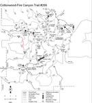
 This trail is located on the lower western slopes of the Chiricahuas and provides a route between the West Turkey Creek and Rucker Creek drainages. Along the way it passes through an area of oak woodlands dotted with juniper and pinyon pine where thickets of manzanita cover the ridgetops. Although the trail is rated more difficult, portions are steep and all of it can be hot. Be sure and bring plenty of water when you travel this route, especially if you come during the warmer months of the year. Since the Cottonwood-Fire Canyon Trail is maintained in a primitive condition, visitors should come prepared to find their own way in places where it can become hard to follow. Remember, that along primitive trails the only maintenance provided is to mitigate environmental damage, control erosion and remove major obstructions. With that in mind, bring your compass and topographic map and be ready for an adventure. This trail is located on the lower western slopes of the Chiricahuas and provides a route between the West Turkey Creek and Rucker Creek drainages. Along the way it passes through an area of oak woodlands dotted with juniper and pinyon pine where thickets of manzanita cover the ridgetops. Although the trail is rated more difficult, portions are steep and all of it can be hot. Be sure and bring plenty of water when you travel this route, especially if you come during the warmer months of the year. Since the Cottonwood-Fire Canyon Trail is maintained in a primitive condition, visitors should come prepared to find their own way in places where it can become hard to follow. Remember, that along primitive trails the only maintenance provided is to mitigate environmental damage, control erosion and remove major obstructions. With that in mind, bring your compass and topographic map and be ready for an adventure.Secluded and remote. Wilderness setting Primitive trail. 3.8 miles of this trail is located in the Chiricahua Wilderness.This trail is maintained in a primitive condition. Using it safely requires appropriate skills and equipment. USGS Maps: Chiricahua Peak Check out the Official Route. Leave No Trace and +Add a Triplog after your hike to support this local community. One-Way Notice This hike is listed as One-Way. When hiking several trails on a single "hike", log it with a generic name that describes the hike. Then link the trails traveled, check out the example. | ||||||||||||||||||||||||||||||||||||||||||||||||||||||||||||||||||||||||||||||||||||
 Route Editor


