Route Editor

| Guide | ♦ | 17 Triplogs | 0 Topics |
details | drive | no permit | forecast | 🔥 route |
stats |
photos | triplogs | topics | location |
| 130 | 17 | 0 |
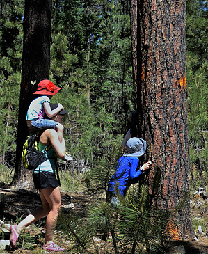
wide-n-easy route-finding by nonot  Overview OverviewThe Carr Lake Loop "trail" makes a 6.6-mile loop between the rim road and the Mogollon rim, making use of old forest roads. Hike This hike is composed of hiking entirely on old forest roads now closed to motorized vehicle travel. Being that you are walking along 16 ft wide roads, navigation is rather easy, although you will encounter many intersections with other closed roads.
There is no actual trailhead for this loop. There are several access opportunities to the trail, but this guide will use the Carr Connector #414 as the access choice, which adds roughly a half-mile in distance and no elevation. From the end of Carr Connector Trail #414, proceed north on FR9350C. In a short distance, you will pass the George Crook trail (the first crossing goes east, the second is the western heading connection). You will continue walking the road through the pine forest until you encounter the Aspen Trail Loop #411, which will join the Carr Lakes Loop for about a half-mile. Keep your eyes open as I spotted a very lost Pronghorn, and some elk, in this section. As you approach Rim Road 300, you encounter a junction at another loop access option (FR9351C), but to stay on the loop go north (signed) along FR9351D. This road is flat and the closest access to Carr Lake, which wasn't a marked/signed spur on the trail and didn't stand out to me as I walked by the area. You will reach the intersection with FR9351 (another access option to the loop) as you near the Rim Road 300 on the northwestern edge of this loop. Turn southwest here onto FR9351 (the intersection is well signed). A short distance later you will reach the intersection with George Crook Trail. Stay left at the intersection to go onto FR9350. The only potential confusion section of this loop is where in about a quarter-mile, the George Crook trail leaves the road with about a million ribbons marking the intersection. The official Carr Lake Trail stays on the road and will rejoin with George Crook trail in about 300 yards when it rejoins the road. To finish the loop, hike east to return to the starting point at the Carr Connector Trail #414. Check out the Official Route and Triplogs. Leave No Trace and +Add a Triplog after your hike to support this local community. | |||||||||||||||||||||||||||||||||||||||||||||||||||||||||||||||||||||||||||||||||||||||||||||||||||||||||||||||||||||||||||||||||||||||||||||||||||||||||||||||||||||||||||||||||||||