Hiking jewel of the desert, Camelback is wedged between the cities of the Valley. This conveniently located hike is one of my favorites. Enjoy your first few trips on the mountain. As soon you may turn into one of the numerous speed hikers that blaze this difficult trail day after day.
Approaching the Echo Canyon trailhead from McDonald Drive offers spectacular views! The parking area is limited, considering the location of this hike. Expect to wait in line for a parking space if you come within three hours of sundown. Summer temperatures get well over 110 degrees. Personally, I enjoy and excel in the summer heat. Keep in mind this is a very dangerous situation if you are new to hiking. Every summer, I see folks in serious trouble because they come unprepared. If you plan on hiking this trail during the hot months, be careful and bring plenty of water.
I have been hiking Camelback and Piestewa Peak for years. Throughout the years, the subject of chit-chat along the trail remains the same. Somebody is usually talking about their best time up or asking you the same. Debates if Camelback or Piestewa is tougher. The Echo Canyon Summit Trail is only slightly longer than the Piestewa Peak Summit Trail. The trail itself is very different. Piestewa Peak is easier on the knees with shorter steps, but the trail is exceptionally jagged in sections. Camelback is smoother with large boulders and less defined in some areas. Lack of parking helps thin out the crowds.
From the trailhead, the 2014 reroute leads up to the first saddle. It follows the natural contours and is easy on your knees. Be on the lookout for sprinters coming down. Nasty falls along this stretch do occur. I should probably mention running like a wild goose on any trail is not recommended. Beautiful views to the east unfold at the saddle. Prime viewing is just before sunrise. From the first saddle, the trail turns a sharp right, south. Hiking along a massive undercut wall beside you, a microhabitat is passed. The shaded environment supports vegetation such as resurrection plant and thick grasses. After another small series of railroad tie steps, the most difficult section is encountered. Two consecutive steep slopes must be conquered. Pipe handrails and chains are in place to assist. The first, also steeper, slope gets easier with practice. Soon after the handrails you'll encounter a steep gully. It's a short scramble up.
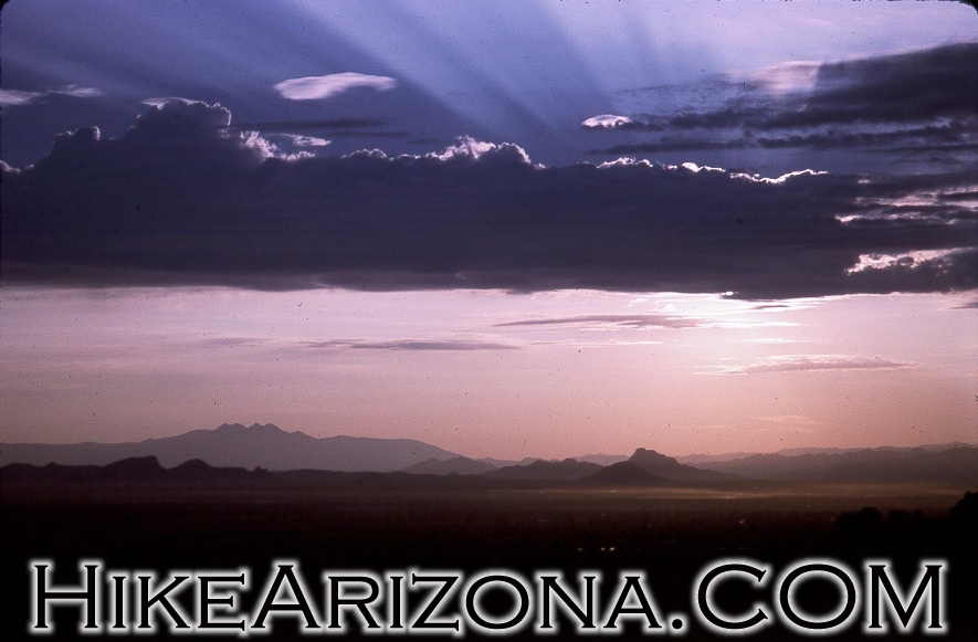
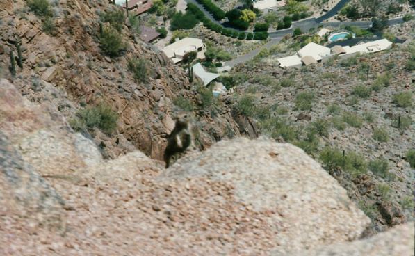
Next comes a peaceful valley with a moderate incline. This section contains loose gravel, called the "Ball Bearings" by many hikers. Although I have never brought a thermometer up here, this always seems to be the hottest place on earth. A lucky few might catch a deep blue skyline here during sunset. A few short zig-zags around the terrain brings you to the never-ending ascent. The trail scrambles in areas of boulder-lined gullies. There will most likely be other hikers to follow, so there's no need to worry about getting lost. Once you have reached the summit, take time to look around. From the summit, you can see several mountains and mountain ranges. The north-northeast area has a spectacular sheer drop you can look straight down.
Beware, this trail is very addictive. I hiked Camelback nearly every day in 1997-98. Sometimes up to three times consecutive. My best time up and down was 46:11, which seemed fast to me. Then again, I know others blow that time away. This hike is most enjoyable with a time of around 70 minutes. I have taken numerous first-timers on this hike, and they average just under two hours round trip. Keep in mind the Echo Canyon parking area closes early.
Spring of 1997 the Cholla Trail on the east end of Camelback reopened. This is a great alternative when the Echo Canyon parking lot is full. This trail approaches the summit from the opposite side of the mountain. The trail itself is rather different and offers great views along the ridgeline.
WARNING! Hiking and outdoor related sports can be dangerous. Be responsible and prepare for the trip. Study the area you are entering and plan accordingly. Dress for the current and unexpected weather changes. Take plenty of water. Never go alone. Make an itinerary with your plan(s), route(s), destination(s) and expected return time. Give your itinerary to trusted family and/or friends.
Permit $$
None
Directions
Road
Paved - Car Okay
To Echo Canyon Trailhead In Phoenix follow 44th St. North. 44th St. turns into McDonald. Follow McDonald to first Right past Tatum, which is Echo Canyon Place. Turn right, go up the hill and good luck finding a parking space in the tiny lot. On Spring and Fall weekends your best choice is bicycling to the trailhead. Otherwise, be prepared to drive in circles up to a half hour for a parking slot as waiting is not allowed.
From PHX (I-10 & AZ-51) 10.4 mi - about 18 mins From TUC (Jct 1-10 & Grant) 112 mi - about 1 hour 44 mins From FLG (Jct I-17 & I-40) 144 mi - about 2 hours 12 mins
 Route Editor

 Hiking jewel of the desert, Camelback is wedged between the cities of the Valley. This conveniently located hike is one of my favorites. Enjoy your first few trips on the mountain. As soon you may turn into one of the numerous speed hikers that blaze this difficult trail day after day.
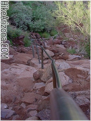


