| Guide | ♦ | 3 Triplogs | 0 Topics |
details | drive | no permit | forecast | route |
stats |
photos | triplogs | topics | location |
| 7 | 3 | 0 |
A Fool's Way to East End Peak by clayncallaway  Notice NoticeOff-trail activities, possibly including the 0.3 mi use trail to the peak 4057, are not permitted in the McDowell Sonoran Preserve. You might get cited by a Regulatory Authority or scolded by a steward. Use proper judgment. Obey the official area closed signage. You can always do the Lookout loop instead. Overview Located in the McDowell Sonoran Preserve (MSP), Gateway Trailhead to East End Peak Loop gives hikers a chance to approach Tom's Thumb from a different direction, enjoy large sections of trail unencumbered by throngs of people, and bag the highest peak in the MSP.
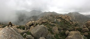
Hike This hike begins at the Gateway Access Area building and takes you across an expensive-looking, essential bridge (sorry for the sarcasm). Shortly after the bridge, you will have the option to go left, right, or straight. Proceed left onto the Gateway Loop Trail until you reach WP1. At this waypoint, continue, and the trail turns into Windgate Pass Trail. Follow this trail until a well-marked intersection (TT17) that denotes the next jump onto the Tom's Thumb Trail. This trail section will snake back and forth with short previews of Tom's Thumb looming above until a team of switchbacks brings the rock formation within full view. Continue following Tom's Thumb Trail down past the intersection of Tom's Thumb Trail and East End Trail. Just past this intersection and just before the Tom's Thumb Trail starts gaining in elevation is East End Peak's turn off. The turn off for East End Peak should open up on your right to a fairly obvious use trail accompanied by an occasional cairn leading up to the saddle to the left of East End Peak. It will be an adjustment on your eyes to transition from the well-marked trails of the MSP to a small use trail, but once adjusted, it is quite simple to follow. If you find yourself bushwhacking, you are doing something wrong. The goal here should be to get to the Saddle located North of the Peak and then turn to the South to bag East End Peak itself. More detailed descriptions of this section can be found in other triplogs that include East End Peak. Once on top of East End Peak, the gated solar panels will be in plain view. Look for a small summit log wedged between two rocks that are the actual highest point. An optional excursion to the West once on top of the peak will put you on top of a section of large boulders that provides incredible views of the MSP and allows you to snoop on all the folks making the busy trek to Tom's Thumb. After you have enjoyed the views, carefully make your way back down and turn left to head down East End Trail at the intersection. East End Trail will end at a well-marked T, and a right turn will put you back on Windgate Pass Trail. Follow this trail back the way you came. Gate Policy: If a gate is closed upon arrival, leave it closed after you go through. If it is open, leave it open. Leaving a closed gate open may put cattle in danger. Closing an open gate may cut them off from water. Please be respectful, leave gates as found. The exception is signage on the gate directing you otherwise. Check out the Official Route and Triplogs. Leave No Trace and +Add a Triplog after your hike to support this local community. | |||||||||||||||||||||||||||||||||||||||||||||||||||||||||||||||||||||||||
 Route Editor


