| Guide | ♦ | 19 Triplogs | 0 Topics |
details | drive | no permit | forecast | route |
stats |
photos | triplogs | topics | location |
| 0 | 19 | 0 |
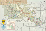
Birds and Cats coexisting by mt98dew  Overview OverviewTuscon Mountain Park is Tuscon's version of South Mountain, with more than 40 trails accessible from 11 different TH. The Rock Wren Trail is most easily accessed from the Richard Gesner Starr Pass TH. There is enough parking for 30 cars, but that being said, it can still fill up fast. There is no water or restrooms at the TH, so come prepared. There is an informative map of the trail system and a little background information on Richard Gesner for whom the trail is named. The Rock Wren Trail is primarily a single-track-trail composed of hard, compact soil and is very rocky for most of its length. Except for the mining road, the rocks are embedded, and though they add character to the trail, they will force you to keep your eyes on the trail. The views, though nice, are not overwhelming. You get some peeks of Tuscon to the east (might be nice at night with the city lights in the distance), but the peaks of Big Cat and Little Cat get most of the attention during the day. The vegetation is a healthy variety of your typical Sonoran desert fare: Saguaro, cholla, Staghorn Cholla, Ocotillo, Bursera, and stunted Paloverde dominate. The elevation is pretty constant, staying within 100-feet of the high and low point.
The Rock Wren Trail starts out heading south, gaining a little elevation as it wraps around some inner slopes. Initially, it plays tag with a defunct mining road alternating between a single track and a 10 ft wide rocky swath. You can still see signs of bygone mining days in the tailings and the hillside cuts. However, evidence of the mining and the wide path is soon left behind as Rock Wren becomes a pleasant single-track trail. At 0.5-miles, it junctures with the "new and improved" Starr Pass Trail. This juncture is signed with a map showing the surrounding trails. From here, the trail continues west, where it will gain a little more elevation as it switchbacks along the side of the hill. The trail never reaches the top of the hill, but it offers nice, but limited views of a basin enclosed by mountains (Big Cat, Little Cat) and hills. At about 1-mile, the trail has circumvented the hill offering lovely views of the mountains and basin to the south and west, as well as the TH and the Starr Resort to the north. The Rock Wren then makes a very gradual descent as it follows a slope to the west. At 1.5-miles, the trail intersects with the Yetman Trail. Again the trails are signed, and a map is provided. The Rock Wren continues to the west and angles a little to the south as it goes in-and-out along hill slopes. This is a pleasant section of the trail as it becomes more enclosed, giving a more intimate, isolated feeling. The trail elevation holds steady with only slight variation and mingles well with the terrain. The trail ends in a wash, connecting again with the Yetman Trail. At this point, you have several options. Returning the way you came for a 5-mile in and out. Making a loop with an assortment of trail connections or doing a shuttle with one of the other trailheads. Maps are provided at all trail junctures (that I have encountered) so deciding as you hike is a viable option. Check out the Official Route and Triplogs. Leave No Trace and +Add a Triplog after your hike to support this local community. One-Way Notice This hike is listed as One-Way. When hiking several trails on a single "hike", log it with a generic name that describes the hike. Then link the trails traveled, check out the example. | |||||||||||||||||||||||||||||||||||||||||||||||||||||||||||||||||||||||||||||||||||
 Route Editor


