Route Editor

| Guide | ♦ | 1 Triplog | 0 Topics |
details | drive | permit | forecast | route |
stats |
photos | triplog | topics | location |
| 19 | 1 | 0 |
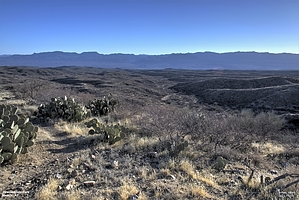
Cherry - Power - Windmill - AZT - Power Loop by Yoder   Overview OverviewThis is a combination of multiple trails in the Oracle State Park. The landscape here is rolling hills and is probably best known for its birding. Most birds seemed to be centered around the Windmill area (at least when I hiked this), probably due to water at the windmill. Hike Trails are very well marked and easy to follow
From the trailhead, take the Cherry Valley Wash east to the intersection of Cherry Valley Wash Trail and the Power Line Trail. Power Line Trail (0.6 miles) Turning South take the Power Line Trail to the intersection of Power Line Trail, Arizona Trail, and Windmill Loop trail. Windmill Loop Trail (3.0 miles) Head East on the Windmill Loop Trail for 1.9 miles. This climbs up and follows a ridgeline and then drops down to a wash before turning back South-East following a wash for just about 1 mile before reaching the Windmill. This section of the hike is probably where you will see the most birds. We spotted a Great Horned Owl, Mexican Jay, Red-tailed Hawk, Northern Cardinal, House Finch, and Black-throated Sparrow all within about 0.25 miles of the Windmill. Shortly after the Windmill, there is an intersection of the Powerline Trail (going north) with the Arizona Trail (continuing East). Continue East on the Arizona Trail. Optionally, you can head North on the PowerLine trail if you want to cut this hike short. Arizona Trail (2.5 miles) Follow the Arizona Trail East for 1.1 miles until it turns back west for another 0.5 miles to the intersection of the Power Line Trail, Arizona Trail. Head North, continuing on the Arizona Trail for another 0.8 miles until you reach the intersection of the Arizona Trail and the Cherry Valley Wash trail. The Arizona trail continues North under Highway 77. We will head East on the Cherry Valley Wash Trail for another 0.3 miles to the Cherry Valley Wash and the Powerline Trail intersection. Powerline Trail (1.1 miles) The Powerline trail has several hills it transverses as it follows the powerline back to the trailhead. Check out the Official Route and Triplog. Leave No Trace and +Add a Triplog after your birding observation to support this local community. | ||||||||||||||||||||||||||||||||||||||||||||||||||||||||||||||||||||||||||||||||||||||||||||