| Guide | ♦ | 5 Triplogs | 0 Topics |
details | drive | no permit | forecast | route |
stats |
photos | triplogs | topics | location |
| 18 | 5 | 0 |
Accessible trail to all by thirstylizard  Overview OverviewCamino Campana is a barrier-free trail accessed from the Fraesfield Trailhead, in the north Scottsdale region of the McDowell Sonoran Preserve. Dedicated in 2021, this "nature" trail provides an easy path into the beauty of Sonoran Desert upland with signage dispersed along the route describing related habitat--including geology, flora, and fauna. No potable water at the trailhead, yet restrooms are available. The trail offers little shade, so mindfulness as to temperature is advised. There are no fees and the trail is accessible year-round from sunrise to sunset. The McDowell Sonoran Preserve is NOT open for night hiking.
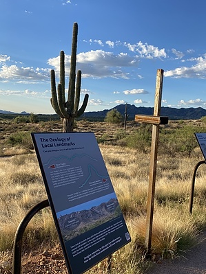
The trail is named for Sam Campana, former Scottsdale mayor and advocate for the outdoors, art and accessibility. Hike The signage and descriptions are thoughtful and elegant, describing not only the features of the desert but also the history of the area including the Rio Fire impacts, ranching, and military history. The artwork on the trail is worth the visit alone. Artists from Scottsdale's "Cattle Track Arts Complex" created the art for the descriptive signage. The signage is thoughtful and elegant with QR codes providing multilingual capability. You will not find individual plants labeled, which also keeps the visual clutter to a minimum. Views of other hiking areas in the preserve including Granite Mountain, Cholla Mountain and Tom's Thumb are visible from the trail as are other Arizona icons including Four Peaks and the Superstition ranges. There is a "Postcard from Arizona" photo station included in the loop. Loop If the group wants more steps added to the day, a simple loop of Black Hill Trail, Dixileta Trail, Whiskey Bottle Trail loop should fulfill that requirement. 48-second Video Check out the Official Route and Triplogs. Leave No Trace and +Add a Triplog after your hike to support this local community. One-Way Notice This hike is listed as One-Way. When hiking several trails on a single "hike", log it with a generic name that describes the hike. Then link the trails traveled, check out the example. | ||||||||||||||||||||||||||||||||||||||||||||||||||||||||||||||||||||||||||||
 Route Editor


