Route Editor

| Guide | ♦ | 1 Triplog | 1 Topic |
details | drive | permit | forecast | 🔥 route |
stats |
photos | triplog | topic | location |
| 70 | 1 | 1 |
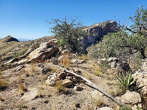
Don't expect to find love here... by Mike_W  Overview OverviewValentine peak is a steep rocky peak on the east side of Pima Canyon and about 2/3 of a mile northwest of Finger Rock. Getting there involves hiking more than 4 miles up the fairly well-maintained Pima Canyon Trail #62, and doing a bushwhack from there up a steep rocky incline to a high saddle and another 100 feet of semi-technical rock climbing to the rocky peak. Hike Start at the Pima Canyon Trailhead and head up the canyon. The first 2 miles of trail are fairly well-maintained and easy to follow. Once you get past 2 miles, the canyon trail gets a little harder to follow and becomes a bit brushier. The next 2 miles of trail are steeper than the first 2 miles. After hiking a total of about 3 miles you will cross into the canyon from the west. If you look up the canyon you'll see an old dam. Look for some cairns across the canyon on the east side which is where the trail resumes.
At the top, I found 2 glass jars. The tops were rusted and one of the jars seemed to be jammed shut. I was able to finally open it, hoping the glass wouldn't shatter and it did not, luckily. I expected only a small number of names on the registry but saw many, some as old as 1990, I believe, but no names in the last 3.5 years. On the registry, someone mentioned a "corkscrew route", but I couldn't find any routes posted for this hike, so I was going at it completely blind. There also were very few cairns along the way. On the way down, I started down the same way as I hiked up, but changed direction about 1/3 of the way down, hiking further northeast, and then I found a gentler route down. I continued northeast and eventually ended up heading into a side canyon. Once I got lower down into this canyon it got a bit technical. There were some 5 to 6 feet drops but I just took my time and made it down safely. There may have been better ways to go. Once at the gentler part of the canyon, I hiked northwest down this smaller canyon to the main Pima Canyon. When getting close to the main extension of Pima Canyon, look for the trail on the southeast side of Pima Canyon. Take this trail all the way out to the trailhead. If you can't find this trail, you can follow Pima Canyon for roughly 1/3 of a mile down and you will eventually see some cairns where you can pick up a better section of the Pima Canyon Trail. Take this trail roughly 4 miles back to the trailhead where you started. Warning If you happen to hike this trail in October, as I did, watch out for rattlesnakes. October and April seem to be the months where I've seen more rattlesnakes out and about. The day I hiked to this peak, I found a 3-foot rattlesnake on the Pima Canyon Trail about 3.5 to 4 miles in. It did not rattle when I was only 6 feet away and luckily I saw it. It did finally rattle after I stomped my feet. The climbing section near the top is semi-technical and not for everyone. Be prepared if you attempt to go to the top. Coming down may be slightly more challenging than going up. Check out the Official Route and Triplog. Note This is a more difficult hike. It would be unwise to attempt this without prior experience hiking. Leave No Trace and +Add a Triplog after your hike to support this local community. | ||||||||||||||||||||||||||||||||||||||||||||||||||||||||||||||||||||||||||||||||||||||||||||||||||||||