Route Editor

| Guide | ♦ | 1 Triplog | 0 Topics |
details | drive | permit | forecast | route |
stats |
photos | triplog | topics | location |
| 18 | 1 | 0 |
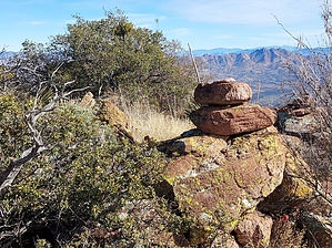
The best views in southern Arizona! by DixieFlyer  Overview OverviewThis hike is to the Tumacacori Mountains highpoint (elevation of 5,736 feet and prominence of 1,416 feet), in Santa Cruz County in southern Arizona. The highpoint is not named, but it is marked "5736" on topographic maps. History The Tumacacori Mountains are named for a nearby Spanish mission called San Cayetano de Tumacácori which was established by Jesuit Father Francisco Kino in 1691. By the late 1800s, the mission had fallen into a state of disrepair. To preserve the mission, the mission and its grounds were set aside as the Tumacácori National Monument in 1908; today it is known as the Tumacácori National Historical Park. Further details on the history of the mission can be found on the park service website.
From the trailhead, begin hiking in a southwesterly direction along the road, which is FR 4145. The road is in good condition for about 3/4 mile, after which point it begins to deteriorate. It eventually becomes more like a jeep road and then like an ATV road. After a couple of miles or so the road becomes undrivable, and turns into more of an unmaintained hiking trail. After about 2.6 miles the road/trail ceases to exist. At this point, you will have gained about 1,300 feet in elevation, with most of that coming in the last mile. This is a good point to stop and take a short break because you now have to make an off-trail ascent to the west up to a ridgeline. This is a brushy ascent that gains 500-600 feet. The brush is not all that thick, so you aren't going through a wall of catclaw or manzanita. Some of the brush has stickers on them, but it is spaced far enough apart that you can dodge the worst of them. The ascent is steep and not particularly pleasant, but if you endeavor to persevere you can make it up to the ridgeline. Once on the ridgeline, the heavy lifting is over. You will be about 1.9 miles from the summit, but only have a net elevation gain of 450 feet over that stretch; however, there are some regain bumps along the way, so the gross elevation gain will be more. You will be heading north on the ridgeline to the summit. Initially, you will be hiking through some grass, but after about 0.2 miles (just to the east of Peak 5675) you can pick up a good use-trail that goes along the ridgeline almost all the way to the destination. Following the use-trail eliminates most of the bushwhacking and makes for an enjoyable hike, especially with the great views that are present along the way. After about a mile of hiking along the ridgeline, the use-trail will take you within about 10-15 of the Tumac Benchmark, which is at an elevation that is only about 100 feet lower than the Tumacacori Mountains highpoint. It is worthwhile to stop and check out the benchmark disk and take a short break to admire the awesome views of the surrounding mountains. From the Tumac Benchmark, it is about 0.75 miles to the destination of the range highpoint. Continue along the use trail until you are about 0.25 miles below the summit, at which point you'll have to leave the use trail to make the final ascent to the summit. The ascent is a bit grassy and brushy, but it isn't too bad and the ascent is not too steep. At the summit, you can enjoy perhaps the nicest views in southern Arizona. A geography teacher would have a field day at the summit! Return the way that you came back to the trailhead. Note that some people have chosen to take a more direct route back to the trailhead by bushwhacking their way down instead of going back along the ridgeline. You may wish to review triplogs to see the experience of others who have chosen to do this. You might also wish to review triplogs for the hike to nearby Tumacacori Peak. Camping There are no developed campsites in this area; however, disbursed camping is permitted. There is a good campsite at the trailhead. Check out the Official Route and Triplog. Note This is a moderately difficult hike. Leave No Trace and +Add a Triplog after your hike to support this local community. | ||||||||||||||||||||||||||||||||||||||||||||||||||||||||||||||||||||||||||||||||||||||||||||