Route Editor

| Guide | ♦ | 1 Triplog | 0 Topics |
details | drive | permit | forecast | 🔥 route |
stats |
photos | triplog | topics | location |
| 6 | 1 | 0 |
It’s a Swamp Thing by pseudalpine  Prologue ProloguePeradventure you’ve explored Hades Lake and/or the East Rim View Sinkhole of the Colorado Plateau. Maybe one has surveyed Greenland Lake and/or the Marble Sinkhole. Perhaps you’ve visited Jacob Lake and/or Jolly Sink. Most of these mentioned geological features are part of the Kaibab Plateau, but they share a natural commonality, which is superficial Permian Karstic[1] limestone. Essentially sedimentologic elemental creatures per see?! 1) an irregular limestone region with sinkholes, underground streams, and caverns. Overview At the south center of the North Rim near Swamp Point, there is an area of convoluted depressions and crests located between the prominent Swamp and Two Springs Ridges. Castle and Grassy Canyons are tucked between these ridges and Forest Road 268 mainly tracks east/west on a central unnamed ridge through this highland landscape. FR 268 is the main feeder road for FR 268B, which is the primary approach to the Swamp Ridge and Kanabownits Roads within GCNP.
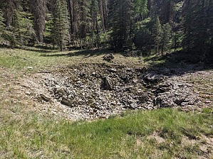
Comparable to Walla Valley, this loop hike is literally another forest bath that meanders mostly amongst ponderosa pine and some of the other forest biomes that are interspersed throughout the area. Much of the trek is more open than Walla Valley, but this is still quintessential North Rim off-trail hiking, so expect to encounter a few Locust thickets, fern beds, and numerous deadfalls to go through, over and/or workaround. The loop can be completed by starting on Swamp Ridge Road also, since it tracks that forest road for about a mile anyway. I hiked it CCW, deciding to visit the lakes first and sinks second. Castle Lake is aptly named, likely because of the northern limestone hoodoos there. I inadvertently missed Sink 7631, but it could easily be integrated into the loop as well. In the past, I’ve referred to Sink 7660 as Swamp Sink, which I’ve hiked to twice now, but I’m not sure if it has an official name. The second sink (7897) on the eastern side of the loop is more of an elongated meadow, like the ones encountered along SR 67 on the drive into the North Rim. I chose to exclude Sink 7780 from the loop because it’s adjacent to FR 268 and therefore could effortlessly be accessed by vehicle. Synopsis Another gratifying alternative to sweltering inner canyon hiking that loops through some splendid, shape-shifted landscapes. It’ll be interesting to see if others originate their own incarnations. I’ve often wondered where the underground passages below these sinks resurge. I’m guessing these mostly drain into the Tapeats Amphitheater tributaries, but feeding Shinumo Creek is also a distinct possibility. Check out the Official Route and Triplog. Leave No Trace and +Add a Triplog after your hike to support this local community. | ||||||||||||||||||||||||||||||||||||||||||||||||||||||||||||||||||||||||||||||||||||||||||||||||||||||||||||||||||||