 Route Editor

| Guide | ♦ | 29 Triplogs | 2 Topics |
details | drive | no permit | forecast | 🔥 route |
stats |
photos | triplogs | topics | location |
| 324 | 29 | 2 |
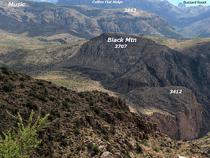
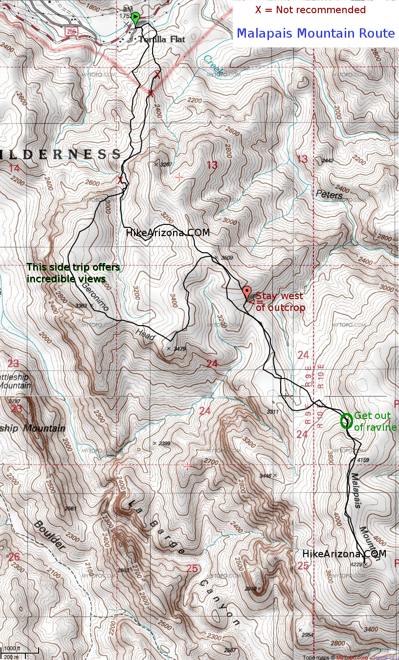
Waves of Desert by joebartels  Overview OverviewOne hundred percent off-trail mean-desert hike to some of the most beautiful views of the Superstition Wilderness. Hike This is an extension of the Geronimo Head hike. Follow that hike to Peak 3509.
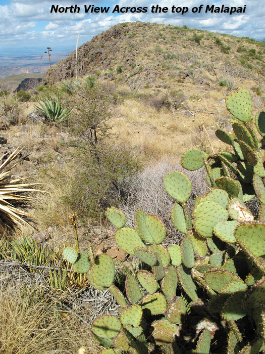
We chose to ascend Malapais via a wide ravine on its northwest face. In doing so, we stayed on the west side. About a third of the way up, we climbed out of the ravine. There were a couple of not-very-helpful random cairns. The ascent is steep and loaded with cacti but not as steep as the initial ascent from the parking lot. It may be possible to ascend the ridge on the west side of the ravine. However, there is a band of cliffs two-thirds of the way up. It "appeared" there was a break in the cliffs. The ravine looked like a safer approach as we didn't want to waste resources. On top of the north Peak 4159, you are rewarded with views and a sense this whole thing has merit. Continue over a half-mile to the south Peak 4229. Like other mountain tops in this area, it's loaded with a maze of desert vegetation. On the south peak, you are rewarded with far-reaching views in all directions: (West) Superstition Ridgeline, (North) Four Peaks, (East) Tortilla Mountain, (South) Miner's Needle if you squint. Tortilla Peak would offer more views to the east. Malapais has views down into the labyrinth of LaBarge and Boulder Canyons, making it among the premier viewing spots in Arizona, in my opinion. Full overhead views of Battleship and Black Mountain too(rarely seen elsewhere). Return The most prudent return is to backtrack. If you are familiar with Peter's Canyon, you can drop down to various points. One time I dropped down to Tortilla Creek. That proved much easier than the bullish entrance route. You "might" be able to drop down off to the south. It looks exceptionally rough. The best break in the cliff band appears to be a good mile away at Squaw Canyon as labeled on topo. However, that would likely have to be a shuttle option as it's unlikely you'd return to Tortilla Flats. Carlson did a loop with the entire length of Peter's Canyon, better eat your Wheaties for that one! Warning Do not attempt this hike in temps over 80 degrees. Not only would it not be enjoyable, but it could also be dangerous. Be Prepared Pants are a must for this hike. Preferably tough pants as you may be sliding on rock surfaces and scree slopes depending on your route. One hiking pole helps on the loose slopes, two would be cumbersome. Some may prefer gloves. Tweezers are a good idea as your chances for cacti encounters are rather high. For 80-degree weather, I recommend 5 quarts+ per hiker. Snacking food to sandwiches is recommended to keep your energy level up on this strenuous hike. Water Sources Virtually none, bring plenty. We saw several 10-20 gallon pools in Upper Geronimo Ravine in October, but you'd have to be mighty thirsty even to drink it filtered. I have witnessed the creek barely flowing Dec-Feb though it's less likely you'll need it in those lower-temp months.
Check out the Official Route and Triplogs. Note This is a difficult hike. Arrive fit and prepared or this could get ugly. Leave No Trace and +Add a Triplog after your hike to support this local community. | |||||||||||||||||||||||||||||||||||||||||||||||||||||||||||||||||||||||||||||||||||||||||||||||||||||||||||||||||||||||||||||||||||||||||||||||||||||||||||||||||||||||||||||||||||||||||||||||||||||


