Route Editor

| Guide | ♦ | 5 Triplogs | 0 Topics |
details | drive | no permit | forecast | route |
stats |
photos | triplogs | topics | location |
| 14 | 5 | 0 |
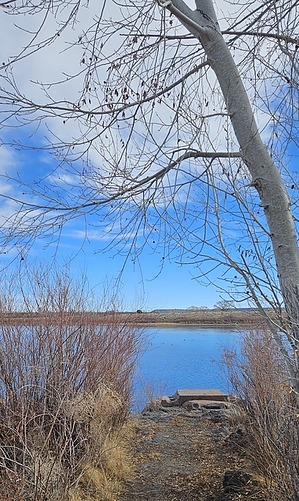
A vista to pond- er by azbackpackr  This is a short loop hike up a slope next to Becker Lake, giving a great view of Round Valley and the mountains beyond, including Flat Top and Escudilla. It's a good place to walk your dog if you are staying nearby. This is a short loop hike up a slope next to Becker Lake, giving a great view of Round Valley and the mountains beyond, including Flat Top and Escudilla. It's a good place to walk your dog if you are staying nearby.Becker Lake Wildlife Area is managed by the Arizona Game and Fish Department. You can fish (catch and release only), kayak, watch birds, and wildlife. There are eagles and osprey in summer. If kayaking, you can often see beavers and muskrats. Waterfowl will include the ubiquitous coots, plus a variety of ducks. You may luck out and see a white-faced ibis or a great blue heron.
Becker Lake Wildlife Area is managed by the Arizona Game and Fish Department. You can fish (catch and release only), AZG&FD page about the area. The photo at the top of that page is NOT Becker Lake. The lake is fed via a ditch from the Little Colorado River. Check out the Official Route and Triplogs. Leave No Trace and +Add a Triplog after your hike to support this local community. | |||||||||||||||||||||||||||||||||||||||||||||||||||||||||||||||||||||||||||||||||||||