Overview
This passage begins on Gardner Canyon Road, just west of Gardner Canyon Trailhead. The route passes the trailhead, heads over to Cave Creek, descends into Fish Canyon, and then heads northwest to Kentucky Camp. It goes through the camp area, follows the Kentucky Camp Road, and then works its way up Sucker Gulch. It goes past Granite Mountain, through Ophir Gulch, and then turns on to FR 165. It descends to Enzenberg Canyon, climbs up to a road, crosses California Gulch, and then crosses FR 62. After a couple of small ridges, the trail reaches the upper end of Oak Tree Canyon. It follows this canyon down to a point about 3/4 mile from Highway 83.
When hiking several trails on a single "hike", log it with a generic name that describes the hike. Then link the trails traveled, check out the example.
WARNING! Hiking and outdoor related sports can be dangerous. Be responsible and prepare for the trip. Study the area you are entering and plan accordingly. Dress for the current and unexpected weather changes. Take plenty of water. Never go alone. Make an itinerary with your plan(s), route(s), destination(s) and expected return time. Give your itinerary to trusted family and/or friends.
Permit $$
no fees or permits reported
if incorrect tell us about it
Coronado Forest MVUMs are rarely necessary to review unless mentioned in the description or directions Coronado Motor Vehicle Use Maps (MVUMs)
Directions
Road
To hike
page created by joebartels on Jan 09 2010 12:35 am
 Route Editor

 Overview
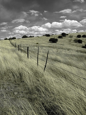


