Overview: From the American Flag Trailhead the route proceeds in a northerly direction across National Forest Land and State Trust Land, crossing Webb Road and continuing to Oracle State Park. The trail within the park is marked with 4x4 wooden posts with the Arizona Trail 'brand'. At Kannally Wash the route briefly follows a powerline road and then continues as a trail passing through several trail junctions. The trail heads west and then turns north and reaches Highway 77. After going under the highway the route follows the Tiger Mine Road for the last 1.5 miles to the Tiger Mine Road Trailhead.
When hiking several trails on a single "hike", log it with a generic name that describes the hike. Then link the trails traveled, check out the example.
WARNING! Hiking and outdoor related sports can be dangerous. Be responsible and prepare for the trip. Study the area you are entering and plan accordingly. Dress for the current and unexpected weather changes. Take plenty of water. Never go alone. Make an itinerary with your plan(s), route(s), destination(s) and expected return time. Give your itinerary to trusted family and/or friends.
Permit $$
no fees or permits reported
if incorrect tell us about it
Coronado Forest MVUMs are rarely necessary to review unless mentioned in the description or directions Coronado Motor Vehicle Use Maps (MVUMs)
Directions
Road
FR / Dirt Road / Gravel - Car Okay
To hike
page created by joebartels on Jan 09 2010 12:41 am
 Route Editor


 Overview: From the American Flag Trailhead the route proceeds in a northerly direction across National Forest Land and State Trust Land, crossing Webb Road and continuing to Oracle State Park. The trail within the park is marked with 4x4 wooden posts with the Arizona Trail 'brand'. At Kannally Wash the route briefly follows a powerline road and then continues as a trail passing through several trail junctions. The trail heads west and then turns north and reaches Highway 77. After going under the highway the route follows the Tiger Mine Road for the last 1.5 miles to the Tiger Mine Road Trailhead.
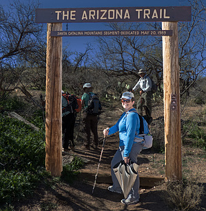


