 Route Editor

| Guide | ♦ | 30 Triplogs | 1 Topic |
details | drive | permit | forecast | route |
stats |
photos | triplogs | topic | location |
| 364 | 30 | 1 |
Canyons are inherently risky. Flash floods occur without notice on sunny days. Technical skills & surrounding topography knowledge required yet does not eliminate risk.
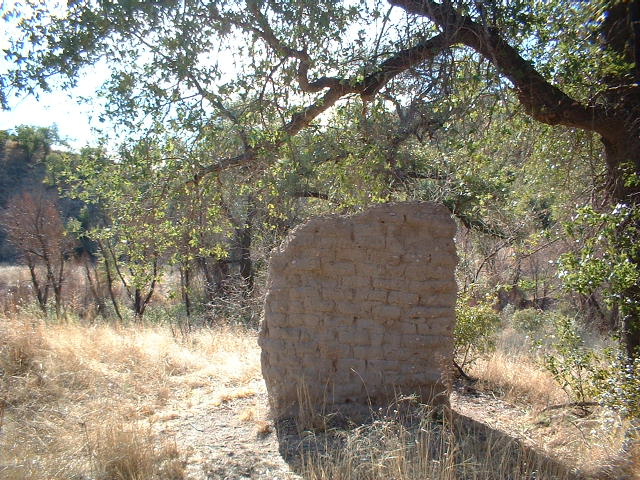
Fantastic by Lizard  When most Arizona hikers hear the words "Sycamore Canyon," a particular red rock canyon near Sedona usually comes to mind. Sycamore Canyon Trail #40 is in the Pajarita Wilderness on the border with Mexico. It's spectacular with a few unique attractions all its own. When most Arizona hikers hear the words "Sycamore Canyon," a particular red rock canyon near Sedona usually comes to mind. Sycamore Canyon Trail #40 is in the Pajarita Wilderness on the border with Mexico. It's spectacular with a few unique attractions all its own.From the trailhead, follow the trail (an old jeep road) across a small field and a wash. Very quickly, you will come to an FS interpretive sign telling you about the Hank and Yank Ruins. On this site were the ranch of John (Yank) Bartlett and Henry (Hank) Hewitt, two trappers, and army scouts. In 1886 the ranch was attacked by Indians, who killed a neighbor and injured Hank. Yank's son Johnny made a daring escape and brought help from nearby Oro Blanco. All that remains is a crumbling adobe wall.
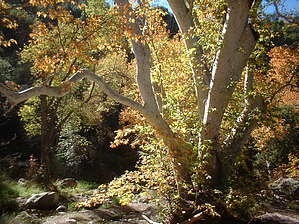
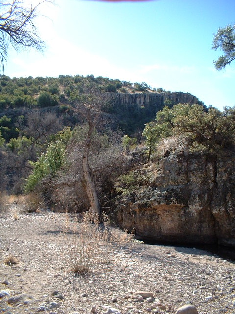
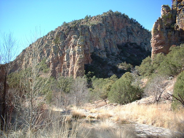
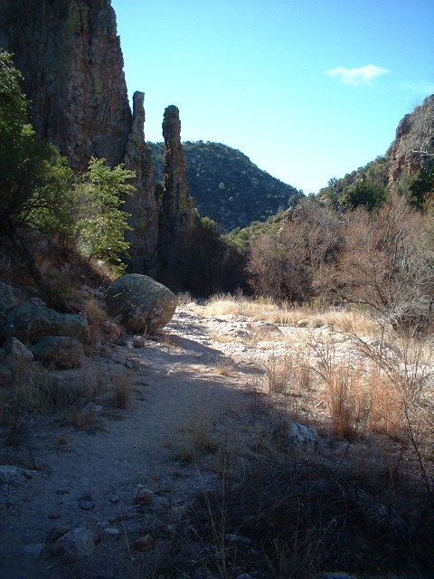
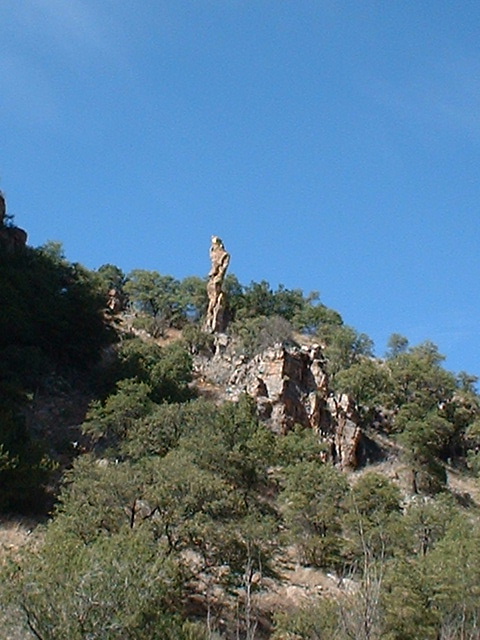
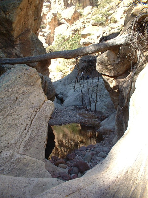
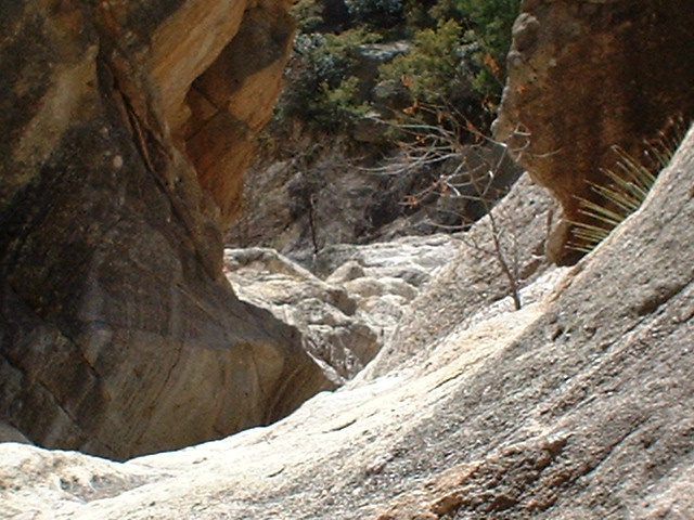
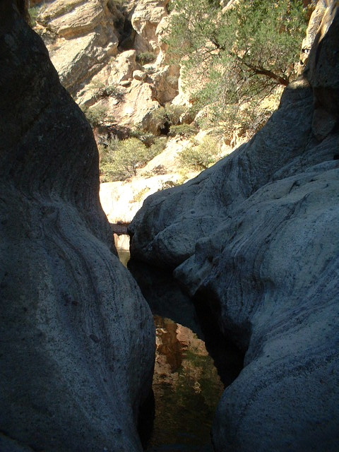
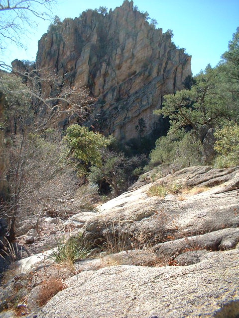
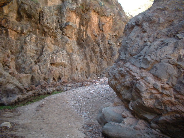
After about 1/2 mile, Sycamore Canyon begins to reveal its wonders. You will come into a large basin type area. A small waterfall trickles down into a pool filled with dozens of minnows. The craggy canyon walls reveal many pinnacles and hoodoos. The trail scrambles on top of a small outcrop with a small campsite and a nice view. Just past this outcrop comes the first slot of the canyon. A fallen tree welcomes you in. To get past this part, you must be willing to do a small bit of climbing/scrambling on the right canyon wall. This canyon does place a premium on agility. However, hikers who are not so sure-footed can avoid all this by simply wading in the knee-deep creek. The canyon stays rather narrow for awhile past this point, so rock-hopping is necessary, but the scenery more than makes up for it. After a few more twists and turns, the canyon opens up again, and the walking becomes easy along gravel stream beds. You will encounter your first of this canyon's white-barked namesake. This segment is protected by wilderness status and designated as the Gooding Natural Research Area. Sycamore Canyon is the habitat for rare and unusual plants and fish too numerous to list. So, please, tread lightly! At 2.7 miles, the canyon enters another narrow bottleneck. This one is easier to navigate than the first. After scrambling through rocks, the canyon opens up yet again. This is a decent turnaround point, or, if you want, you can continue down the canyon to the Mexican border. The creek is flowing through small foothills at the border, and a barbed-wire fence impedes further progress. Turn around and go back the way you came.
Coronado FS Details Most of those who come to visit in this area are drawn here by the unique environment of Sycamore Canyon. Home of one of the few perennial streams in extreme southern Arizona, it supports such a diverse plant and animal community that part of it has been designated the Goodding Research Natural Area. Over 625 species of plants have been identified here, many of which are rare and/or endangered. Sycamore Canyon's animal life is extremely diverse as well, especially its birds. Over 130 species have been identified as frequent visitors here. Among those are colorful vermilion flycatchers and various warblers, raptors and herons. The trail starts out at the Hank and Yank Ruins. The remnants of an old adobe wall are all that's left of a Civil War-era homestead that was pioneered in this canyon by Hank Hewitt and Yank Bartlett. The trail itself exists only in a few places along the floor of Sycamore Canyon. More generally it just follows the stream, crossing it and recrossing it via stepping stones and gravel bars. As the canyon meanders toward Mexico, pinnacles and sheer rock cliffs that form the canyon walls occasionally crowd the stream so that a little fancy footwork is required. A number of pools in the inner reaches of the canyon usually hold water year-round. About 5 miles downstream of the trailhead, the canyon opens out and crosses a barbed wire fence that marks the Arizona/Mexico border. Here, you can either turn around and return the way you came or turn east and travel along a little-used pathway called the Border Trail. This foot and horse path was put here to provide access for maintenance of the international boundary fence. It leads over the grassy foothills of the Pajaritos to the end of the Summit Motorway (FR 39A), which may sound like a thoroughfare, but it's a 4-wheel drive road. Check out the Official Route and Triplogs. Leave No Trace and +Add a Triplog after your canyon trip to support this local community. | |||||||||||||||||||||||||||||||||||||||||||||||||||||||||||||||||||||||||||||||||||||||||||||||||||||||||


