 Route Editor

| Guide | ♦ | 25 Triplogs | 2 Topics |
details | drive | permit | forecast | 🔥 route |
stats |
photos | triplogs | topics | location |
| 57 | 25 | 2 |
high noon by PrestonSands   Note: Page data reflect #318 one-way segment. The description below is for an 8.5mi / 2,550 aeg / 5 hour round-trip hike. Note: Page data reflect #318 one-way segment. The description below is for an 8.5mi / 2,550 aeg / 5 hour round-trip hike.The Noon Creek Ridge Trail climbs Noon Creek Ridge on the eastern slope of Heliograph Peak, in Arizona's Pinaleno Mountains. Noon Creek Ridge was named for Noon Creek, which was the old midday rest stop for summer visitors headed to the cool forests of Mt. Graham. Two trailheads access this trail: the lower (main) trailhead, and the upper trailhead (which cuts about a mile off of the hike). Personally, I recommend starting at the upper trailhead as it bypasses the rather uneventful first mile and a half of the Noon Creek Ridge Trail. Total mileage listed here is for a round trip hike over the entire trail. Subtract 2 miles for a round trip hike if you start at the upper trailhead.
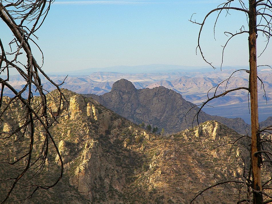
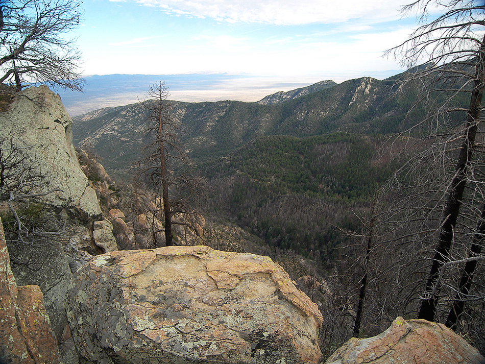
At 1.5 miles the Noon Creek Ridge Trail arrives at the junction with the shortcut trail coming up from the upper trailhead. The little shortcut trail drops 400 feet in a half mile to the unmarked trailhead. Continuing on from the junction, the trail turns north and soon arrives at the 6557 foot saddle. There are some spectacular views of the massive ridges to the north, including awesomely rugged Deadman Peak. When snow covers the barren rocky cliffs of Deadman Peak in winter, it looks like it belongs in the Colorado Rockies. From the saddle the trail turns west and finally begins to tackle the ridge in earnest. Now on the north side of the ridge, you will enter a blackened pine forest. As of this writing, dozens of fallen logs block the trail as it climbs a couple long switchbacks up to the 6800 foot level. Thousands of young silver oak trees have sprouted in this area. A few more switchbacks and the trail reaches another saddle on the crest of the ridge at 2.5 miles. Just beyond here the trail clings to a steep rock face on the north side of the ridge, where many spiny new mexican locust shrubs growing in the trail do their best to rip you apart. Far below you to the right Noon Creek can be heard splashing out of sight over the rocks. As the trail rounds a corner at the 7300 foot level, it enters into a nice patch of surviving pine-fir forest. A half mile walk through this forest on the nearly vertical mountain side brings you to yet another saddle, which has a small campsite. After one last short climb, the trail reaches the top of Noon Creek Ridge where some great views to the south open up among the granite boulders. The trail now leaves the ridge, turning south to contour along the 8000 foot level. After a third of a mile hike through the scorched remnants of giant trees, the Noon Creek Ridge Trail comes to an end at the Arcadia Trail. A right turn on the Arcadia Trail can take you to the top of 10,000 foot Heliograph Peak, while a left turn provides the opportunity to complete a loop using the Arcadia Trail and the Swift Trail to return to your starting point. Check out the Official Route and Triplogs. Leave No Trace and +Add a Triplog after your hike to support this local community. One-Way Notice This hike is listed as One-Way. When hiking several trails on a single "hike", log it with a generic name that describes the hike. Then link the trails traveled, check out the example. | |||||||||||||||||||||||||||||||||||||||||||||||||||||||||||||||||||||||||||||||||||||||||||||||||||||||


