History
Known initially as Interior Valley and was once noted for its continually flowing springs. A disastrous fire in 1876 destroyed its splendid stand of Engelmann spruce, with the probable result that the springs are now intermittent.
Overview
Inner Basin is probably one of the prettiest hikes in the Flagstaff Area. It starts in Locket Meadow and ends up in the Inner Basin. It feels like a 'Little Colorado.'
The Inner Basin is the middle of the crater of San Francisco Mtn, Arizona's only Stratovolcano. Surrounding you is Arizona's six highest points and four highest mountains. As you enter the Inner Basin, from right to left, you have Rees Peak (11,474 feet), Abineau Peak(11,878 feet), Humphreys Peak(12,633 feet), Agassiz Peak (12,356 feet), Fremont Peak (11,969 feet), and Doyle Peak (11,460 feet). Rees Peak and Abineau Peak are not real peaks, just named high points on Humphreys ridge. Inner Basin is the only place in Arizona that mountains higher than 11,000 feet surround you.
Old Trail
The trail you are on is an old forest service road. Only certain vehicles are allowed up this road. Horses and Bikes are allowed.
The hike in is a steady but easy climb the whole way. Thick forests surround you, covered in ferns and grass. Trees are a mix of fir and aspens. There is not one place you can see where you're going. There are no views until you reach the Inner Basin. If you hike when there is snowmelt, the spring is running, which adds to the beauty. In the fall, the aspens are changing colors, which make for a photographers paradise.
New Trail
The course of the trail changed somewhere around 2010 - 2012. The new alignment is the most beautiful hike through aspen in Arizona for 1.7 miles. Then you merge into the old route, which is a maintenance road. Even most die-hard "I won't hike a road" snobs will be taken away by the beautiful scenery. Around 3.95 mi, the road fades into a trail. The final 0.3-mile stretch is a steep set of switchbacks up to the Weatherford Trail.
Coconino FS Details The San Francisco Peaks are actually the remains of an extinct volcano. Millions of years ago this great mountain was shattered by an explosion similar to the one that devastated Washington's Mt. Saint Helens in 1980. Inside the now quiet caldera a lush alpine environment has blurred evidence of that cataclysmic event.
The trail into the heart of the ancient volcano begins in beautiful Lockett Meadow. From this island of emerald ringed with aspens and high peaks it follows a primitive road into the mountain's now quiet Inner Basin and then connects to the Weatherford trail. Here, extensive stands of aspens cover the steep slopes of the old caldera coloring them solid gold in early fall. In spring and summer, wildflowers add a sprinkling of blue, red and yellow. From the basin's rims, avalanche tracks streak down the talus slopes and remnants of old lava flows bear witness to the mountain's cataclysmic heritage.
Snow may remain here even into summer. Cross-country skiers continue to ski as late as June in some years. Hiking is the most popular way of visiting this beautiful and unique environment; however, and hikers begin coming to the basin before the snows have completely melted from the trail.
Animals you may see in this high country include porcupine and elk. Black bears have been known to stroll right through groups of picnickers without so much as a glance at their lunches. The hermit thrush sings his best here. The climb to this high mountain place, where spring comes late and fall arrives early, is moderate but steady, but the reward is worth every bit of the effort.
When hiking several trails on a single "hike", log it with a generic name that describes the hike. Then link the trails traveled, check out the example.
WARNING! Hiking and outdoor related sports can be dangerous. Be responsible and prepare for the trip. Study the area you are entering and plan accordingly. Dress for the current and unexpected weather changes. Take plenty of water. Never go alone. Make an itinerary with your plan(s), route(s), destination(s) and expected return time. Give your itinerary to trusted family and/or friends.
Permit $$
no fees or permits reported
if incorrect tell us about it
Directions
Road
FR / Dirt Road / Gravel - Car Okay
To Inner Basin Trailhead From Flagstaff take US 89 north to Sunset Crater Rd. Do not turn on Sunset Crater Rd. Turn left instead of Right. Turning left will take you on the forest service roads. There will be a sign on your left telling you different destinations and an arrow. Go straight until you reach a 'T'. Turn right (north). This road will turn west. Turn north when you come to a road with a sign that points to Locket Meadow. Follow this road all the way down, 6 miles I think into Locket Meadow. Once in Locket Meadow turn right and keep driving until you see a parking place for hikers. It is by the outhouse. Parking is on the left, the trail is on the right. A gate blocks the entrance for vehicles.
From PHX (I-10 & AZ-51) 173 mi - about 2 hours 59 mins From TUC (Jct 1-10 & Grant) 278 mi - about 4 hours 27 mins From FLG (Jct I-17 & I-40) 26.9 mi - about 52 mins
 Route Editor

 History
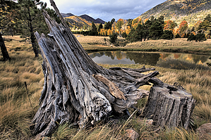


