Rough Eye Javelina Loop, AZ | HikeArizona
username
X
password
register
for free!
help
  🔥

Rough Eye Javelina Loop, AZ

Guide 39 Triplogs  0 Topics
  3.4 of 5 
Fav
Wish
4
details
drive
no permit
forecast
🔥
route  
stats
photos
triplogs
topics
location
583 39 0
Statistics
tap icons for details
Difficulty 2 of 5
Distance Round Trip 8.25 miles
Trailhead Elevation 2,180 feet
Elevation Gain 450 feet
Accumulated Gain 1,156 feet
Kokopelli Seeds 14.03
 Interest Off-Trail Hiking, Seasonal Waterfall & Seasonal Creek
 Dogs not allowed
feature photo
Photos Viewed All MineFollowing
Will recalculate on button tap!
14  2023-02-04
Golden Dome
trekkin_gecko
18  2023-02-04
Golden Dome
johnlp
10  2022-10-21 Yoder
14  2021-11-28
Javelina Willow Rough Anniversary Loop
trekkin_gecko
35  2021-11-28
Javelina Willow Rough Anniversary Loop
tibber
6  2021-02-07 rayhuston
8  2020-10-31 survivordude
34  2019-11-24
Goldfields Meander
mr_squishy
Page 1,  2,  3,  4
Author
author avatar Guides 16,881
Routes 17,283
Photos 24
Trips 1 map ( 6 miles )
Age 26 Male Gender
Location HAZ, TrailDEX
Associated Areas
list map done
Phoenix Region
Historical Weather
Trailhead Forecast
Radar Map
Expand Map
Preferred Nov, Dec, Jan, Feb
Sun  6:54am - 6:23pm
Official Route
 
7 Alternative
 
 Water
Historic Fire Perimetersacres
🔥 Gost 20055.4 mi*
🔥 2020 Superstition Fire9.6k
🔥 2005 Ghost5.4 mi*
🔥 View (All) - over Official Route 🔥
*perimeter length in miles


Overview
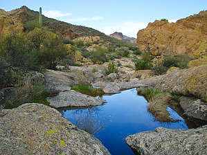
A moderate Goldfield loop hike that is about 80 percent bushwhack. This route takes you out the Rough-N-Ready Trail to the Packsaddle junction in the wash, then return via the high ground catwalk, the golden ridge that runs along the Rough-N-Ready 100 feet northeast of the wash back to the Quartz Crystal Arroyo Trail. The views from the ridge are superb. Continue to the Golden Eye Mine Trail and finally joining the Javelina Mine Trail and back to the trailhead. See the individual hike descriptions for further details.

Check out the Official Route and Triplogs.

Leave No Trace and +Add a Triplog after your hike to support this local community.

2018-07-14 HAZ_Hikebot
    WARNING! Hiking and outdoor related sports can be dangerous. Be responsible and prepare for the trip. Study the area you are entering and plan accordingly. Dress for the current and unexpected weather changes. Take plenty of water. Never go alone. Make an itinerary with your plan(s), route(s), destination(s) and expected return time. Give your itinerary to trusted family and/or friends.

     Permit $$
    None


     Directions
    or
    or
     Road
    FR / Dirt Road / Gravel - Car Okay

    To Javelina Mine (arbitrary/unofficial) Trailhead
    About 2 miles past the Lost Dutchman Park entrance.

    NW on the Apache Trail from AZ-88 & Idaho Road in Apache Junction. 6.8 miles to just short of highway marker 203. Just before the marker turn right into parking area. The trailhead is not marked but is a clear pull off area just before the 203 sign and has parking for several many cars or horse trailers.

    From PHX (I-10 & AZ-51) 42 min (41.5 miles)
    From TUC (Jct 1-10 & Grant) 1 h 53 min (112 miles)
    From FLG (Jct I-17 & I-40) 2 h 50 min (183 miles)
    (Trailhead is generic)
    page created by AZLOT69 on Feb 06 2010 8:09 pm
    helpcorrectionissue

    end of page marker