Route Editor

| Guide | ♦ | 122 Triplogs | 1 Topic |
details | drive | no permit | forecast | route |
stats |
photos | triplogs | topic | location |
| 582 | 122 | 1 |
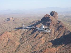
Short and STEEP by JoelHazelton   You have two options with Vulture Peak. The first option is a quick workout hike up to the saddle. This is a 0.8-mile 800-foot elevation gain. Your second option is to start from the back trailhead. This tacks on 1.4 miles each direction and a beautiful stroll in and out of washes up to the second trailhead at the base of the mountain. You have two options with Vulture Peak. The first option is a quick workout hike up to the saddle. This is a 0.8-mile 800-foot elevation gain. Your second option is to start from the back trailhead. This tacks on 1.4 miles each direction and a beautiful stroll in and out of washes up to the second trailhead at the base of the mountain.From the lower passenger car-accessible trailhead, the trail begins flat and wide. In a couple hundred yards you drop into an unnamed wash and then promptly climb back out. At this point, my sister and I started to feel our Filiberto lunch. It's not a good idea to eat greasy Mexican food before you hike. Anyway, from here you travel over a couple of hills and through the bottom of a wash before you hit the upper trailhead. The trail is extremely easy to follow as it is well marked with very large cairns the entire time at the bottom of the wash. Once you leave the wash, the road to the upper trailhead is visible and you reach the parking lot in about a minute. From the upper trailhead (only accessible with a 4wd vehicle) you will begin your ascent. Actually, you've already climbed 200 feet, but you can't really feel it. For some reason, the first stretch of trail from the upper trailhead was the most difficult part of the hike for me. It is not a very steep grade, but it is relentless, and the ground was very soft and muddy from the previous night's storm. It's not long before the real climb begins, though. Once the trail starts to go up, you gain elevation very quickly through a series of tight switchbacks that become steeper and tighter until you reach the saddle. I would say this is about a 700-foot climb in .6 miles. Since it was so wet this particular day, there were several spots of water trickling off of the boulders above the trail into small pools on the ground during the portion just below the saddle. At the saddle, you get great views of the back of the White Tanks to the east, and views of, well, I don't know to the west. It's a good view, though.
Check out the Official Route and Triplogs. Leave No Trace and +Add a Triplog after your hike to support this local community. | |||||||||||||||||||||||||||||||||||||||||||||||||||||||||||||||||||||||||||||||||||||