 Route Editor

| Guide | ♦ | 55 Triplogs | 7 Topics |
details | drive | permit | forecast | 🔥 route |
stats |
photos | triplogs | topics | location |
| 389 | 55 | 7 |
Only in Arizona by joebartels   Note NoteThe flume has been removed. The following description remains for historical viewing. Permit April 1st to Oct 1st, view permit info.
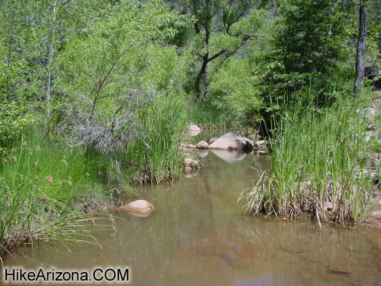
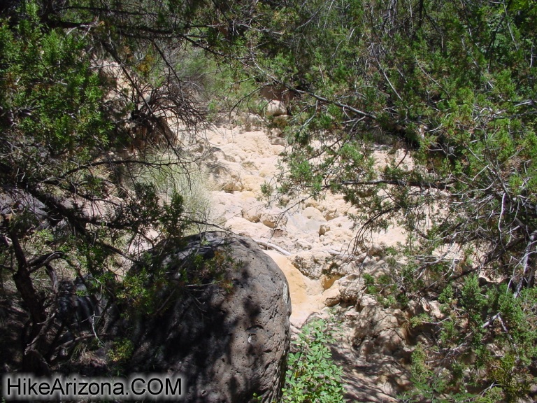
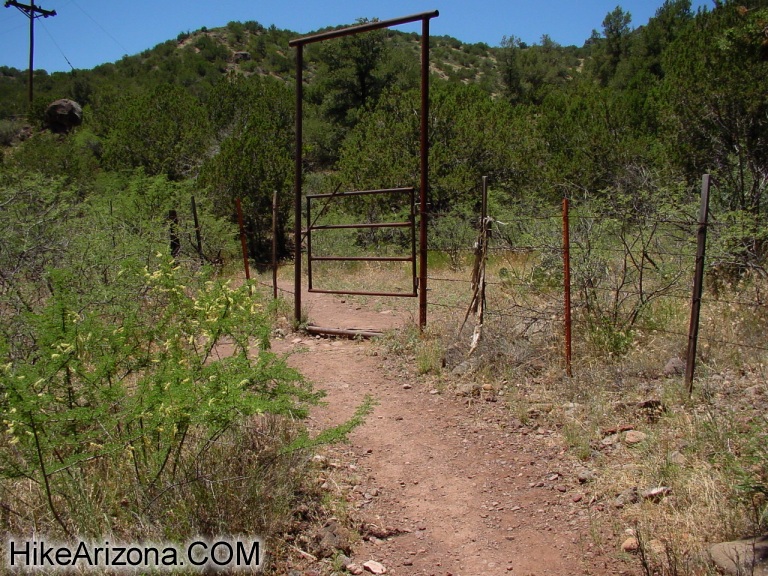
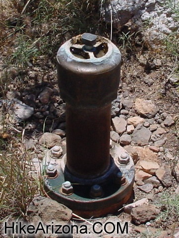
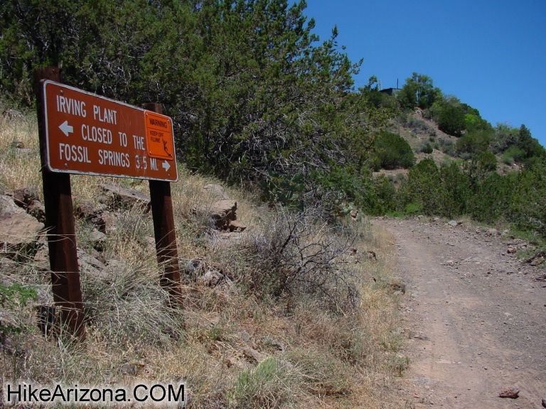
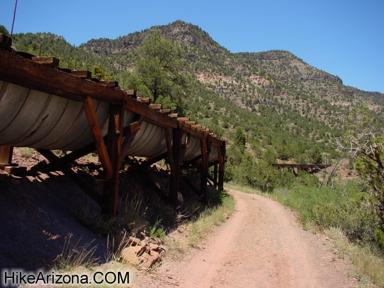
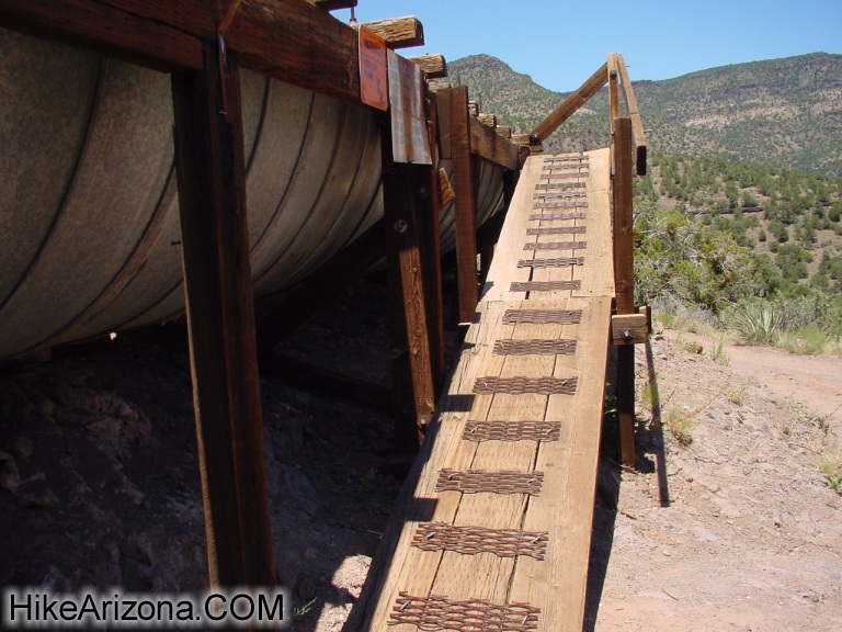
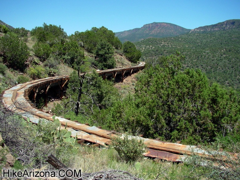
Irving Power Overview Three trails access Fossil Springs. The Mail Trail heads down three miles from the General Crook Trail. The Fossil Springs Trail is a four-mile venture from FR708. Described here is the Flume Trail. This historic flume built back in 1916 channels water to the Irving Power Plant and further down to the Childs Power Plant. Nearly 85% of this route follows a service road, so wilderness die-hards need not apply. The drive to the trailhead from either Camp Verde or Strawberry is very scenic. Though seemingly remote, this area sees lots of visitors. Which in turn translates into lots of litter. Do your part and keep the place clean. I'm sure the boy scouts are sick of picking up trash. Which reminds me... In 1998 I was following Fossil Creek upstream here when I came across two boy scouts. They obviously weren't practicing an honored scout activity when I surprised them. In fact, I've had several odd encounters within ten miles of here in the past. Anyhow... the mineralized creek has some cool little areas worthy of exploring. Flume Trail From the trailhead follow the trail left of the trailhead signage. Fossil Creek is reached immediately. According to "Sedona Hikes", it's a tough task crossing the creek. My experience thus far on numerous trips has been an easy skip and jump across some rocks. I'm sure after a rain, or during spring runoff, the conditions could be severe. The trail immediately zips up the other side of the creek. The Mountaineers "100 Hikes in Arizona" suggest scrambling up the dried up mineral deposit cascade if you can't find the trail. Heck, the trail is a few yards away to the left and much easier. I mention this only because years ago, I took this option, and it was hell. Next you pass through a gate. This all happens real quick, so if you have been hiking for over ten minutes, you're definitely in the wrong area. Okay... As long as you're on track, it's a no-brainer from here on. It's a steep 360-foot ascent to the service road, which follows the historic flume. The only possible trail direction question comes near a pipe in the ground where the trail forks. Take the left fork. Once on the service road go right. Just before topping out on the service road is a trail register. The flume isn't in view just yet. Look at this photo again, you can see a little building on the hill. Coming down from the building area is what I believe to be the same dried-up mineral cascade as below. Only there's a trickle-up here. Here's my theory... (e-mail me with corrections as needed) The flume somehow converts the water into a pipe near the little building. The overspray or runoff shoots down the cascade. The pipe heads straight down underground and across the slope to the Irving Power Plant below. The pipe back near the fork is some sort of checkpoint or tester cause I've never seen a wilderness fire hydrant. Coming around the first corner of the road, you get a glimpse of the flume high above. Check out the sweeping views up and down the canyon. Before you know it the flume is beside you. Signs remind you to keep off the flume anywhere access is possible. There's no need to be climbing on it anyhow. The trail goes directly over it in a short distance. Here you can peek inside and see the running water. I was amazed at how quickly it moves so quietly. Fossil Springs further down the trail pumps out 275 gallons of water per second. The water is mineralized and a constant 72 degrees. I have yet to hike all the way to the springs on several trips. Somehow I always forget this area until summer. This trip, I turned around at about 1.5 miles before the heat seemed a nuisance. There are some cool views of the flume even in the short distance I went. This might be a good March or November date hike. It's a nice scenic drive all the way from Phoenix. You have the mini-adventure across the creek and up the hill to the flume road. Followed by some ooohs and aaahs checking out the flume. Then you have six miles out and back of easy scenic strolling perfect for chattin'. Keep in mind you'd both need to be somewhat into hiking. Cause 7.4 miles can be brutal on a beginner, especially without shade. Camping Regulations Download PDF
Tonto FS Details The Flume Trail on Fossil Creek starts at the old Arizona Public Service Irving Power Plant location and follows the line of the since-removed flume that carried the water from the dam to the power plants for generating electricity. The trail follows the old APS flume access road along the canyon hillside and ends at the old dam, a five mile trek one way. The trailhead is located on Forest Road 708 just north-east of the Fossil Creek Bridge. It shares a parking lot with the Irving swimming hole. Visitors must cross the creek at the low water crossing and follow the path through the old residential area. Check out the Official Route and Triplogs. Leave No Trace and +Add a Triplog after your hike to support this local community. | |||||||||||||||||||||||||||||||||||||||||||||||||||||||||||||||||||||||||||||||||||||||||||||||||||||||||||||||||||||||||||||||||||||||||||||||||||||||||||||||||||||||||||||||||||||||||||||||||||||||||||||||||


