 Route Editor

| Guide | ♦ | 85 Triplogs | 0 Topics |
details | drive | permit | forecast | route |
stats |
photos | triplogs | topics | location |
| 300 | 85 | 0 |
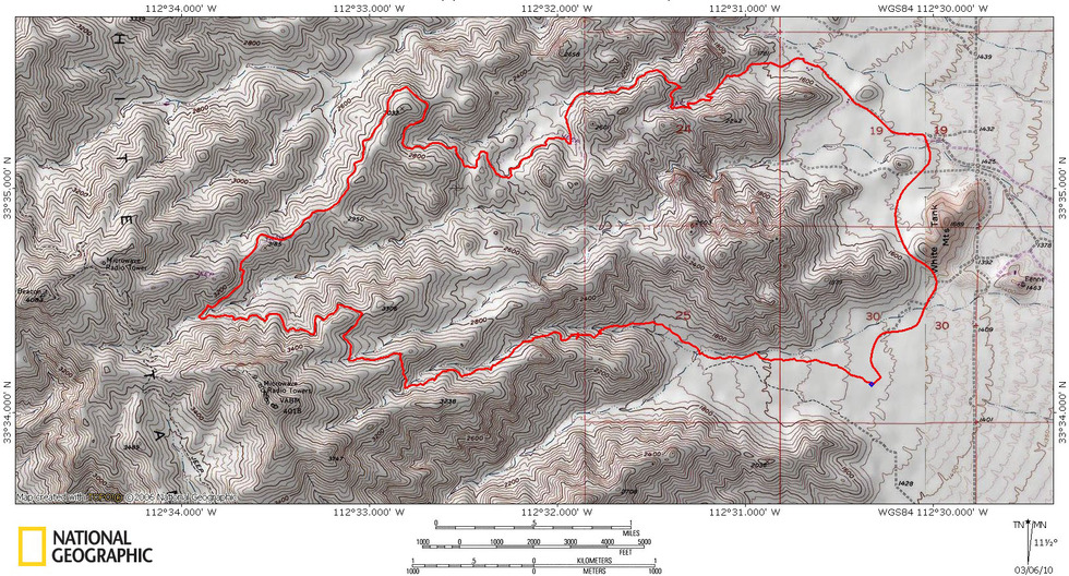
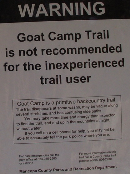
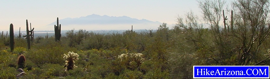
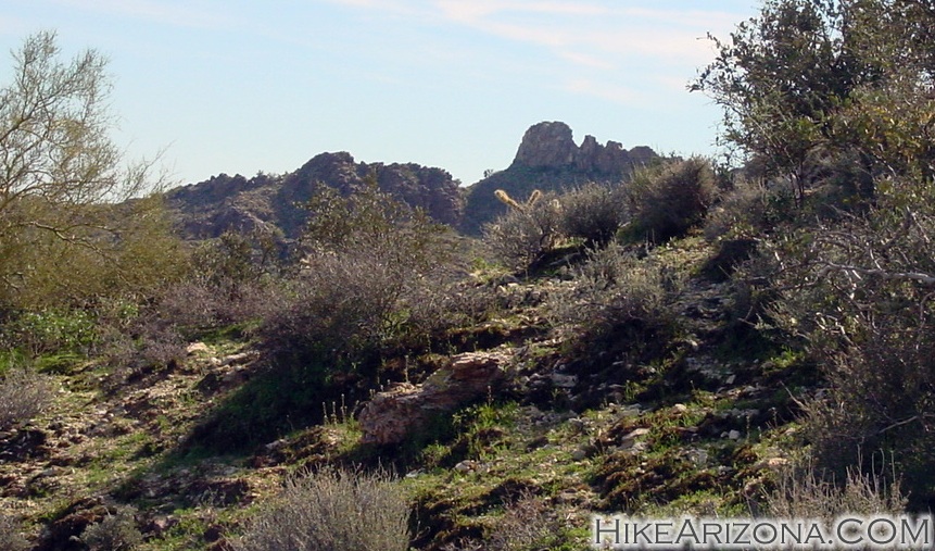
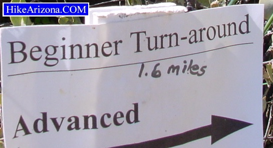
Hop-Scotching the Desert Valley by joebartels  Overview OverviewGoat Camp Trail → Mesquite Trail → Mesquite/Waddell Trailhead → road back to Goat Camp trailhead. Hike Trailhead signs warn this trail is for experienced hikers only. Glad I made the cut. I'm not saying the trail is a no-brainer, but it isn't that tough. There are a couple of indistinct areas along the way. Just pay attention, and you'll be okay. Head out on the Goat Camp Trail. From the beginning, it's flat, easy hiking. Look over your left shoulder and back towards the Estrella Mountains. Smog cuts a line blocking out the lower sections, and the peaks rise above. Continuing, soon the vegetation thickens up. The trail weaves in and out of the desert foliage heading west. Notice the stumpy needle on the ridge in the distance. The trail heads towards the needle. Much further into the hike you can see the back side once on the Mesquite Trail. Pass the South Trail junction which takes you to a spur trailhead.
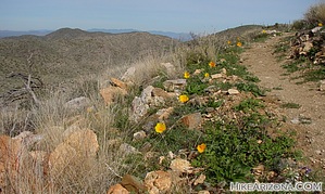
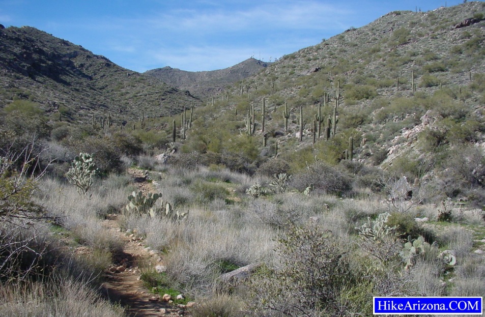
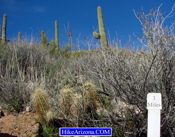
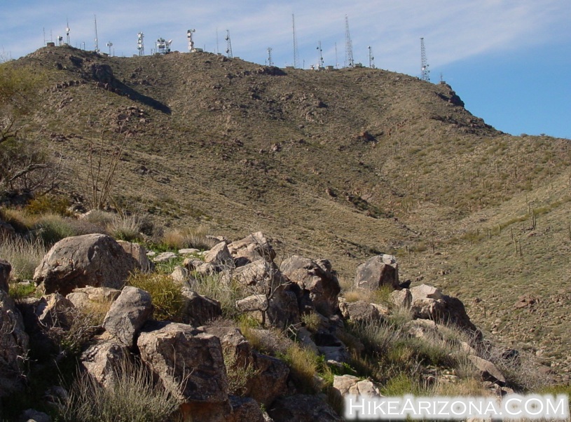
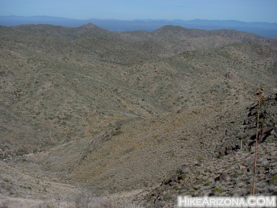
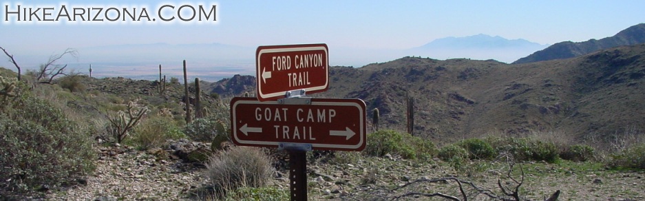
Reaching the 3 mile mark there's a cluster of saguaros on the northern slope to your left. The trail begins to get slightly overgrown. The vegetation is so low it's not a bad problem. Do keep an eye out for cholla and prickly pear cacti near the edge of the trail. The views to the east reveal the smog of the valley. You can see right over the smog to the Four Peaks. At about this point, I realized that I was the only one hiking out here without a walking stick. So it must be the thing to do. Shortly after the 3 mile marker you press on up to a saddle. The views are pretty good all around. Continuing, the outlying trail vegetation is now practically barren. It made me wonder if there was a fire in the area a long time ago. You're heading towards the radio towers. The trail comes up to the bottom of the slopes of the radio towers, then skirts north and away. It's in this area where you need to pay close attention to the trail. You wouldn't think it'd be hard to find the trail, but it is. The vegetation is scattered every two feet, and you're taking on a slope too. Lack of vegetation makes the trail indistinct. Paint dots and markers lead the way. I don't understand why the park system outlaws paint dots and, at the same time, doesn't put enough markers to lead the way. You could probably make it here okay. On trails like the Flatiron, it would be near impossible. It's probably one of those money issue thingys. Okay, I've vented enough. Next, you come to another saddle. You could take a short excursion to the right at the saddle. I believe there would be good views of the valley. I didn't do it, so I'm not sure. Continuing on the other side, the trail immediately goes down. Looking ahead you can see light traces in the distance where the trail goes. Use some caution as the trail is slightly steep in sections. During this hike in Feb 2001, it was very dry up here. With above-average January rains, poppies did scatter the area. Not the big beautiful thick fields as seen at Picacho Peak, but consistently scattered about every four feet. At this point in the trail, I realized there weren't going to be the cool white granite slabs featured along the Ford Trail. Nevertheless, it's very peaceful on the backside of the Goat Camp Trail. You do cross a wash with jagged white rock. It's nothing spectacular. Also, you don't follow the wash. It's only about ten to twenty feet across the wash. Shortly after the wash, I did come across a cool little field of poppies. Also, there's a nice view down the canyon to the east. Then it's up another slope. I started wondering where this trail got its name. I still don't know. I didn't see any goats camping out anywhere along the trail for those interested. - Haha Soon you hook up on a little ridge with views down to valleys on both sides. This was my favorite section. I didn't see another soul on this back section. Too bad for those that turn around early. This is the best part. It doesn't last long though, soon you come to the Ford Canyon junction. It took me two hours to reach this point. Take a moment, check out the views of the Estella Mountains. South Mountain looks a long way away, glad I don't have to walk home. The terrain between the Ford Canyon Trail junction and the Mesquite Canyon Trail junction is a little more rugged. It's a good variation and helps to keep the hike from getting boring. There are actually some steep loose rock sections, so be careful. I didn't spot Mesquite Springs just before the Mesquite Trail junction. I forgot all about it, so maybe next time. Head back down to the Waddell/Mesquite trailhead. From here, it's a two-mile walk on the road back to your car. You could do a shuttle, making this only a 7.4-mile hike. Maybe lock a bike at one end. I walked the full loop so I could get an accurate time for the loop. It was four hours and ten minutes total. That's steady walking, taking tons of photos, and one bathroom break. There are several bathrooms along the road on the way back to your car.
Check out the Official Route and Triplogs. Leave No Trace and +Add a Triplog after your hike to support this local community. | |||||||||||||||||||||||||||||||||||||||||||||||||||||||||||||||||||||||||||||||||||||||||||||||||||||||||||||||||||||||||||||||||||||||||||||||||||||||||||||||||||||||||||||||||||||||||||||


