Overview
From the heart of the city to the heart of the preserves. The true trailhead is more for locals in the neighborhood. Most hike portions of this loop starting at other trailheads. For those that want to check off 1A as complete... read on!
Trailhead
This hike starts at the end of Myrtle Ave. The park will tell you it starts at 16th Street and the canal. However, there's no parking at that location. It would also involve walking 16th Street and Myrtle Ave. I call those streets, not trails. They have it starting there to link the preserves in with other county trail systems that won't be finished or used until I'm dead, so let's go with the end of Myrtle Ave for now.
Hike
Start off switchbacking down a fenced corridor to the Myrtle Tunnel. Pass through the concrete jungle, and a real trail exists on the flip side, up a ramp. Albeit a real trail, it's right beside a street, a neighborhood, and well, that hissing freeway fifty feet above you. About 0.5 mi heading north, you leave the neighborhood and come to the Y of the 1A loop.
Hiss
Stay left for a clockwise loop. This also gets more of the undesirable out of the way. What you could hear before now comes into view. Bear in mind, the freeway was kind of an afterthought. Planning dates back to 1955 as a spur to the I-10. Yet little surfaced(bad joke) until the mid-80s. It started out as a parkway from 1986 to 1991. Then it was doomed by the massive valley growth to become a full-fledged high-speed hissing highway.
Loop
About 2.0 miles from Myrtle, you approach the Dreamy Draw conglomerate of trails going everywhere. The 1A is the most signed trail in the preserves. Since there are several intersections without directions, bring a map or a loaded GPS Route.
After a big Z switchback, you are on the high northern ridge of the loop heading east. The city is still in the distance. Yet at this point, the trail becomes peaceful, leaving the hiss behind. You will pass a couple of shortcut options. The first is the VOAZ 1B Trail. The second is called the Irregular Link. Past both of these, the soil turns dark. It may not seem like much, but with everything else in the preserves being white-toned quartz, it's a welcome sight.
Soon, the loop takes you south towards the 304 Nature Trail. Here again, you might have route-finding issues if you're not familiar with the area. The 304 section doesn't even last a quarter mile, then you are sharing the trail with the 302 circumference Freedom trail. This is the meanest climb of the loop. It's only 250 feet, but it'll get your heart rate up.
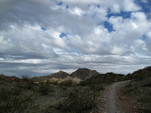
From the saddle, it's 1 mile through the tranquil valley to another saddle where you split away from the 302. Take the right, which heads down quickly into the biggest valley inside the city (that I know of anyhow). In the distance to the west, you can just make out an old CCC stone structure. The trail misses it and goes above into the mountains overlooking the neighborhood. Even though it seems you should know the way, a map still might come in handy.
WARNING! Hiking and outdoor related sports can be dangerous. Be responsible and prepare for the trip. Study the area you are entering and plan accordingly. Dress for the current and unexpected weather changes. Take plenty of water. Never go alone. Make an itinerary with your plan(s), route(s), destination(s) and expected return time. Give your itinerary to trusted family and/or friends.
Permit $$
None
Directions
Road
Paved - Car Okay
To hike According to the Phoenix Preserves trail map, this hike starts south of Myrtle on 16th Street at the canal. However, their description says "The trail follows 16th Street north of Myrtle Avenue, then east along Myrtle and through a tunnel at 19th Street." May the force be with you.
 Route Editor

 Overview