 Route Editor

| Guide | ♦ | 94 Triplogs | 0 Topics |
details | drive | permit | forecast | route |
stats |
photos | triplogs | topics | location |
| 549 | 94 | 0 |
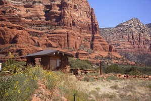
Tourist hot spot by joebartels   Page data is for the one-way segment. Description below is for a 4 mile loop from Bell Rock Trailhead utilizing this route. Page data is for the one-way segment. Description below is for a 4 mile loop from Bell Rock Trailhead utilizing this route.Bell Rock - Courthouse Butte Loop Here's an easy trail with many rewards. You can bring the whole family on this Sedona stroll. Checking out the trail logbook, I'd say roughly 75% stated vacation as the reason for this hike. The trail description presented here loops around Bell Rock and Courthouse Butte. Several variations are possible if you are looking for a shorter hike. As usual, I head out for Sedona with one trail in mind and end up on something different. Today being no different. High winds canceled the thought of Wilson Mountain. I believe I've passed Bell Rock a hundred times. Never giving much thought to hiking the area. My thinking was tourist central so stay away. Since you get a great view of Bell Rock driving by, why even bother. On this beautiful but windy April morning, I decided to give it a go. It turned out to be pretty impressive.
Continue on the Bell Rock Path around the west side of Bell Rock. It's peaceful, except for 179 hugging the trail. Vegetation with wildflowers took me by surprise. The trail meets up with the Courthouse Butte Loop on the north side of Bell Rock. This is an area where folks love to play on the sandstone slopes. Some venture up looking to conquer Bell Rock. Most come in on the Bell Rock Path from the north parking lot instead of our venture from the south. Hang a right on the Courthouse Butte Loop. From here on the trail is single track heaven around Courthouse Butte. You will encounter several side trails along the way. If you stay close to Bell Rock and Courthouse Butte, you should be okay. The forest closes in, and the scenery goes into overdrive. Up, down and curving the contours of the land, this is one awesome stretch of trail. Be on the lookout for mountain bikers as you stroll east. As you begin to head south on the east side of Courthouse Butte, you enter the Munds Mountain Wilderness. I mention this because mountain bikes are not allowed in the Wilderness zone. Down near the southeast side of Courthouse Butte, I passed two artists hard at work sketching the monument. The trail heads back west to the junction with Bell Rock Path. Head on back to the parking area. Summing it all up. The Bell Rock Path is where the tourist hang. You will probably get a different feel for what Bell Rock is as you see it up close. In my opinion, the loop around Courthouse Butte is the highlight. I especially enjoyed the stretch of trail along the north and east sides of the butte.
Check out the Official Route and Triplogs. Leave No Trace and +Add a Triplog after your hike to support this local community. One-Way Notice This hike is listed as One-Way. When hiking several trails on a single "hike", log it with a generic name that describes the hike. Then link the trails traveled, check out the example. | |||||||||||||||||||||||||||||||||||||||||||||||||||||||||||||||||||||||||||||||||||||||||||||||||||||||||||||||||||||||||||||||||||||||||||||||||||||||||||||||||||||||||||||||||||||||||||||||||||||||||


