Route Editor

| Guide | ♦ | 102 Triplogs | 0 Topics |
details | drive | permit | forecast | route |
stats |
photos | triplogs | topics | location |
| 385 | 102 | 0 |
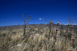
In the middle of it all by fricknaley  Nestled in between the would-be valley separating the Catalinas and Rincons stands a rather tall peak or hill, if you will, named Agua Caliente Hill. From the right perspective, it is obvious, from others you would never even know it's there. Well, it's there and there is a very nice trail to the summit, though this trail is not even mentioned on the Coronado National Forest website trail directory. I set out to find it today and was rewarded with a great new hike, with good distance and elevation to boot. Nestled in between the would-be valley separating the Catalinas and Rincons stands a rather tall peak or hill, if you will, named Agua Caliente Hill. From the right perspective, it is obvious, from others you would never even know it's there. Well, it's there and there is a very nice trail to the summit, though this trail is not even mentioned on the Coronado National Forest website trail directory. I set out to find it today and was rewarded with a great new hike, with good distance and elevation to boot.From the trailhead cruise straight through a hikers gate and immediately start switchbacking up the near foothills to access the ridge north. You gain elevation quickly and the views of everything are immediate. The trail is well-maintained. You have a strange top-of-the-world feel on this hike as you can almost always see the whole range of the Catalinas and Rincons. The trail scrambles along ridges, foothill summits, and through drainages for about 1.5 miles.
The climb picks up intensity and heads straight for a grass-covered peak. Which it then skirts around in one of the best false summit fakeouts I've encountered in a while. Yes, I am a dork because in retrospect it is obvious that this could not be the summit. Oh well, at least no one was with me to point it out. As you skirt right off this summit the real peak is ahead and still much work to do. You scramble along a ridge to the base of the peak. The final push to the summit is all that's left. This however is no small task. This last push is a bruiser, hands-on thighs huffing and puffing to the top (hamstring singing along all the while). Here fantastic panoramic views greet you in all directions: Catalinas, Rincons, Galiuros, even Pinalenos on the horizon. It was clear, calm, and pretty cold up here... awesome. Gate Policy: If a gate is closed upon arrival, leave it closed after you go through. If it is open, leave it open. Leaving a closed gate open may put cattle in danger. Closing an open gate may cut them off from water. Please be respectful, leave gates as found. The exception is signage on the gate directing you otherwise. Check out the Official Route and Triplogs. Leave No Trace and +Add a Triplog after your hike to support this local community. | |||||||||||||||||||||||||||||||||||||||||||||||||||||||||||||||||||||||||||||||||||||||||||||||